
Preah Vihear province
Preah Vihear means sacred sanctuary. The province borrowed the name from a temple on a clifftop, and for the better part of a century that temple has been the least sanctuary-like address on the Cambodian border — litigated at The Hague, shelled, evacuated, and litigated again. It is an odd inheritance for a province that is otherwise almost entirely forest and sky, where the roads run empty for an hour at a stretch and the loudest thing in most villages is the wind moving through dry leaves.
Eighteen People to the Square Kilometre
At 13,788 square kilometres, Preah Vihear is Cambodia's third-largest province and one of its emptiest, holding roughly 250,000 people at a density of eighteen per square kilometre. Seven districts and one municipality — Chey Saen, Chhaeb, Choam Khsant, Kuleaen, Rovieng, Sangkom Thmei, Tbaeng Meanchey and Preah Vihear town — divide into fifty-one communes spread thin across it. The Dângrêk Mountains fence the northern edge, and beyond them lie Thailand and Laos; Oddar Meanchey and Siem Reap sit to the west, Kampong Thom to the south, Stung Treng to the east. This is also the hottest ground in the country by the record books. On 15 April 2016 a thermometer here read 42.6°C, the highest temperature ever recorded in Cambodia.
Sixteen Years as the Capital
From 928 to 944 the Khmer Empire was governed not from Angkor but from Koh Ker, in what is now Kuleaen district, first by Jayavarman IV and then briefly by his son Harshavarman II, who reigned three years and probably did not die of natural causes. The move lasted sixteen years and left behind something extraordinary: Prasat Thom, a seven-tiered sandstone pyramid thirty-six metres high on a square base sixty-two metres across, a shape found nowhere else in Khmer architecture. UNESCO inscribed Koh Ker on the World Heritage List on 17 September 2023, at the committee's session in Riyadh. Even now only about two dozen of its monuments are open to visitors. The rest stand in forest that has never been fully cleared of mines.
What the Looters Took
Koh Ker's sculptures began leaving in the 1880s, carried off by French expeditions to the Musée Guimet in Paris, and they never really stopped — a disputed Koh Ker statue was still the subject of a Sotheby's case in 2011. A hundred kilometres east of Angkor, the vast complex of Preah Khan Kompong Svay tells the same story more brutally. Its outer enclosure encloses some twenty-two square kilometres around a baray 2.8 kilometres long, built up from the eleventh century and later used by Jayavarman VII as a base during the wars with Champa. Thieves worked through it in the 1990s, prising off carvings and undermining what held the buildings up. In 2003 the central tower came down during a looting attempt. It is one of the least-visited Angkorian sites in Cambodia, and one of the most damaged.
The Cliff and the Court
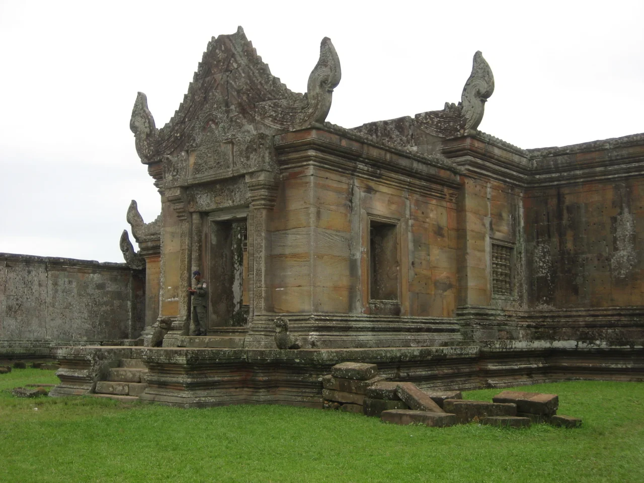
The temple that named the province stands 525 metres above the Cambodian plain, an 800-metre processional of courtyards and gateways climbing 120 metres up the Dângrêk escarpment, begun in the Koh Ker period and built out under Suryavarman I and Suryavarman II across the eleventh and twelfth centuries. In 1962 the International Court of Justice ruled nine votes to three that it stood on Cambodian soil and that Thailand must withdraw and return what it had taken. UNESCO inscribed it on 7 July 2008 over Thai objection, and the shooting started three months later. Artillery exchanges in February 2011 damaged the temple itself; UNESCO's investigators concluded the destruction came from both sides' guns. In 2013 the court ruled again, awarding Cambodia the promontory around the temple.
The People Who Live Underneath It
The arguments are conducted between governments; the consequences land on farmers. In 1979, Thai forces drove Cambodian refugees who had reached Preah Vihear back down the escarpment, and an estimated three thousand people died on that mountainside — men and women who had already survived the Khmer Rouge and were killed by the descent. The pattern returned in 2025. Fighting between 24 and 28 July displaced more than 200,000 civilians across the border districts; a second, worse round in November and December uprooted over half a million. Soldiers died on both sides, and so did dozens of civilians who had no part in the boundary question at all. Ceasefires signed on 28 July and 27 December 2025 have held since, uneasily. In the villages below the cliff, holding is not the same thing as peace.
Our Forest
South of the temples, Preah Vihear shares in Prey Lang, established as a wildlife sanctuary in 2016 and covering more than 430,000 hectares across four provinces — the largest lowland evergreen forest left on the Indochinese peninsula. Its name comes from Kuy, and means, roughly, the forest that belongs to all of us. Around 70,000 Kuy live in Cambodia, most of them in these northern provinces; only about a quarter still speak the language, which the Khmer Rouge forbade them to use. Their ancestors smelted the iron that armed the Khmer Empire, a trade documented from around 800 AD that finally died out in the 1940s. Today the northern Prey Lang landscape runs as a REDD+ carbon project under Japan's Joint Crediting Mechanism, and the Kuy patrol their own forest against loggers, which is a very old arrangement wearing very new paperwork.
From the Air
The province spans roughly 13.3–14.4°N and 104.2–105.6°E, with the provincial capital near 13.81°N, 104.97°E. Preah Vihear temple sits at the top of the Dângrêk escarpment on the Thai frontier near 14.39°N, 104.68°E — a hard north-facing cliff line that is one of the clearest natural navigation features in northern Cambodia, visible from 60 km out in good air. Koh Ker lies southwest near 13.78°N, 104.54°E. Cruise at 6,000–10,000 ft AGL to hold the whole escarpment-to-floodplain gradient in one view. Nearest commercial field is Siem Reap–Angkor International (VDSA/SAI) to the southwest; Phnom Penh's Techo International (KTI) is roughly 250 km south. The Thbeng Meanchey strip (OMY) is abandoned. Note that the international border here has seen armed clashes as recently as December 2025 and remains sensitive — check NOTAMs and restricted airspace before planning anything near the Dângrêk line. Best visibility November to January; heavy haze February through April, and towering convection through the southwest monsoon.
Nearby Stories
- Beng Mealea 20 km away
- Preah Khan Kompong Svay 25 km away
- Mahendraparvata 39 km away
- Khong Island 40 km away
- Anlong Veng 40 km away
- Emerald Triangle (Southeast Asia) 42 km away
- Prey Lang Wildlife Sanctuary 43 km away
- Chinit River 46 km away