.JPG)
Quiraing
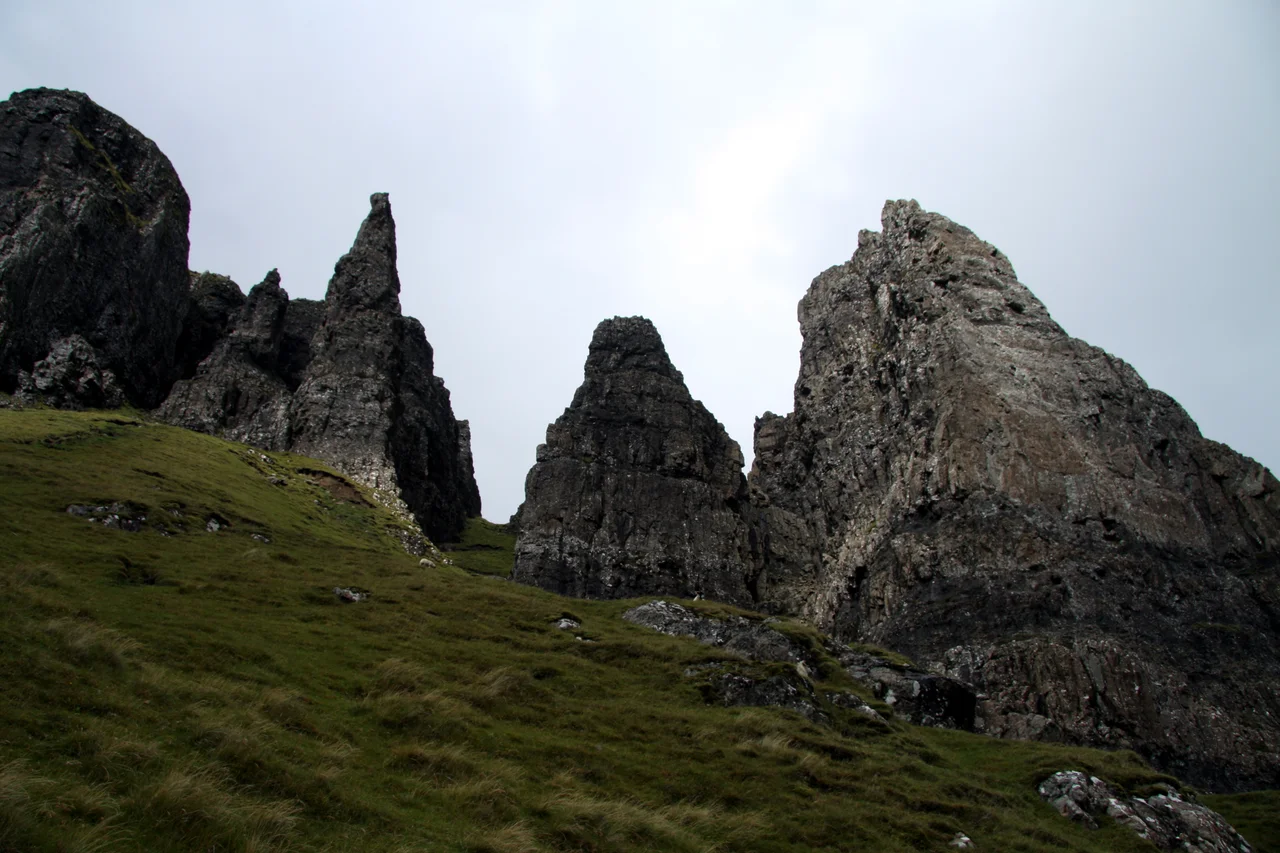
The ground here is still moving. Not visibly, not in any way you would notice from the path, but the great tilted ridge of the Quiraing - the Needle, the Prison, the green plateau called the Table - is the slowest avalanche in Scotland, a section of mountainside that began to slide millions of years ago and has not yet come to rest. Engineers go up every spring to remeasure the single-track road that crosses below it, because the road moves a few centimetres every year. The Victorian poet Alexander Smith called the place "a nightmare of nature," which sounds like hyperbole until you stand under the rampart and look up.
How It Slid
The Quiraing is the northern end of the Trotternish escarpment, the longest continuous landslip system in the British Isles. The geology is a layered problem. Around sixty million years ago, in the Paleocene, enormous floods of lava poured out of fissures across what is now Skye and the Inner Hebrides, leaving stacked sheets of basalt up to seven hundred metres thick. Underneath that heavy basalt lay older sedimentary rocks - Jurassic mudstones and shales, weak and slick when wet. The weight of the basalt eventually became too much for the foundation to bear. The cliff edge began to break off in huge slumped blocks that slid east toward the sea, then rotated and tilted, leaving the inland-facing face of every block standing higher than its outward face. The Quiraing is one of the most spectacular of these failures. The cliff above is the headscarp where the slide pulled away. The jumbled ground below, full of pinnacles and hidden hollows, is the wreckage.
The Needle, the Prison, the Table
Walk in from the parking pull-off on the Staffin-to-Uig road and the landforms appear in sequence. First the Prison, a hulking rectangular tower of basalt that looks startlingly like the keep of a medieval castle, complete with crenellations and a vertical wall. Then the Needle, a slim jagged pinnacle a hundred and twenty feet tall, leaning slightly as if it might topple. Then a steep scramble brings you onto the Table, a flat green plateau the size of a football field hidden inside the rampart, invisible from below. Cattle were once driven up onto the Table during clan raids; the story goes that the enclosing cliffs hid them from view of the Norse and other invaders sweeping the coast. Whether that history is exactly true or partly folklore, the geography would work. The Table is genuinely a place where you could lose a herd, or yourself, in plain sight.
The Name
Quiraing comes from the Old Norse Kvi Rand, meaning "round fold" or "pillared enclosure" - a reference to the natural pen formed by the surrounding cliffs. The Norse named a great deal of the northern half of Skye between the ninth and thirteenth centuries: Trotternish itself is from the Norse Throndarnes, the headland of Thrond. The Gaelic name for the local summit is Meall na Suiramach, the hill of the wooer or pleader. Listen to the names and you are listening to two languages layered on the same ground, the Norse on top of the Gaelic, both still in use, both still pointing at the same rocks.
Light and Weather
Photographers come to the Quiraing for a single reason: the morning light. The ridge runs roughly north-south, so the rising sun hits the eastern faces of the pinnacles first, picking out every fold and crevice while the hollows behind remain in shadow. On a clear summer dawn you get an hour of theatrical lighting that makes basalt look molten. On any other morning - and most are not clear - you get cloud spilling over the headscarp like a slow waterfall, the Needle appearing and disappearing, the path under your feet slick with last night's rain. Skye is one of the wettest places in the British Isles. The Quiraing is one of its wettest corners. Bring waterproofs and good footing, and assume that whatever you saw in the photograph was the rare moment, not the norm.
Still Slipping
The Trotternish landslide is described in geological literature as currently active. After heavy rain, small slumps still occur on the inner faces of the rampart. The road below requires regular relevelling. Climbers who come back to the Needle from year to year have noticed small changes in its lean. None of this is happening on a human timescale fast enough to be dangerous on a single walk, but it is happening - and that is the strange truth of the place. You are not looking at a finished landscape. You are looking at an event that began before there were people on Skye and will continue long after.
From the Air
The Quiraing sits at 57.64N, 6.27W on the northern Trotternish peninsula of Skye, approximately 3 nm west of Staffin Bay. The summit of Meall na Suiramach above the slide reaches 543 m / 1781 ft, with the rampart cliffs about a hundred metres lower. The pinnacles are visible from cruising altitude on a clear day as a notched line along the eastern edge of Trotternish. Nearest ICAO airports: Inverness (EGPE) 95 nm east-southeast, Stornoway (EGPO) 70 nm northwest, Plockton airstrip (EGEC) on the mainland 25 nm south. Recommended viewing altitude 4000-5000 ft AGL to clear the ridge and keep both faces in frame. Expect rapid orographic cloud formation on the escarpment - the same conditions that brought down the B-17 on neighbouring Beinn Edra in 1945.
Nearby Stories
- Isle of Ewe 0.7 km away
- Glamaig 1.9 km away
- Torridon 7.2 km away
- Capture of Eilean Donan Castle 7.4 km away
- Tarbert (Harris) 10 km away
- Shiant Islands 15 km away
- Neist Point 18 km away
- German submarine U-722 22 km away