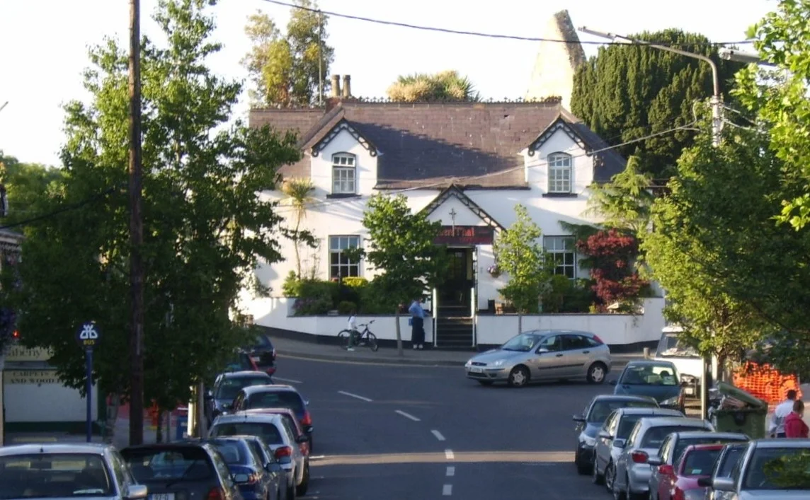

Raheny
There are villages, and there are villages with paperwork. Raheny's first written mention dates to 570 AD - making the settlement older than the city it now belongs to, older than Christianity in Ireland's western counties, older than the Vikings who would eventually sail into Dublin Bay just south of here. The Old Irish word raheny preserves in its sound the structure of the place: a rath, a ringfort, the circular earthen enclosure of an Iron Age chieftain named Eanna whose name has outlasted his bones by a millennium and a half. Walk through the modern village today and you are walking across what was once his fort - its outline still visible in the curve of a graveyard wall and an embankment behind the Scout Den.
The Ringfort Underfoot
Excavations in the 1970s suggested the rath was about 110 metres across, large enough to enclose a sizeable settlement. It would have had timber roundhouses inside its earthen banks, a defensive ditch outside, and access to a holy well dedicated to the local patron St. Assam. The well sat in a field now occupied by the Church of Our Lady Mother of Divine Grace; when last recorded it was just a depression in the ground, eventually covered over and its waters diverted into the Santry River that runs through the village. Another well near the boating lake in St. Anne's Park is still marked by a stone cupola - dry now for decades despite repeated efforts to revive its flow. The ringfort's outline is fragmentary, but the modern village's odd geometry - the way the streets curve and the church grounds bulge - is the rath insisting on its old shape.
Doh-Ray-Mee
On Station Road near the Howth Road junction stand eight cottages arranged in a gentle crescent, the oldest buildings in Raheny still in use. They were built around 1790 by Samuel Dick, then Governor of the Bank of Ireland, to house the men who worked his estate. The locals call them the Doh-Ray-Mee cottages because their stepped facades, viewed from the road, look exactly like a row of piano keys. The cottage nearest the Manhattan pub used to be the village post office. Samuel Dick left the cottages in trust to support what is now Springdale School, and the rents from seven of them still help run the school more than two centuries after he died.
Bull Island and St. Anne's
Raheny shares two of Dublin's largest municipal parks with neighbouring Clontarf. North Bull Island is a UNESCO biosphere reserve - a five-kilometre crescent of sand and dune that did not exist before 1800, accreted by tides after a sea wall was built to keep Dublin Bay navigable. The 5 km Dollymount Strand runs the length of its seaward side. On the inland side sits St. Anne's Park, formerly the estate of the Guinness family of brewing fame, who lived in a now-demolished mansion among 240 acres of formal gardens, rose beds and ornamental follies. The folly towers and a Roman-style temple still stand. So does St. Anne's Golf Club, founded by Raheny locals in 1921, and the Royal Dublin Golf Club, which has its service entrance on the Raheny side of the island. Few suburbs in Europe can claim a 5 km beach and two municipal parks of this scale on their own doorstep.
All Saints and a Wedding
All Saints' Church on the Howth Road is the local Church of Ireland parish church. It is also where, in 1982, Paul Hewson married Alison Stewart - better known to the world as Bono and Ali of U2. Bono had gone to church at All Saints' growing up; he met Ali through the Mount Temple comprehensive school crowd, the same crowd that would soon become his band. Raheny has produced and held a remarkable cluster of names beyond U2: the Nolan sisters, the Eurovision-era girl group that became huge in Japan; actor Simon Delaney; Olympic marathoner Pat Hooper; broadcaster Eileen Dunne; novelist A.J. Cronin; producer Moya Doherty, who co-founded Riverdance. The former Taoiseach Charles Haughey lived at 490 Howth Road for a stretch, losing local elections from a Raheny address before winning national ones.
A Village That Stayed
Most of Dublin's medieval villages were swallowed without trace by the twentieth-century expansion of the city. Raheny is one of the few that kept its village core - a recognisable crossroads at the heart of the modern suburb, with the spire of the 1962 Church of Our Lady Mother of Divine Grace rising above the green limestone of its bell tower, and the old plaza marked by the Marie Elizabeth Hayes memorial cross. Hayes was a local woman who became one of Ireland's first female medical graduates and a 19th-century medical missionary in India; the cross was paid for by the people she had worked among, then shipped back to the parish she had left. The village won the National Tidy Towns Best Urban Village award in 2009 and again in 2014, took bronze in its category every year from 2015 to 2019, and still publishes a four-page weekly newsletter on green paper - the Raheny News, founded in 1975 and produced by volunteers most weeks of the year. It is the kind of place that takes its 1,455 years personally.
From the Air
Raheny lies at 53.38°N, 6.17°W, on the north Dublin coast about 8 km from the city centre and 7 km from Dublin Airport (EIDW). From altitude it is recognisable by the long curving sandbar of North Bull Island in the bay immediately to the south, with Dollymount Strand running its full seaward length. The green canopy of St. Anne's Park dominates the inland skyline, and Howth Head rises as a pronounced rocky peninsula to the east-northeast.
Nearby Stories
- Wicklow Mountains 12 km away
- Mornington 14 km away
- German submarine U-1051 16 km away
- Abbey of Kells 18 km away
- Irish Military Intelligence Service 20 km away
- HMS Manners (K568) 37 km away
- Templemore 42 km away
- Irish Sea Bridge 43 km away