Rancho Valle de San Felipe
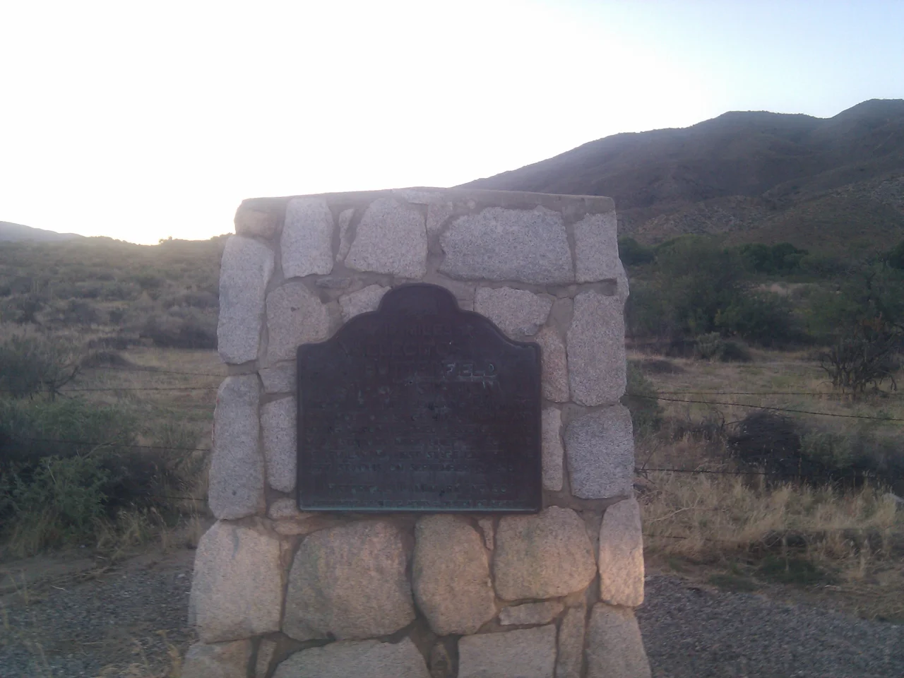
The Butterfield Overland Mail was the first regular passenger and mail service from the Mississippi River to California, and at San Felipe Station — sitting on the Rancho Valle de San Felipe — it stored 48 tons of barley and 36 tons of hay. Numbers like those tell a story: this was not a simple waypoint but a major operational hub, responsible for supplying horse-powered transportation across some of the most demanding desert terrain in North America. The rancho itself had been granted in 1846 to Felipe Castillo; within a few years of American annexation, it had become part of the infrastructure that connected the new western state to the rest of the country.
The Grant and Its First Owner
The Mexican government issued the Valle de San Felipe grant in 1846, just months before the Mexican-American War would change the region's political status permanently. Felipe Castillo received the nearly 10,000-acre grant — 9,972 acres, to be precise — covering a valley on the western edge of what would become the route into the Colorado Desert. By 1850, Castillo had sold the rancho to John Forster, who had married Ysidora Pico, sister of the last Mexican governor of California, Pío Pico. Forster's family connections placed him at the center of California's political transition; his landholdings placed him at the center of its geographic transition from Mexican ranchland to American commercial corridor.
Scissors Crossing and the Stage Road
The San Felipe Valley sits near what is now called Scissors Crossing — the junction where California State Route 78 and County Road S2 meet, a crossing that was equally significant in the Butterfield era. The Butterfield Overland Mail began service in 1858, running from Missouri to San Francisco in approximately 25 days over a southern route that avoided the snow-blocked Sierra Nevada passes. San Felipe Station on the rancho served as a relay station, and according to historical records, it managed the supplies for twelve stage stations in the surrounding region — a logistical operation requiring the stored tons of feed documented in period records. The route through this valley became the lifeline that proved southern California could be integrated into the national mail and passenger system.
A Civil War Outpost
When the Civil War began in 1861, the Union Army moved to secure the overland routes that connected California to the federal government and prevented Confederate sympathizers from disrupting communications. San Felipe Station became a Union Army outpost from 1861 to 1865, garrisoning soldiers in the same buildings that had previously served stage passengers and mail carriers. California's role in the Civil War was primarily logistical and political rather than military — no battles were fought in the state — but the presence of federal troops at strategic points along the southern overland route helped ensure that California remained firmly in the Union. San Felipe's transformation from a mail relay to a military post reflected the way war reordered the priorities of frontier infrastructure.
Desert Passage History
The route through the San Felipe Valley that Butterfield's stages traveled — and that Union soldiers guarded — followed a corridor that human beings had used for centuries before either arrived. The Kumeyaay people knew these passes intimately, and Juan Bautista de Anza's 1775-1776 expedition had documented the route as part of his overland path to Alta California. The Juan Bautista de Anza National Historic Trail now roughly follows these same passages, connecting the modern hiker or driver to a chain of human movement through the desert that runs from the Spanish colonial period through the gold rush, the Civil War, and into the present. Near Scissors Crossing, interpretive markers help travelers understand the layers of history compressed into this desert valley.
From the Air
Rancho Valle de San Felipe sits at approximately 33.12°N, 116.52°W in San Diego County, in the San Felipe Valley on the western approach to the Anza-Borrego Desert. The valley is visible from altitude as a corridor between mountain ridges, with the junction known as Scissors Crossing visible where the highways meet. Anza-Borrego Desert State Park begins nearby to the east, and the desert transition is dramatic and visible from altitude — green mountain vegetation giving way to desert scrub within a few miles. Ramona Airport (KRNM) is approximately 30 miles to the west. The valley terrain allows relatively good visibility from altitude except during occasional winter fog.
Nearby Stories
- Escondido Public Library 1.8 km away
- American Airlines Flight 6-103 5 km away
- 700,000 People Looking Up 6.7 km away
- The International Banana Museum 14 km away
- Santa Rosa Mountains 18 km away
- Fish Creek Mountains Wilderness 18 km away
- California State Prison, Centinela 22 km away
- Tenaja Fire 24 km away