.jpg)
Ras Nouadhibou
Portuguese sailors gave it a plain name for a plain reason. In 1441 they rounded a headland of pale rock thrust into the Atlantic and called it Cabo Branco, the White Cape, the colour of the cliffs above the surf. Six centuries later the same finger of land carries three names in three languages, Ras Nouadhibou in Arabic, Cap Blanc in French, Cabo Blanco in Spanish, and a border runs down its spine that two governments cannot agree on. But the most remarkable thing on this 60-kilometre spit is not the geopolitics. It is the seals.
The Last Colony
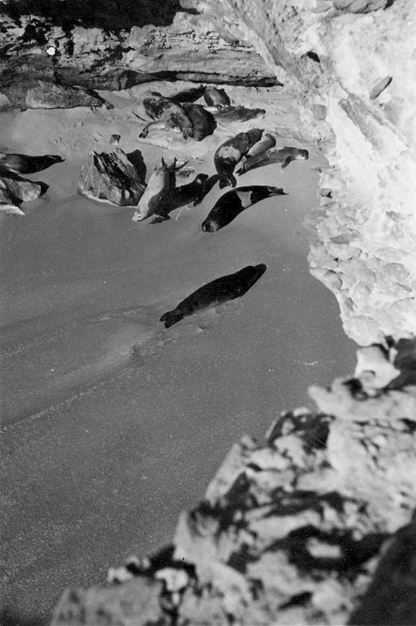
Along the headland's cliffs, in sea caves with entrances hidden below the waterline, lives the largest surviving colony of the Mediterranean monk seal, one of the rarest marine mammals on Earth. Cabo Blanco and the Greek island of Gyaros are the only two places in the world where these animals still gather in a true colony rather than scattered, lonely individuals. The species once ranged from the Black Sea across the Mediterranean and out into the Atlantic, hauled out on beaches from Madeira to the Azores. Hunting and disturbance erased them almost everywhere. Here, on a coast too remote and too forbidding for resorts, a few hundred held on.
Back From the Brink
In the summer of 1997, disaster nearly finished them. A bloom of toxic algae swept the colony, and within weeks roughly two-thirds of the animals were dead, the population crashing from some 350 to little more than 100. It looked like the beginning of the end. Instead, it became the start of a recovery few dared to hope for. Under protection from Mauritania, Morocco, Spain, and Portugal, the colony clawed its way back, and the population has since more than tripled to around 360 animals, with yearly pup births climbing from 26 to roughly 80. The threat of another mass die-off has never gone away. But for now, against long odds, the seals of Cap Blanc are winning.
A Border in the Sand
The headland is divided. On the eastern shore, barely a mile from the line, stands the bustling Mauritanian city of Nouadhibou. On the western shore lies La Guera, a ghost town of empty buildings whose ownership belongs, on paper, to the unresolved dispute over Western Sahara. The boundary was drawn by France and Spain at a convention in 1900, splitting the cape between their colonies; today it separates Mauritania from a territory claimed by Morocco and by the Polisario Front alike. Neither force occupies the western tip, so Mauritania quietly polices it. The arrangement is one of those frozen compromises that hold precisely because no one tests them, a quiet edge of an old quarrel.
Where Africa Watches the Sun Go Down
Cap Blanc is not the westernmost point of Africa, yet because of the tilt of the Earth it claims a stranger distinction: at least twice a year, it is the last place on the entire continent to see the sun set. A lighthouse has marked the cape since 1910, sweeping the same waters that wrecked countless ships over the centuries. The wider headland is an Important Bird Area, a wintering ground for turnstones, gulls, and Caspian and Sandwich terns. The literature of shipwreck haunts this coast: Captain James Riley beached his vessel near here and survived to write of it, and Herman Melville name-checks Cape Blanco in Moby-Dick. Few places hold so much loss and so much stubborn survival on one strip of sand.
From the Air
Ras Nouadhibou runs north to south at roughly 20.77 N, 17.05 W, a slender peninsula enclosing Dakhlet Nouadhibou Bay. The nearest field is Nouadhibou International (GQPP) on the eastern shore. From the air, the cape reads as a pale, low spit of land dividing open Atlantic from the calmer bay, with the city of Nouadhibou clustered on its inner edge and the abandoned La Guera near the western tip. The cliffs that shelter the monk-seal caves face the open ocean. Best viewed at 2,500-5,000 ft in afternoon light; the headland often catches the day's final sun while the mainland behind it has already gone to shadow.
Nearby Stories
- Arguin 26 km away
- Guerguerat 38 km away
- Banc d'Arguin National Park 57 km away
- Chami 120 km away
- Inal, Mauritania 164 km away
- SS Noemijulia 307 km away
- Sao Miguel 2003 km away
- Rocas Atoll 3267 km away