
Rathmines
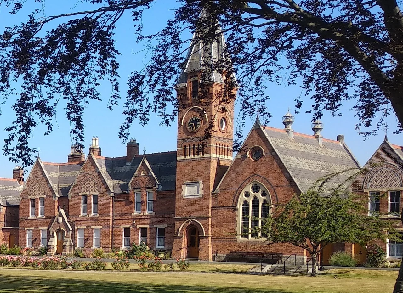
Four clock faces. Four different times. The clock tower on Rathmines Town Hall has been telling the wrong hour - in four directions simultaneously - for so long that Dubliners have given it a name. The Four Faced Liar. Walk south from the Grand Canal up Rathmines Road and the green copper dome of the Mary Immaculate church appears first, then the cream stone of the Town Hall with its lying clock. Underneath that genteel Victorian skin lies a suburb whose history involves a copper church dome originally bound for St. Petersburg, a battle that may have decided the fate of Ireland, and a generation of young civil servants who knew it simply as Flatland.
Two August 1649
The Battle of Rathmines was fought on 2 August 1649 between Royalist forces under the Marquess of Ormonde and Parliamentary troops besieged inside Dublin under Michael Jones. Up to five thousand died in a single afternoon - a casualty figure comparable to Naseby in the English Civil War. Ormonde lost catastrophically. The Royalist siege of Dublin collapsed within hours, and Oliver Cromwell, watching from England with his army ready to embark, suddenly had an open port through which to land an invasion force. He arrived two weeks later. The conquest of Ireland that followed remains one of the most brutal episodes in either nation's history. Some historians argue Rathmines decided that outcome before Cromwell's first foot touched Irish soil. The battlefield is now suburban streets - Bloody Fields was the local nickname for centuries, marking the ground between Rathmines and Ranelagh where most of the dead fell.
Dublin's Belgravia
Rathmines became the place wealthy Dubliners moved when they wanted distance from the city's deteriorating Georgian core. The Rathmines Township, established by Act of Parliament in 1847, eventually absorbed Rathgar, Ranelagh, Sallymount and Milltown into a kind of self-governing south-Dublin shadow city. The 19th-century guidebooks called it the 'Dublin Belgravia.' Grand terraces rose along Leinster Road, Belgrave Square, Grosvenor Square - Victorian redbrick on top of Georgian foundations. The township had its own clock-tower town hall (designed by Sir Thomas Drew, completed 1897), its own library funded by Andrew Carnegie's grant of £8,500 in 1913, its own gas company, its own sewerage. It was absorbed into the City of Dublin only in 1930, and the place still half-remembers being its own polity. The Four Faced Liar clock dates from those independent years.
The Dome Meant for Russia
The Mary Immaculate, Refuge of Sinners Church - a neoclassical Catholic church with a Roman portico - rises on the western side of Rathmines Road. Its current green copper dome arrived in Dublin in 1922 by accident of history. The original dome had burned in a 1920 fire that started, conveniently for the IRA, in a vestry being used to store weapons during the War of Independence. The replacement was a copper dome manufactured for a church being built in Saint Petersburg before the Russian Revolution interrupted everything. With the Russian project abandoned, the dome was redirected to Dublin and lifted into place over the rebuilt nave. It has been turning a deepening shade of green for over a century now. Across the road, John Semple's Gothic Revival Holy Trinity Church was built in 1828 out of black calp limestone that darkens in the rain - one of two churches Dubliners called the Black Church.
Flatland
From the 1930s onward those great Georgian and Victorian houses began to be subdivided. The single-family terraces of Leinster Road and Grosvenor Square became bedsits and small flats, rented to civil servants newly arrived in Dublin, country girls training as nurses or teachers, students at the technical colleges and universities. The neighbourhood acquired a new nickname - Flatland - and a particular bohemian-respectable character that lasted into the 1990s. James Joyce had been born nearby at 41 Brighton Square in 1882, and spent some of his childhood at 23 Castlewood Avenue. The Sheehy-Skeffingtons - Francis the murdered pacifist and Hanna the suffragette - lived at 11 Grosvenor Place. Lafcadio Hearn, the writer who would later settle in Japan and become a Japanese citizen as Koizumi Yakumo, was brought up here. Constance Markievicz lived in a house her mother bought for her. So did James Connolly's daughter Nora and Kathleen Lynn the revolutionary doctor. Then gentrification reversed the process. The bedsits were re-amalgamated. A redbrick terraced house on Rathmines Road that had been chopped into seven flats sold in 2021 as a single family home for over a million euro.
A Liar Still Lying
Modern Rathmines still hums. The Swan cinema was rebuilt in 2014 into a multiplex with eight screens; the vintage Stella was restored in 2017 to show classics in a single auditorium. St Mary's College on Rathmines Road has produced multiple Ireland rugby internationals, including Johnny Sexton and Brian O'Driscoll, both of whom still live in the neighbourhood. The Luas tram glides past on the old Harcourt Street railway line, closed in 1959 and reopened in 2004 as light rail. Cathal Brugha Barracks - the old Portobello Barracks where Sheehy-Skeffington was murdered in 1916, where Michael Collins later kept his headquarters - is still in continuous military use. And above it all, the Four Faced Liar tells four different lies in four different directions, no two of which agree, every minute of every day, exactly as it has for over a century.
From the Air
Rathmines lies at 53.33°N, 6.27°W, immediately south of the Grand Canal and Dublin's inner city, stretching down Rathmines Road toward Rathgar and Terenure. From altitude it is recognisable by the dense grid of Victorian terraces, the green copper dome of the Mary Immaculate church on the main street, and the clock tower of Rathmines Town Hall. The Grand Canal forms its northern boundary; the Wicklow Mountains rise on the southern horizon. Dublin Airport (EIDW) lies 11 km north.
Nearby Stories
- Wicklow Mountains 12 km away
- Mornington 14 km away
- German submarine U-1051 16 km away
- Abbey of Kells 18 km away
- Irish Military Intelligence Service 20 km away
- HMS Manners (K568) 37 km away
- Templemore 42 km away
- Irish Sea Bridge 43 km away