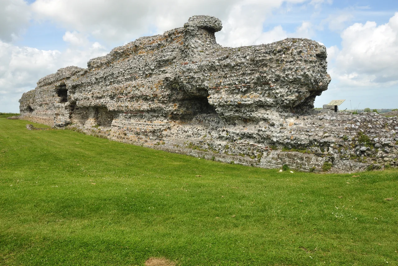

Richborough Castle
Two parallel V-shaped ditches, at least 650 metres long, lie just under the soil at Richborough. They are 2,000 years old. Roman legionaries dug them in 43 AD to protect a beachhead - the landing site for the Claudian invasion of Britain. The Wantsum Channel that brought those ships up to Richborough has long since silted up; the fort that grew up around the beachhead now sits two miles inland from the modern coast. But for nearly four centuries, Richborough was the front door of Roman Britain. Soldiers came in through it. Trade came in through it. And around 410 AD, the last Roman soldiers walked out through it forever.
Rutupiae, Gateway of Britain
The Romans named it Rutupiae or Portus Ritupis. The first part of the name comes from a British Celtic root meaning rust or mud, related to Welsh rhwd. An alternative form, Ritupiae, may contain ritus meaning ford - perhaps referring to a crossing point between the Isle of Thanet and the mainland when the Wantsum Channel was still a navigable strait. The Romans valued the place for its position near a large natural harbour and for the quality of its oysters - the Latin poet Juvenal mentions Rutupine oysters in the same breath as those of Italy's famous Lucrine Lake. The phrase Rutupine shore became a common Latin metonymy for Britain itself. From Rutupiae ran the road we now call Watling Street, the spinal cord of Roman Britain, leading to London and on to Wroxeter.
The Triumphal Arch
Around AD 85, after the general Agricola's victory at the Battle of Mons Graupius in Scotland, somebody built a colossal monument at Richborough. It was a quadrifrons triumphal arch - four-sided, vaulted - and almost 25 metres tall, faced with high-quality Carrara marble, adorned with sculpture and inscriptions. It must have been an imperial commission; only an emperor could afford that scale and that imported stone. The arch straddled Watling Street where the road met the harbour. Anyone arriving by ship to Britannia passed through it. Anyone leaving Britannia passed through it. It announced, in stone and gilded letters, that you were entering or leaving the empire. Only the foundations and a low mound remain at the site today. The Romans themselves pulled the arch down two centuries later, when they needed building materials for something more urgently practical.
The Saxon Shore Fort
By the late third century the security situation along the Channel coast had changed. Saxon pirates raided from across the North Sea. Pictish raiders harried Britain from the north. The Romans built a chain of heavy stone fortresses around the south-east and east coast, called the Saxon Shore forts, to guard against seaborne attack. Richborough's was one of the largest. Construction began around 277 and was finished by 285. To get the stone, the Romans demolished their own triumphal arch and reused the granite blocks as spolia in the new fort walls. The numismatic evidence - the coins found in the masonry - suggests the work happened during the reign of Carausius, the Roman naval commander who in 286 declared himself emperor of Britain and northern Gaul. The walls he built still stand to a height of several metres, massive and unmistakable, the most impressive Roman ruin in Britain.
The Amphitheatre and the Painted Walls
About 300 metres south-west of the fort lies a low grassy hummock that almost no visitors used to notice. It is a Roman amphitheatre, with capacity for around 5,000 spectators. Excavations in 2021 transformed our understanding of it. The arena walls, built of chalk block from local quarries, were plastered and painted in vivid red and blue - the first painted amphitheatre walls known in Roman Britain. A carcer, or holding cell, was found alongside, with walls almost 2 metres high, designed to hold the gladiators, criminals, and wild animals waiting their turn to enter the arena. The amphitheatre seems to have remained in use from the invasion all the way to the end of Roman rule in the early fifth century. That is over 350 years of public spectacle on the same spot - longer than the entire history of European baseball, played out within sound of the Channel surf.
The Wooden Gateway of 2023
There is also a small ruined structure that may be the remains of a Roman Christian church, probably built at the end of the fourth century or the beginning of the fifth - the Romans were officially Christians by then, and a hexagonal stone font was found at the site. In 2023 English Heritage built a replica wooden Roman gateway on the precise site of the original 43 AD invasion gateway. Climb to the top and on a clear day you can see north to Reculver, the ruined twin towers of Regulbium, another Saxon Shore fort. The on-site museum has been refurbished to display the extraordinary finds: brooches, coins, pottery, fragments of the painted amphitheatre wall. Richborough is the only place in Britain where you can stand on the spot where Roman Britain began - and look across the same grass at the spot where it ended. Both transitions happened here. Both are still legible in the stones.
From the Air
Richborough Castle sits at 51.294 degrees N, 1.332 degrees E, in flat coastal land about a mile north of Sandwich and two miles from the modern coast. From altitude the Roman fort's massive rectangular stone walls are clearly visible against the surrounding green fields. The amphitheatre is a faint oval hummock about 300 metres south-west. Pegwell Bay and the former Ramsgate Hoverport are visible 2 nm north. Manston (closed) is 2 nm north-west. Best viewed at 1,500-3,000 feet AGL approaching from the Channel; the fort's walls are unmistakable.
Nearby Stories
- Ringlestone Inn 3.4 km away
- Cliffs Pavilion 3.5 km away
- Citadel of Calais 6.5 km away
- 2021 English Channel Disaster 11 km away
- Stag Inn, Hastings 15 km away
- Dungeness Lighthouse 19 km away
- Clacton Pier 32 km away
- Four Days' Battle 54 km away