
Rinyirru (Lakefield) National Park
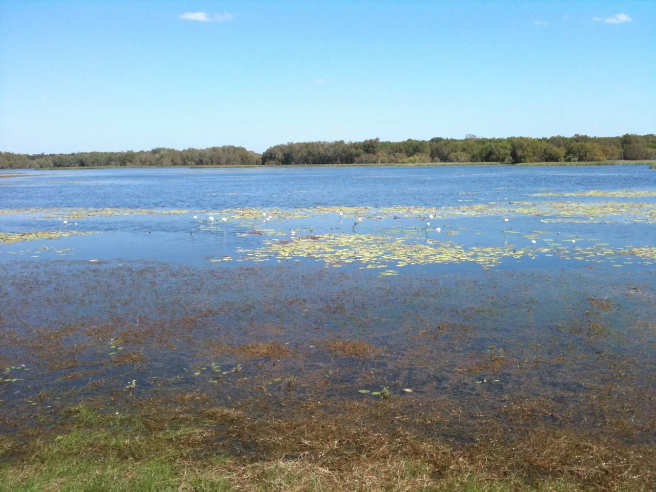
Wait for the dry season and the country changes its mind about you. In the wet, Rinyirru drowns - rivers spill their banks, tracks vanish, the whole floodplain becomes one shining inland sea. Then the rain stops, the water pulls back into a thousand lagoons, and what is left is one of the great wetland wildernesses of Australia: more than five thousand square kilometres of lily-covered water and golden grass at the base of Cape York. This is Rinyirru, the place most maps still call Lakefield, and the older name is the truer one.
A Country Made of Water
Rinyirru is the second-largest national park in Queensland, sprawling from the shores of Princess Charlotte Bay south toward the little town of Laura. To grasp the scale, the park is larger than Trinidad and Tobago. Through it run the Normanby, Morehead and North Kennedy rivers, threading between more than a hundred permanent lagoons - billabongs that hold their water long after the floodplain dries. In the early morning the lagoons mirror the sky so perfectly that the waterbirds seem to walk on light. Brolgas and the taller, rarer sarus cranes stalk the shallows; magpie geese rise in clattering thousands; black-necked storks - the jabiru - pick through the margins on stilt legs; comb-crested jacanas trot across the lily pads as though the water were solid ground. It is, by any measure, one of the richest gatherings of waterbirds in the country.
The Old People's Country
Long before any European reached these rivers, this was home. The fertile coastal strip supported numerous Aboriginal clans, and the floodplain is dense with their presence still - occupation sites, ceremonial grounds, and the named places where stories live in the land. This is the country of the Lama Lama and Kuku Thaypan peoples and related clans and families, whose ancestors read these wetlands as a calendar and a larder and a library all at once. The colonial frontier came late and came hard to Cape York, in the 1870s and after. That the descendants of the first people are still here, still connected to this country, is not a footnote. It is the heart of the place.
Handed Back
In 2011 something remarkable happened: the land was returned. More than half a million hectares were transferred to Aboriginal freehold, held by the Rinyirru (Lakefield) Land Trust, and the park was reborn under a category that says its purpose out loud - jointly managed by the Rinyirru Aboriginal Corporation and the Queensland Government as Cape York Peninsula Aboriginal Land. Traditional Owners and rangers now care for the country together, weaving fire management, cultural knowledge and conservation science into a single way of looking after a place. The name change to Rinyirru was part of that return - a word that belongs to the land itself, restored to it.
Living With Crocodiles
Rinyirru is crocodile country in the fullest sense, and the park makes no apology for it. Estuarine crocodiles - the largest living reptiles on Earth - patrol these rivers and lagoons, and they have done so since long before there were people to fear them. The rule for visitors is blunt and absolute: do not camp within fifty metres of any water, do not stand at the edge to fish, do not assume the quiet lagoon is empty. This is the price and the privilege of a wetland that still works. There are bush campgrounds scattered through the park and two with showers, at the Kalpowar and Hanns crossings, but everything here runs on respect - for the water, for the crocodile, and for the people whose country this has always been.
From the Air
Rinyirru (Lakefield) National Park centres near 14.55°S, 144.12°E on Cape York Peninsula, roughly 340 km northwest of Cairns by road. From the air the park is a sprawling floodplain laced with the dark, looping channels of the Normanby, Morehead and North Kennedy rivers and dotted with hundreds of bright lagoons; its character shifts dramatically with season - a vast sheet of water in the wet (December-April), a mosaic of shrinking billabongs in the dry. The park runs from Princess Charlotte Bay in the north to Laura in the south. Recommended viewing altitude 6,000-10,000 ft to take in the river systems and lagoon chains. Nearest airfields: Cooktown (YCKN) to the southeast, Coen (YCOE) to the northwest, with Laura and Musgrave as remote strips; Cairns (YBCS / CNS) is the main gateway. Expect afternoon build-ups and reduced visibility in the wet season; remote terrain with no services - full fuel reserves essential.
Nearby Stories
- Coen, Queensland 42 km away
- Musgrave Telegraph Station 52 km away
- Cape York Peninsula 54 km away
- Cape Melville 57 km away
- Coen Carrier Station 68 km away
- Guugu Yimithirr language 89 km away
- Mrs Watson's Cottage 106 km away
- Japanese submarine Ro-33 589 km away