.jpg)
The Rocky Fire: When a Water Heater Burned 69,000 Acres
A Cal Fire veteran called it "really unprecedented in recent times, or in even veterans of our department's recollection." On a Wednesday afternoon in late July 2015, a gas-powered water heater strapped to a tree in an outbuilding full of flammable liquids caught fire on Morgan Valley Road, east of Clearlake in Lake County. The outbuilding served an illegal cannabis growing operation. By nightfall, the resulting wildfire had consumed 13,500 acres of oak woodland, grassland, and chaparral -- and it was only getting started. Over the next 16 days, the Rocky Fire would burn 69,438 acres across three counties, destroy 96 structures, produce towering pyrocumulus clouds visible from Sacramento, and cost $46.1 million to fight. The two suspects responsible fled the country before investigators could question them.
Decades of Fuel, Waiting
The terrain east of Clearlake had not burned in several decades. Fire suppression policies -- the longstanding practice of extinguishing every wildfire as quickly as possible rather than allowing periodic burns to clear undergrowth -- had allowed dense chaparral to flourish unchecked, growing more than six feet tall in places. Oak woodlands and grasslands filled the rough, hilly landscape between Clear Lake and the Sacramento Valley. Then came the drought. Beginning in 2011, California entered a multi-year dry spell that would become one of the most severe in the state's recorded history. By July 2015, moisture levels in chamise brush -- one of the dominant vegetation types in the Rocky Fire burn area -- had dropped to near-record lows, even though September and October are typically the driest months. The landscape was primed. It needed only a spark.
Five Hours, Twenty Thousand Acres
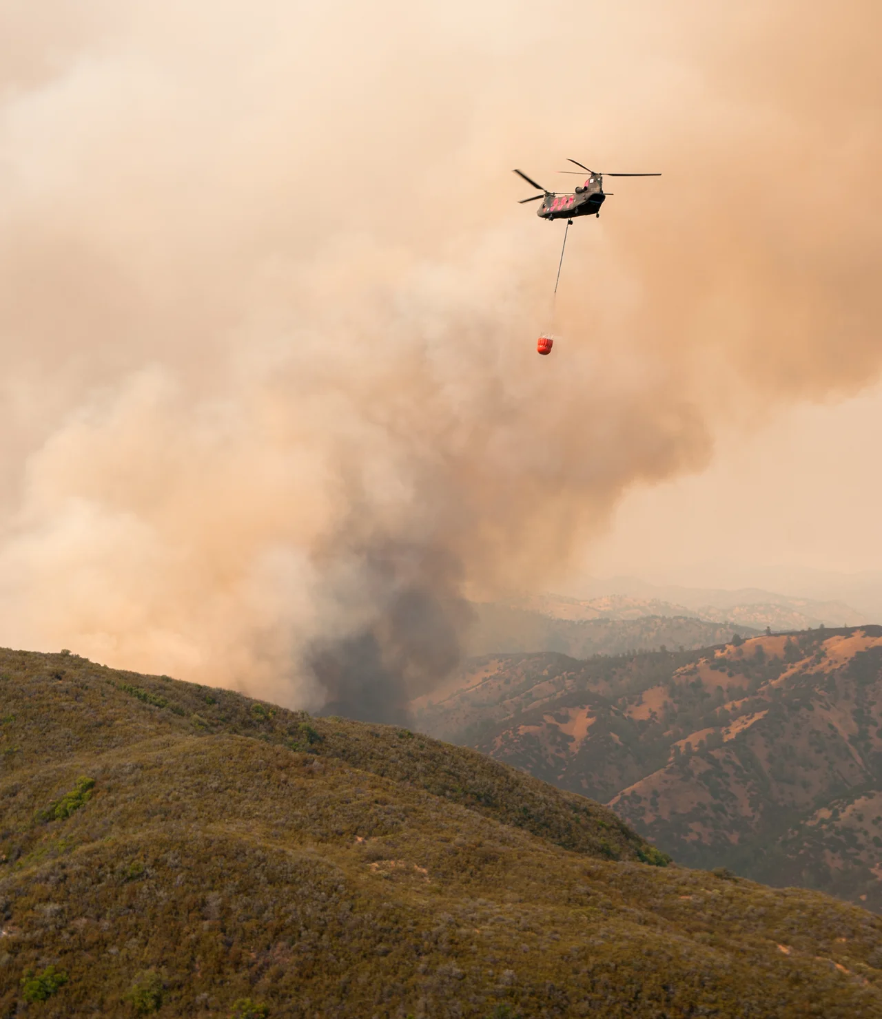
The spark came at about 3:30 p.m. on July 29. Firefighters were initially dispatched to what they believed was a structure fire on Rocky Creek Road. A second fire was reported on Morgan Valley Road with an unknown cause. The fire took its name from Rocky Creek, which flows north of Morgan Valley Road. High temperatures and wind drove the flames into thick brush, where the fire advanced through ember spotting -- burning embers carried aloft and dropped ahead of the fire front, igniting new blazes. By nightfall it was the largest active wildfire in Northern California. What happened next defied the computer models. In a single five-hour window, the Rocky Fire consumed roughly 20,000 additional acres, a rate of spread that veteran Cal Fire personnel had never witnessed in a fire not driven by strong winds. The fire generated its own weather: massive pyrocumulus clouds that climbed to 35,000 feet, towering columns of superheated air and moisture that collapsed unpredictably, sending downdrafts racing across the surface and scattering embers in every direction.
Retreat and Regroup
Firefighters abandoned containment lines on the northern and eastern flanks. There was no holding the fire where they had drawn their lines, so they fell back several miles to California State Route 20 and State Route 16, using the highways as firebreaks. Along those corridors, they conducted firing operations -- deliberately burning fuel between the roads and the advancing fire to starve it of vegetation. The strategy held on most fronts. But near Cache Creek, the fire burned upslope through a drainage, producing a massive plume. A sudden wind shift sent embers sailing across Route 20, igniting spot fires as far as a mile away in Long Valley. The fire tore through a subdivision, destroying multiple structures as it pushed north toward Indian Valley Reservoir. By August 5, the Rocky Fire's burn area exceeded 69,000 acres -- more than four times the size of any other active wildfire in California at the time. Only the segment that had jumped Route 20 remained uncontained.
The Reckoning
Improved weather arrived later that week. Temperatures dropped, humidity climbed, and firefighters doubled their containment of the perimeter in just two days. On August 14, the Rocky Fire was declared 100 percent contained at 69,438 acres. No one died. No firefighters were seriously injured. But 96 structures were gone, residents had been scattered to hotels, Red Cross shelters, and tents in parking lots, and Governor Jerry Brown had declared a state of emergency. Smoke drifted southeast to Sacramento, triggering air quality advisories. A year later, Cal Fire announced the cause: a malfunctioning gas-powered water heater associated with an illegal cannabis operation. The arrangement -- a water heater strapped to a tree, housed in a shed full of flammable liquids -- was described by a Cal Fire spokesperson as "inventive" but "not very safe." The Rocky Fire was one of five wildfires linked to cannabis cultivation in Northern California that year, and one of 52 wildfires nationwide that exceeded 40,000 acres in 2015.
A Landscape Rewritten
The Rocky Fire burned through terrain that had quietly accumulated fuel for decades. In that sense, the fire was not an anomaly but a correction -- a violent reassertion of a natural process that suppression policies had deferred but could not prevent. Lake County would learn this lesson again just weeks later, when the Valley Fire burned through nearby Middletown and killed four people. The two fires, arriving in rapid succession, marked 2015 as the year Lake County entered California's modern era of megafire. The charred hillsides east of Clearlake have since begun to recover, chaparral and grass returning to slopes that were stripped bare. From the air, the fire's footprint is still legible in the patchwork of regrowth and bare ground, a scar that stretches across three counties and tells the story of what happens when drought, fuel, and a single careless ignition converge.
From the Air
The Rocky Fire burn area is centered at approximately 38.89N, 122.48W, spanning rough terrain between Clear Lake to the west and the Sacramento Valley to the east. The fire crossed through portions of Lake, Colusa, and Yolo counties. Key landmarks include Clear Lake (easily identifiable), Cache Creek drainage, Indian Valley Reservoir to the north, and California State Routes 20 and 16 which served as firebreaks. The nearest airports include Lampson Field (1O2) in Lakeport and the Clearlake area. Sacramento Executive Airport (KSAC) lies to the southeast. The terrain is hilly with oak woodland and chaparral. At 2,000-4,000 feet AGL, the fire's burn scar remains partially visible as a mosaic of regrowth and bare terrain. Summer conditions bring high fire danger and turbulent thermals over the dark burn scar areas.
Nearby Stories
- The People of the Roundhouse 5.2 km away
- Where Three Hundred Thousand Wings Descend 6 km away
- Robert Louis Stevenson State Park 7.5 km away
- Austin Creek State Recreation Area 12 km away
- From Radio Towers to Tribal College: D-Q University 15 km away
- The Valley That Drowned 15 km away
- Berryessa Snow Mountain National Monument 21 km away
- The Day Two Nuclear Bombs Fell on Yuba City 22 km away