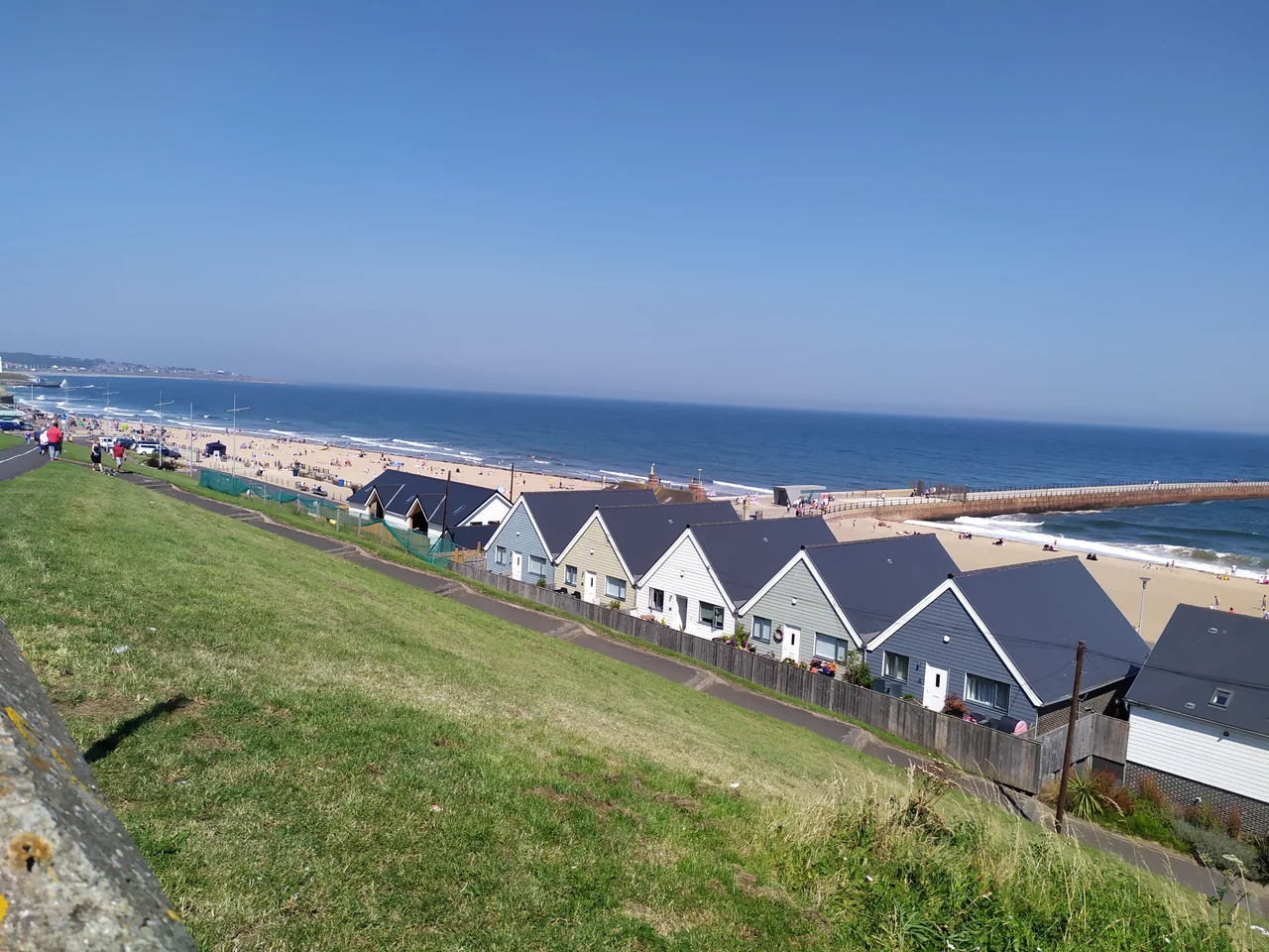

Roker
There is a signpost next to the Bungalow Cafe on Roker promenade. Four wooden arms pointing in four directions. To Beach. To Village. To Bungalow. To Germany. The first three are useful. The fourth is the joke that everyone takes a photo of - because Germany is exactly where you would arrive if you walked straight out across the North Sea from this stretch of Sunderland coast, 460 nautical miles east, and because Roker has always known its place in geography. This is the last edge of England before the sea takes over.
Six Soldiers and a Cliff
The Abbs family was granted land on the north side of the Wear in 1587 on a peculiar condition: they had to supply six soldiers to defend the mouth of the river. The arrangement is the kind of late-Elizabethan feudal bargain that nobody made for very long, but the Abbs held the cliffs for generations. Roker as a place name was first recorded in 1768 as Roca, possibly transferred from Cabo da Roca in Portugal - the European mainland's westernmost point - by Sunderland mariners who had rounded the Iberian coast. The cliff-top terraces appeared in 1840. The pier and lower promenade followed in 1846. By the end of the nineteenth century Roker had become what it remains: a coastal resort on the door of an industrial port.
Roker Pier and the Striped Light
Henry Hay Wake was 25 when he became Chief Engineer to the River Wear Commission in 1868. By 1885 he was laying the foundation stone of a pier that would be applauded as a triumph of engineering. The New North Pier - now Roker Pier - extends 1,198 feet into the North Sea, built of granite-faced concrete blocks moved by a Goliath crane onto wagons and placed by a Titan crane at the working face. The lighthouse at the pier head, completed in 1903, is built of naturally coloured red and white Aberdeen granite in alternating bands. When new it was claimed to be Britain's most powerful port light - 150,000 candle power, visible 15 nautical miles out. Automation came in 1972. The light still flashes. The pier was damaged by Storm Babet in October 2023 and was due for repair in 2025.
Edward Schroeder Prior's Masterpiece
Two streets back from the seafront stands St Andrew's Church, built between 1905 and 1907 by Edward Schroeder Prior. Architectural historians rank it among the finest churches of the first half of the twentieth century - the masterpiece of an Arts and Crafts movement that took medieval forms and made them new. Prior worked in rough magnesian limestone, with a single vast transverse arch carrying the roof and clear glass flooding the interior with North Sea light. The result is not pretty in the conventional sense. It is sober and grand, with the proportions of a small cathedral compressed into a parish church. Nikolaus Pevsner called it one of the most interesting and successful churches of its date in England. Most people walking the promenade have never been inside it.
The Roker Roar and What Came After
From 1898 to 1997 Roker meant football to most of the world. Roker Park Stadium stood half a mile inland - home of Sunderland AFC, scene of the Roker Roar that visiting players said disoriented them. When the club moved to the Stadium of Light in 1997 a housing estate rose on the pitch, its streets named Promotion Close and Goalmouth Close. The resort itself kept going. The Sunderland International Airshow drew hundreds of thousands of spectators every July from the 1980s until 2019, when the council ended it for environmental reasons. The Bungalow Cafe still pours tea. The Roker Watch House museum, opened in 1906 as the Volunteer Life Brigade's headquarters, still keeps Sunday hours. Bede's cross stands on the cliff top, remembering the saint who lived and worked at the twin monasteries of Wearmouth and Jarrow thirteen hundred years ago. Roker contains all of this within about half a mile of coast.
From the Air
Centered at 54.923 degrees north, 1.366 degrees west, Roker occupies the cliffs on the north side of the Wear estuary, running about a kilometre north to the boundary with Seaburn. From 1,500 to 2,500 feet AGL the Roker Pier Lighthouse with its striking red-and-white granite stripes is the dominant landmark, marking the harbour mouth. Roker Park recreation ground sits on the cliffs immediately south of the seafront terraces. Nearest major airport is Newcastle International (EGNT), 11 nautical miles north-northwest. Durham Tees Valley (EGNV) is 23 nautical miles south. North Sea visibility deteriorates rapidly in coastal fog - check conditions before approaching the shore.
Nearby Stories
- Seaton Carew 2.7 km away
- HMS Unity (N66) 6 km away
- George Stephenson's Birthplace 6.1 km away
- Raby Castle 9 km away
- Cragside 15 km away
- Whitby Abbey 21 km away
- German submarine U-2367 46 km away
- Alexander L. Kielland (Platform) 277 km away