.jpg)
Twenty-Nine Minutes Over Borneo
The flight was supposed to last 29 minutes. On the evening of September 6, 1997, a Dornier 228-212 turboprop lifted off from Brunei International Airport at 7:13 p.m. local time, carrying eight passengers and two pilots on a short hop across the border to Miri, in the Malaysian state of Sarawak. It was a charter operation, flown by Merpati Intan Sdn Bhd on behalf of Royal Brunei Airlines, a routine commuter run on a route measured in tens of nautical miles rather than hundreds. The aircraft never arrived. Somewhere on approach, in the darkening skies over Lambir Hills National Park, the Dornier struck a forested slope at 500 meters elevation. No one survived.
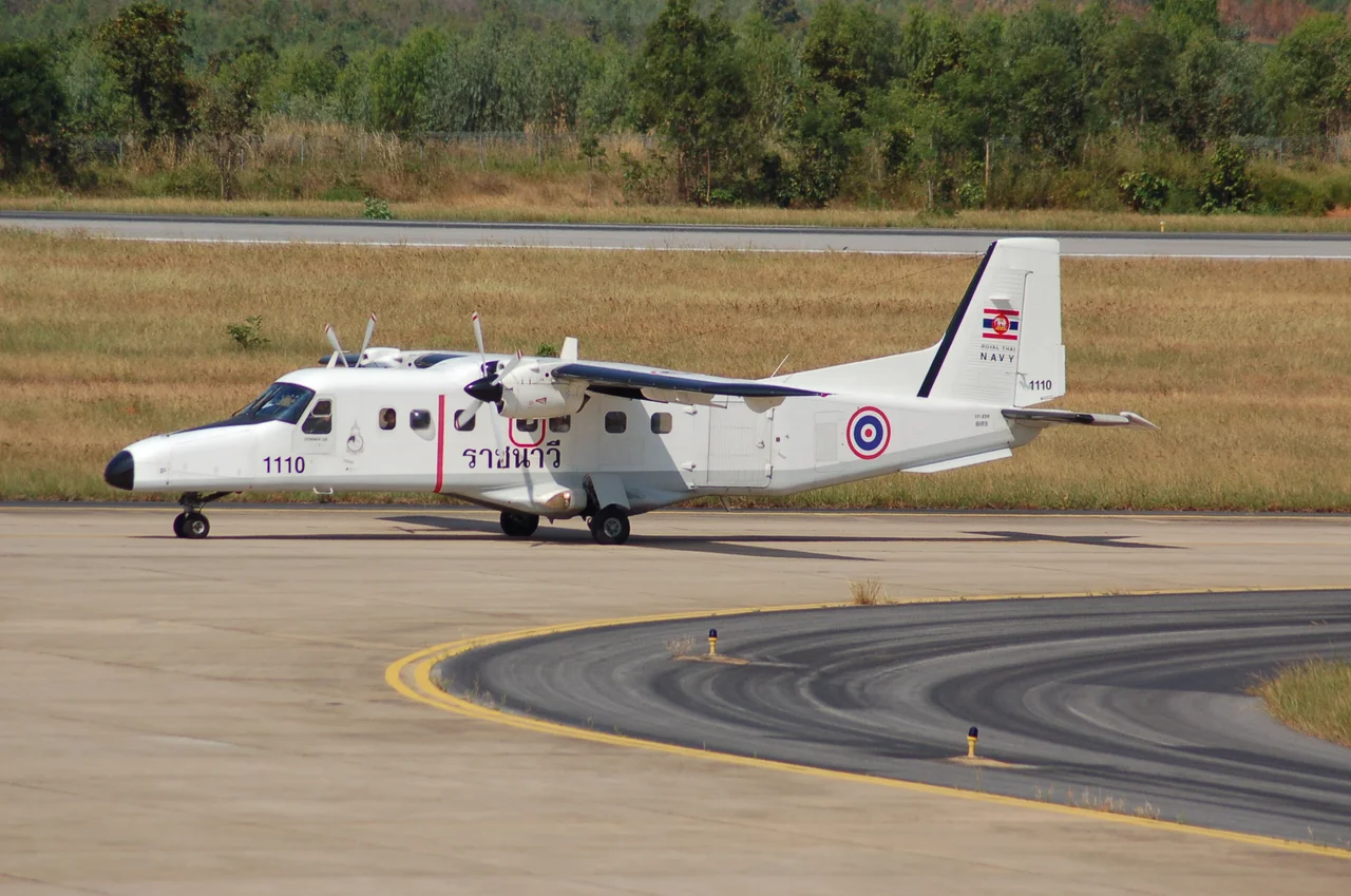
The Crew and Their Aircraft
The pilot-in-command was 40-year-old Captain Mohammad Tarmizi Muda, a former military pilot who had accumulated 3,947 total flight hours, 783 of them on the Dornier 228. His first officer, 29-year-old Wong Lein Yee, was far less experienced, with 1,120 total hours and just 22 on the type. The Dornier 228-212, registered 9M-MIA, was a German-built twin-turboprop designed for short-haul and regional operations. Manufactured by Dornier Luftfahrt GmbH with serial number 8217, it was a sturdy workhorse of Southeast Asian regional aviation, well suited to the short runways and demanding conditions of Borneo's interior airstrips. Merpati Intan Sdn Bhd operated the aircraft as a charter carrier, feeding passengers into Royal Brunei's network on routes too thin for the national airline's own equipment.
Into the Hills
Flight 839 departed Brunei International Airport on schedule, heading southeast toward Miri Airport, a flight path that traced the coastline of northern Sarawak before turning inland for the approach. As the Dornier neared Miri, the crew contacted air traffic control and requested clearance to land. Controllers cleared the flight for a visual approach to Runway 02. Then silence. The crew never acknowledged the clearance. At 7:42 p.m., just 29 minutes after takeoff, the aircraft struck a slope in the Lambir Hills, the same forested ridgeline that shelters one of Borneo's most biodiverse national parks. The impact site sat at roughly 500 meters elevation, deep in the canopy of mixed dipterocarp forest. The wreckage was not located until 7:10 the following morning, when search teams working through dense vegetation reached the debris field on the hillside.
A Year of Losses
The crash of Flight 839 was the sixth aviation accident in Malaysia in 1997, a grim frequency that shook confidence in the country's regional carriers. It was also the second fatal crash at Miri itself. On September 3, 1991, six years and three days earlier, another aircraft had gone down near the same airport, killing 14 people. The pattern underscored the challenges of flying in northern Borneo, where equatorial weather could shift from clear to opaque in minutes, and where the terrain surrounding coastal airports rose quickly into forested hills. Miri Airport sits near sea level, but the Lambir Hills begin their climb just kilometers to the south, presenting an unforgiving obstacle for any aircraft that drifts below its intended glide path during an approach.
What Remains
Today the Lambir Hills stand much as they did that September evening, the canopy long since healed over the impact site. The national park draws weekend visitors from Miri who come for its waterfalls and hiking trails, most of them unaware that a crash site lies somewhere in the interior forest. The Dornier 228 has largely faded from the region's active fleet, replaced by newer turboprops better suited to the demands of modern regional aviation. But the flight endures in the statistical record, a line in the Aviation Safety Network database, a PDF in the Malaysian Ministry of Transport's archived accident reports. For the families of the eight passengers and two crew members, it remains something else entirely: the evening a half-hour commuter flight across the Borneo coast never completed its descent.
From the Air
The crash site is located at approximately 4.20°N, 113.96°E, on a forested slope in Lambir Hills National Park at roughly 500 meters (1,640 feet) elevation. Miri Airport (ICAO: WBGR) lies approximately 24 km to the north, at near sea level. The flight's route from Brunei International Airport (ICAO: WBSB) traced the northern Sarawak coastline before turning inland for the approach to Runway 02 at Miri. The terrain south of Miri rises quickly from coastal lowlands into the Lambir Hills, making it critical to maintain proper altitude on approach. Pilots should note the rapid elevation change between the coastal strip and the forested ridgeline.
Nearby Stories
- Miri 8.4 km away
- The Black Lake and the White Crocodile 24 km away
- Sarawak Chamber 30 km away
- Niah National Park 34 km away
- Similajau National Park 61 km away
- Our Forests, Our Name 86 km away
- Crown Colony of Sarawak 167 km away
- Luconia Shoals 201 km away