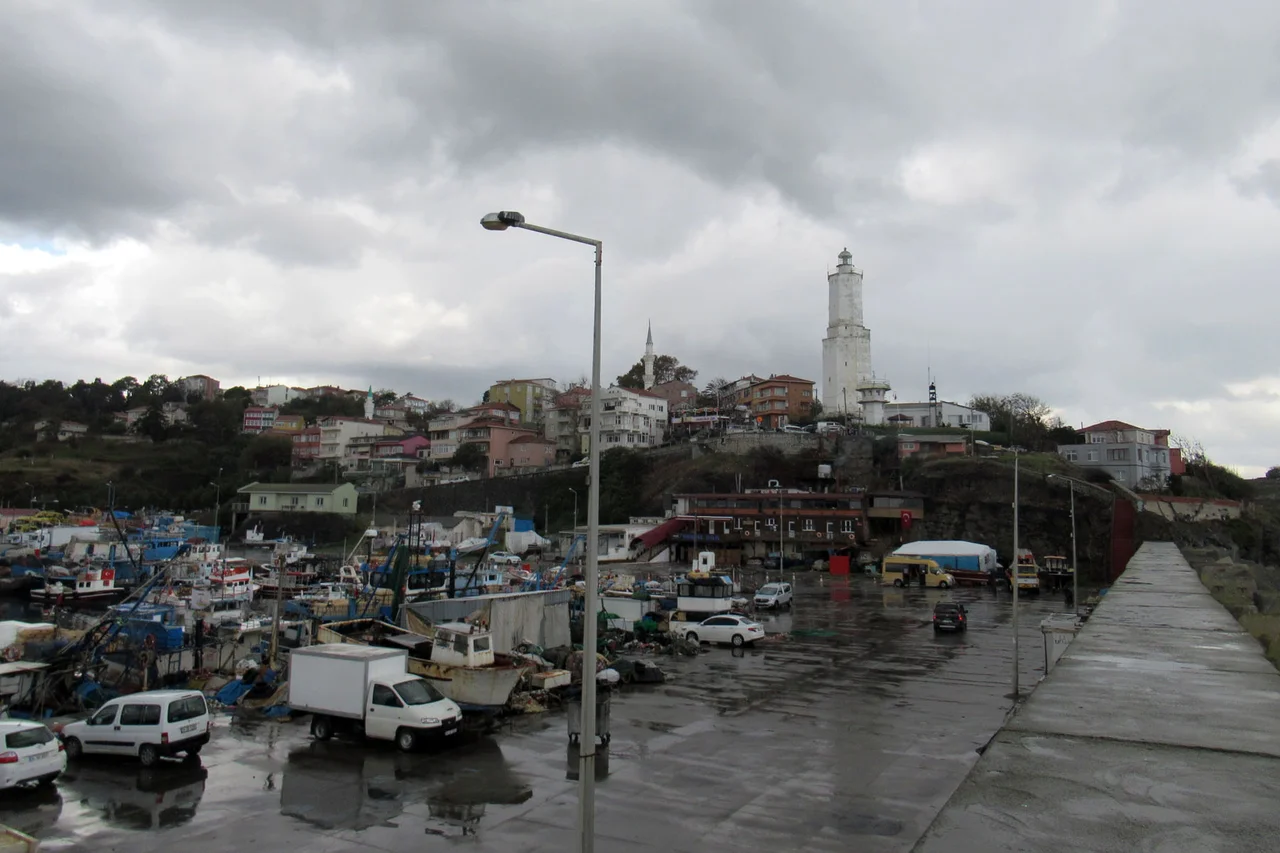

Rumelifeneri, Istanbul
Every ship that has entered the Bosphorus from the Black Sea — every grain carrier from Crimea, every Ottoman warship, every tanker bound for the Marmara — has passed this point. Rumelifeneri sits at the extreme northwest tip of the European shore, the place where the strait begins and the open sea ends. The village takes its name from a lighthouse that sailors have relied on since at least the 15th century, and probably much earlier. At its core, Rumelifeneri is simple: a fishing village on a dramatic headland. Its history is anything but.
The Light That Named the Village
The lighthouse here appears in portolan charts — the navigational maps that medieval sailors used to thread the Mediterranean and Black Sea — and in literary sources dating to at least the 1400s. When the French humanist Petrus Gyllius visited in the mid-16th century, he found an octagonal lighthouse and described it as a structure of Byzantine origin. The village's Greek inhabitants called it Phanarion, from the Greek word for lighthouse, and sometimes used the affectionate diminutive Phanarakion. It is the kind of name that reveals how entirely a community can organize itself around a single essential fact — in this case, that the light was what kept ships from wrecking on the headland in the dark. The name Rumelifeneri, meaning "lighthouse of Rumeli" in Turkish, preserves the same essential meaning across languages and centuries.
Before the War Changed Everything
In the late 19th century, Rumelifeneri was a Greek village of about 900 inhabitants. There was a church dedicated to St. George — possibly built on the foundations of a Byzantine predecessor — and a hagiasma, a sacred well known as tis Tsirpinas, the kind of holy spring that Greek Orthodox communities across Anatolia maintained as gathering places for prayer and community ritual. Archaeological evidence in the area dates back to the late Byzantine era, and a Greek inscription from the 3rd century CE was once on display in the village's Greek cemetery, though it has since been lost. This was a community with deep roots and a stable identity tied to both the sea and the church. Before World War I, that identity was intact. Afterward, and across the upheavals of the 20th century, it was not.
Fishermen and Ferry Trippers
Today Rumelifeneri is a fishermen's village in the practical sense: boats go out, nets come in, the catch goes to the restaurants that line the waterfront. The village has a population of 4,337 (2022) and sits about 10 kilometers from the Sarıyer district center and roughly 25 kilometers from central Istanbul. That relative proximity makes it a destination for day-trippers from the city who come for the seafood, the clean air, and the particular quality of light at the point where the Bosphorus opens into the Black Sea. The water here moves with purpose — currents that have shaped trade routes for millennia — and on clear days the Anatolian shore of the strait is visible across the water, the twin perspective of Anadolufeneri answering from the Asian side.
The Edge of Europe
There is something genuinely vertiginous about standing at Rumelifeneri and looking north. Behind you is Istanbul, 25 kilometers of city, and behind that the full weight of European civilization stretching to the Atlantic. In front is the Black Sea, ringed by Bulgaria, Romania, Ukraine, Russia, Georgia, and Turkey — an inland sea that is really not very inland at all, connected to the Mediterranean only through this narrow strait you are standing beside. Ships move through this gap with the regularity of traffic on a highway. The lighthouse that gave the village its name still stands and still functions. After 600 years of documented service, it remains the last landmark Europe offers to the Black Sea and the first it offers coming back.
From the Air
Rumelifeneri is located at approximately 41.233°N, 29.117°E at the northwestern tip of the European Bosphorus entrance, where the strait meets the Black Sea. From the air, the headland is unmistakable — a promontory jutting into the transition zone between the narrow strait and the open sea. The lighthouse is visible on the point. Looking east across the water, Anadolufeneri on the Asian shore provides a visual counterpart. Nearest major airport is Istanbul Airport (LTFM), approximately 20 km to the west-southwest. Recommended viewing altitude 2,500–4,000 feet for the full panorama of the Bosphorus entrance.
Nearby Stories
- Kınalıada 6.2 km away
- Şile Castle 7.8 km away
- Second Battle of Çatalca 8.9 km away
- Hereke 20 km away
- 2025 Istanbul Earthquake 25 km away
- Battle of Constantinople (922) 61 km away
- Januarius MacGahan 87 km away
- Edirne 160 km away