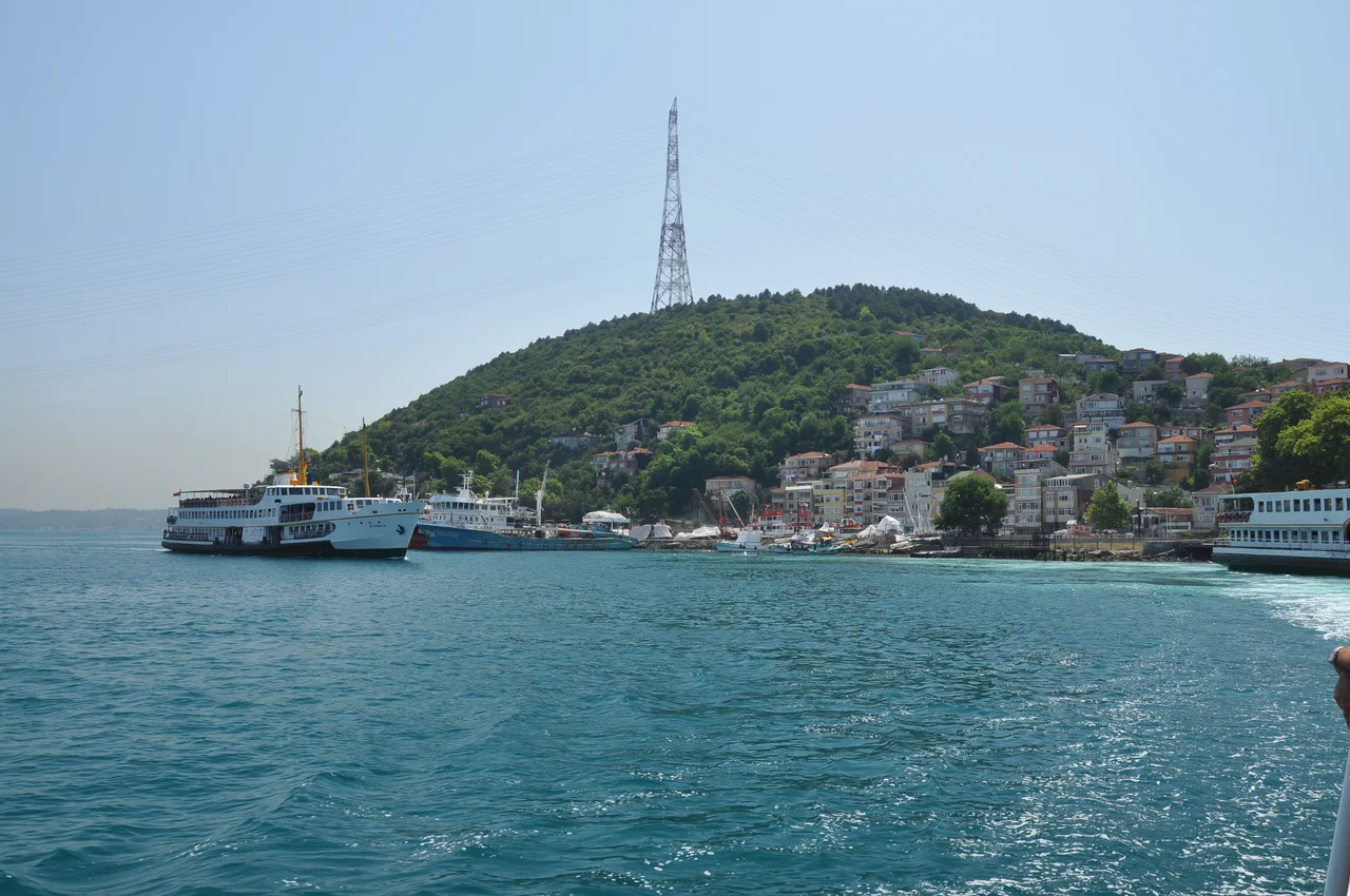

Rumelikavağı
The name tells you what this place was built to do. "Kavak" in Ottoman Turkish means control post — a checkpoint, a position of surveillance, a place where authority meets the waterway and says: nothing passes without our knowledge. Rumelikavağı occupies a strategic bend of the Bosphorus where the strait curves slightly and ships must slow, and for centuries whatever power controlled this bank controlled what moved between the Black Sea and the Marmara. Today it is a neighborhood of 3,657 people, known for its fish restaurants and its ferry pier. But the geography that made it strategically essential has not changed.
A Castle Against the Cossacks
In the 17th century, Cossack raiding fleets from the north became a serious problem for Ottoman Istanbul. Operating in fast, shallow-draft vessels, Cossack forces from the Dnieper and Don rivers swept south through the Black Sea and into the Bosphorus itself on multiple occasions, terrorizing Bosphorus villages and threatening the capital. The Ottoman response included fortifying the upper strait, and a castle at Rumelikavağı was among the defensive installations established to monitor and resist these incursions. The castle ruins still exist, medieval stonework embedded in the hillside above the waterfront. They are not the kind of grand preserved fortress that draws tour buses; they are the kind of ruins that make a neighborhood more layered — fragments of a serious military purpose that the village has long since grown around and beyond.
War, Displacement, and New Neighbors
The Russo-Turkish War of 1877–1878 brought another wave of transformation to the northern Bosphorus shore. As Russian forces advanced through the Balkans and the Ottoman empire ceded territory, a portion of the displaced people from Russian-occupied provinces made their way to Rumelikavağı and settled there in 1877. This kind of demographic layering — fishing families, fortress garrison descendants, war refugees — is characteristic of Bosphorus villages that served multiple functions over time. Well into the 20th century, much of Rumelikavağı remained a military restricted zone, closed to ordinary settlement and visitors until the 1960s. The ruins of churches, mosques, fountains, and hamams scattered through the neighborhood are physical evidence of those accumulated centuries.
The Bridge That Changed the View
North of the neighborhood, the Yavuz Sultan Selim Bridge spans the Bosphorus in a single graceful arc. When it opened in 2016, it became the third bridge linking Europe and Asia across the strait, and at the time of its opening it held the record as the world's widest suspension bridge. The bridge is named for Selim I, the Ottoman sultan who vastly expanded the empire's territory in the early 16th century. From Rumelikavağı's waterfront, the bridge is visible to the north, its twin towers rising above the forested hillsides on both shores. It is a dramatic addition to a view that already included historic fortress walls, the shimmer of the Bosphorus, and the Anatolian shore in the distance.
Fish and the Ferry Pier
The ferry pier at the center of Rumelikavağı is where the neighborhood's daily life concentrates. Ferries from Istanbul connect the village to the city without requiring the drive through Sarıyer, and the pier is the social and logistical anchor of the waterfront. The fish restaurants that cluster around it serve the same Bosphorus catch that local fishermen have pursued for generations — turbot, bluefish, sea bass — alongside the tourists and day-trippers who make the ferry journey north for lunch. There is a pleasantly unhurried quality to a Bosphorus village that still receives its visitors by water. The strait is not just background scenery here. It is the reason the village exists, the route that brings its guests, and the source of what feeds them.
From the Air
Rumelikavağı is located at approximately 41.182°N, 29.075°E on the European shore of the Bosphorus, well upstream from the strait's Black Sea entrance. From the air, the Yavuz Sultan Selim Bridge is the dominant landmark to the north, its towers clearly visible spanning the strait. The village and ferry pier sit at the water's edge below forested hills where castle ruins are partially visible. On the Asian shore across the strait, Anadolukavağı provides a visual mirror. Nearest major airport is Istanbul Airport (LTFM), approximately 25 km to the northwest. Recommended viewing altitude 3,000–5,000 feet to capture both the village and the bridge in the same frame.
Nearby Stories
- Kınalıada 6.2 km away
- Şile Castle 7.8 km away
- Second Battle of Çatalca 8.9 km away
- Hereke 20 km away
- 2025 Istanbul Earthquake 25 km away
- Battle of Constantinople (922) 61 km away
- Januarius MacGahan 87 km away
- Edirne 160 km away