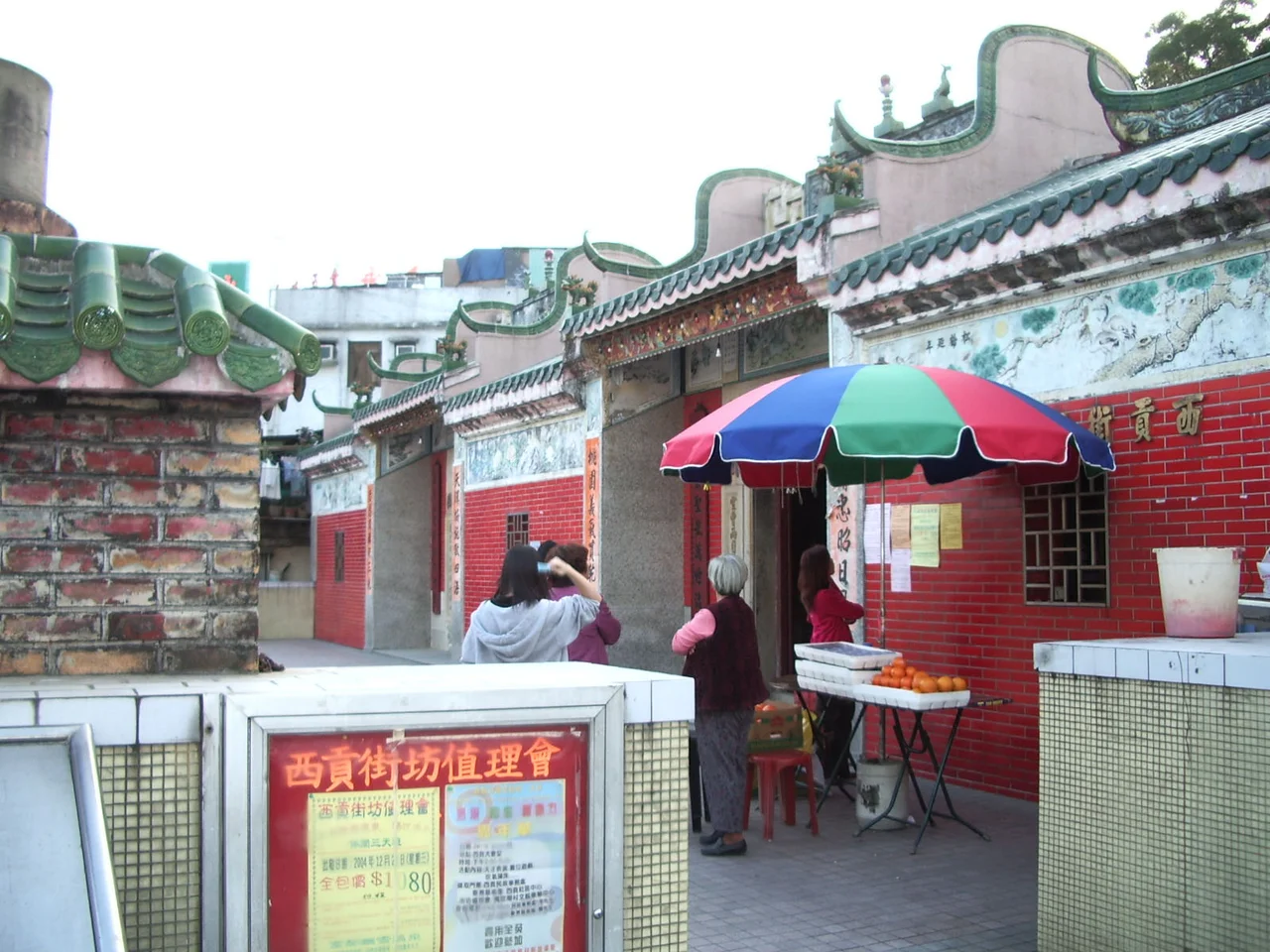

Sai Kung District
Hong Kong has 18 administrative districts, and most visitors pass through several of them without realizing it — Kowloon City for the night market, Wan Chai for the bars, Central for the towers. Sai Kung District is the one most Hong Kongers think of when they imagine the place they would go if they could leave the city without actually leaving it. Called the 'back garden of Hong Kong,' the district stretches across the southern Sai Kung Peninsula and the Clear Water Bay Peninsula in the New Territories, plus more than 70 offshore islands. Its population of over 460,000 is concentrated mostly in the new town of Tseung Kwan O — but the district's identity belongs to the hills, the harbours, and the small settlements that have been here far longer than any new town.
Older Than the Colony
The land that became Sai Kung District was ceded to British Hong Kong in 1898 under the Convention for the Extension of Hong Kong Territory, which added the New Territories to the existing colony. But settlement in the area predates the British presence by many centuries. Hakka fishing communities established coastal villages here from roughly the 14th century, building temples to Tin Hau and Hung Shing in sheltered anchorages. What makes Sai Kung historically distinctive, according to scholarly research, is that unlike many other New Territories areas, the villages here never coalesced into the powerful single-surname clans — the Dengs, Wens, and Liaos — that dominated politics elsewhere. The threat of pirates during the Qing dynasty kept communities diverse and defensive; mixed-surname villages bound by mutual protection rather than by lineage gave Sai Kung its particular social character, one that still marks the district today.
The Back Garden
The phrase 'back garden of Hong Kong' is something of an understatement. Sai Kung District contains Sai Kung East Country Park and Sai Kung West Country Park, two of the largest protected areas in Hong Kong, together covering tens of thousands of hectares. The coastline alone — jagged, island-dotted, sheltered in some places and wild-surf-exposed in others — offers some of the finest hiking in South China. The 100-kilometre MacLehose Trail begins at Pak Tam Chung in Sai Kung, tracing a route from east to west across the hills. Tai Long Wan, accessible only on foot or by boat, is regularly cited as one of Hong Kong's most beautiful beach complexes, its four strands — Sai Wan, Ham Tin Wan, Tai Wan, and Tung Wan — separated by low headlands. The district also includes the Hong Kong UNESCO Global Geopark, a recognition of the extraordinary volcanic geology visible along the eastern coast.
A Name That Travels
There is an odd footnote in Sai Kung's identity: the Chinese characters for 'Sai Kung' — 西貢 — are also the Vietnamese Chữ Nôm characters for 'Saigon,' the former name of Ho Chi Minh City. This geographical coincidence occasionally causes confusion, especially since there is also a Saigon Street in Hong Kong, named after the Vietnamese city rather than the district. The two places share their written form entirely by accident, the result of different historical pathways through the same logographic system. Sai Kung's own name likely derives from its role as a local market — the Chinese characters can be parsed to mean something close to 'western tribute' or 'market port,' though the etymology is debated. Whatever its origins, the name has been in Western written records since at least the early 1900s.
New Town, Old District
The paradox of Sai Kung District is that its most populous place is a thoroughly modern new town. Tseung Kwan O, built on reclaimed land on the western edge of the district, has grown into a dense residential city of several hundred thousand people with its own MTR station, shopping malls, and schools. The district administrative office relocated there from the traditional centre at Sai Kung Town. Meanwhile, on the other side of the hills, Sai Kung Town itself remains relatively small — a seafood-famous, waterfront-facing community that feels, by Hong Kong standards, almost unhurried. The Hong Kong University of Science and Technology sits on the Clear Water Bay Peninsula within the district, one of the eight publicly-funded universities in Hong Kong and consistently ranked among the leading research universities in Asia. Science and tradition coexist within the same administrative boundary, a few mountain ridges apart.
From the Air
Sai Kung District sits at approximately 22.38°N, 114.27°E on the eastern side of the New Territories, easily identified from the air by the dramatic contrast between the urbanized western edge at Tseung Kwan O and the largely undeveloped hills and coastline to the east and north. From 5,000 feet, the island-studded Port Shelter (Sai Kung Hoi) is a distinctive inland sea south of the district's main settlement. Hong Kong International Airport (VHHH) is approximately 30 nautical miles to the west on Lantau Island. The Clear Water Bay Peninsula is visible as a narrow finger of land pointing southeast into the South China Sea.
Nearby Stories
- Sha Chau and Lung Kwu Chau Marine Park 5.9 km away
- Wanshan Archipelago 22 km away
- Hong Kong 12 25 km away
- Second Battle of Chuenpi 27 km away
- Mount Guanyin (Dongguan) 43 km away
- Battle of Penghu 474 km away
- Penghu Air Raids 482 km away
- Checheng Fu'an Temple 592 km away