
Sai Kung East Country Park
Getting to some of the best beaches in Hong Kong requires effort — and that is precisely the point. The four strands of Tai Long Wan, tucked into the eastern end of Sai Kung East Country Park, can be reached only by a two-hour walk over the hills or by hiring a boat. That inaccessibility has kept them largely as they were a century ago: wide arcs of pale sand backed by green ridges, with the South China Sea stretching away to the east. Sai Kung East Country Park was established in 1978 and covers 44.77 square kilometres of the Sai Kung Peninsula's most rugged terrain — a landscape built from ancient volcanoes, shaped by typhoons, and protected, now, by law.
A Coastline Carved by Fire and Water
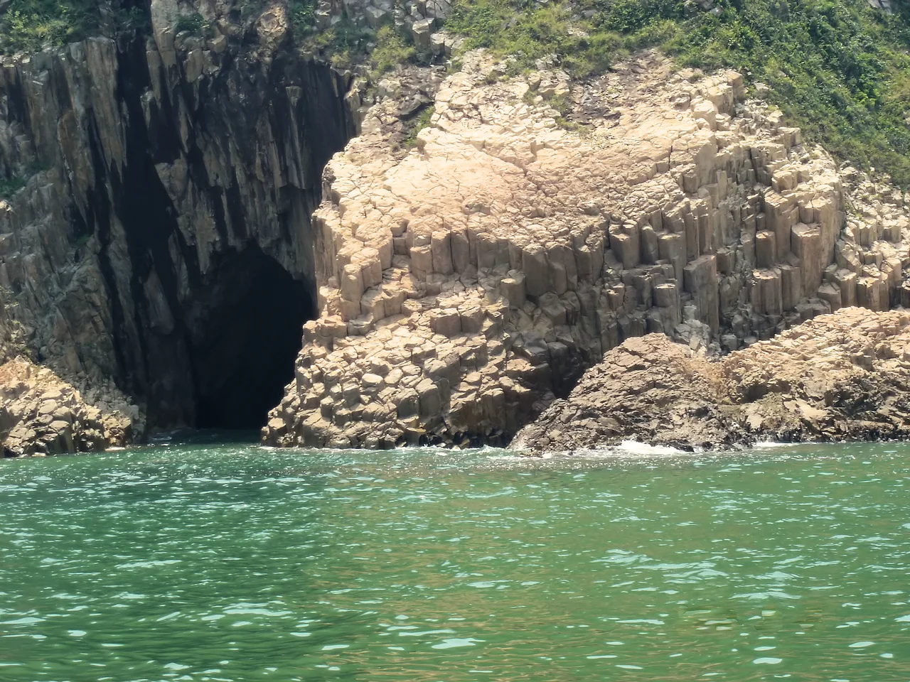
The geological story of Sai Kung East Country Park goes back some 140 million years to a period of intense volcanic activity. What looks like ordinary coastal scenery is actually the solidified remnants of enormous eruptions: tuff, lava, and pyroclastic rock compressed and cooled into the peninsula's hills and islands. The most dramatic expression of this history is at Po Pin Chau and the East Dam of the High Island Reservoir, where hexagonal columnar joints — perfectly geometric columns of rock, formed as ancient volcanic tuff cooled at a uniform rate — emerge from the sea in formations that look almost architectural. These columns, some standing several metres tall and packed tightly together like bundled pencils, are part of the Hong Kong UNESCO Global Geopark and represent one of the finest examples of this geological phenomenon in Asia. Along the exposed southeastern coastline, waves have carved sea caves, rock arches, and stacks from the same volcanic material.
The Reservoir That Swallowed a Channel
High Island Reservoir, at the park's heart, is an engineering achievement on an unusual scale. Before 1971, the Kwun Mun Channel separated High Island from the main Sai Kung Peninsula. Engineers closed off both ends of the channel with massive dams, pumped out the seawater, and created a freshwater reservoir with a capacity of 273 million cubic metres — one of the largest in Hong Kong. The project, completed in 1979, also opened the area to road access for the first time; before the reservoir roads were built, the eastern Sai Kung Peninsula beyond Tai Mong Tsai was reachable only on foot or by small local ferry. The East Dam's setting, where the geometric columnar basalt meets the calm reservoir water with the open ocean just beyond, has become one of Hong Kong's most photographed landscapes.
Beaches at the End of the Trail
Tai Long Wan — the name means 'big wave bay' — contains four separate beaches: Sai Wan, Ham Tin Wan, Tai Wan, and Tung Wan. Each has its own character. Sai Wan is the outermost and wildest, directly exposed to South China Sea swells. Ham Tin Wan is the longest. Between the beaches, low headlands carry footpaths connecting the strands, and a scattering of simple guesthouses and noodle stalls serves the hikers who arrive each weekend. Long Ke Wan, another beach within the park's boundaries, is similarly remote and similarly striking — a crescent of grey-white sand framed by dark volcanic cliffs. The MacLehose Trail, Hong Kong's premier long-distance hiking route, passes through the park, and the eastern section of the trail crosses Sharp Peak (468 metres), the area's dominant summit, with views down to both Tai Long Wan and the open sea.
Villages in the Wilderness
Within the park boundaries, or at its edges, a handful of settlements persist. Sheung Yiu, near Wong Shek Pier, is a fortified Hakka village that operated lime kilns supplying the colony in the nineteenth century; it has been preserved and opened as a folk museum, its thick stone walls and courtyard layout intact. Chek Keng, deep in Long Harbour, was once reachable only by sea; residents were among those relocated to make way for the High Island Reservoir works. Ko Lau Wan and Tan Ka Wan are two further coastal villages within the park, accessible by the ferry services that still connect the more remote corners of Sai Kung Hoi. These settlements are reminders that what looks like wilderness from the trail has, in fact, been inhabited and worked for centuries.
From the Air
Sai Kung East Country Park occupies the eastern tip of the Sai Kung Peninsula at approximately 22.40°N, 114.34°E. From altitude, the park's coastline is one of the most visually complex in Hong Kong: jagged inlets, offshore islands, and the bright rectangle of the High Island Reservoir's east dam are all clearly visible on a clear day. Sharp Peak is the most prominent summit, identifiable as the highest point on the eastern ridgeline. Hong Kong International Airport (VHHH) is approximately 35 nautical miles to the west-southwest on Lantau Island. The park lies under the general approach corridor for traffic arriving at VHHH from the east; recommended observation altitude 4,000 to 6,000 feet.
Nearby Stories
- Sha Chau and Lung Kwu Chau Marine Park 5.9 km away
- Wanshan Archipelago 22 km away
- Hong Kong 12 25 km away
- Second Battle of Chuenpi 27 km away
- Mount Guanyin (Dongguan) 43 km away
- Battle of Penghu 474 km away
- Penghu Air Raids 482 km away
- Checheng Fu'an Temple 592 km away