.jpg)
Sai Kung Peninsula
Until 1970, most of the Sai Kung Peninsula beyond the village of Tai Mong Tsai was reachable only on foot or by small wooden ferry. The roads that followed the High Island Reservoir project changed that — but not entirely. The eastern half of the peninsula remains without through roads, its beaches and valleys accessible only by trail or boat. This is, by design and by circumstance, one of the most intact stretches of coastal landscape in any major metropolitan area in the world. Hong Kong, a city of over seven million people, manages to contain within its borders a peninsula where leopard cats still roam, where pangolins are occasionally sighted, and where fishing communities built their temples and salt pans six centuries before the British colony was declared.
Pirates, Hakka, and Mixed Surnames
From about the fourteenth century, fishing communities established themselves in the sheltered inlets of the Sai Kung Peninsula, living on boats before founding small coastal villages. They built temples to Tin Hau — goddess of the sea — and to Hung Shing in places of permanent anchorage. The peninsula's history was shaped by its vulnerability: during the Qing dynasty, pirates were a constant threat. The Xin'an County Chronicles record that in September 1672, a pirate force under Li Qi landed and attacked local villages, slaughtering residents before a militia drove them back. To survive, the Hakka communities on the peninsula — smaller in clan size than the dominant lineages elsewhere in the New Territories — formed alliances across surname lines with neighbours and in-laws. The result was a social structure unlike almost anywhere else in the region: mixed-surname villages, bound by mutual defense rather than kinship, that gave Sai Kung its distinctive cooperative character. Iron cannons from those defensive years can still be found in some of the old villages.
A Landscape Built by Volcanoes
The Sai Kung Peninsula is composed almost entirely of volcanic material. Coarse tuffs dominate the north and southwest, pyroclastic rock and lava appear in the Sharp Peak area, and acid lavas surround the High Island Reservoir. The most extraordinary geological feature is the hexagonal columnar jointing near the reservoir's East Dam and at Po Pin Chau — columns of solidified tuff, geometrically perfect, created when an ancient volcanic deposit cooled slowly and uniformly. The columns are part of the Hong Kong UNESCO Global Geopark and draw visitors from across Asia. Along the exposed southeastern coast, the same volcanic rock has been worked by sea and wind into caves, arches, and stacks. The peninsula's geology is not just scenically dramatic — it is scientifically important, representing one of the best-preserved records of Cretaceous-era volcanism in the region.
The Reservoir That Opened the Peninsula
Before 1971, this was a genuinely remote place. The High Island Reservoir project changed that, though not by removing the remoteness — rather by providing access to part of it. Engineers closed both ends of the Kwun Mun Channel, which had separated High Island from the main peninsula, creating a freshwater reservoir with a capacity of 273 million cubic metres. Two new roads came with the dam works, pushing into territory that had previously been reachable only by kai-to ferry. Some villagers and fishermen were relocated to Sai Kung Town as part of the project. The reservoir was completed in 1979, and the infrastructure it brought made the park accessible enough for hiking, while the protected-area designation kept most of the coast wild. The East Dam, where the columnar basalt meets the still reservoir water with open ocean just beyond, is one of Hong Kong's most striking engineered landscapes.
What Grows and What Moves Here
Grassland covers most of the hilltops, thickening into shrubland on the lower slopes and native woodland in the valleys. Chinese red pine was planted extensively in the 1950s, and many of those old trees are now in decline — but under-storey native broadleaf species are filling in behind them, a slow ecological recovery. The wildlife list is impressive for a landscape so close to one of Asia's densest cities. Pangolins have been documented in the area. Leopard cats, masked palm civets, and wild boar move through the hills at night. Pythons sun themselves on rock faces. In the streams, kingfishers hunt. In the fung shui woods behind old villages — groves traditionally maintained for spiritual and ecological reasons — thrushes arrive each winter migrating down from China. Hoi Ha Wan, on the northern coast, is one of the most accessible coral dive sites in Hong Kong, its marine ecosystem protected by law and suitable for training dives.
On the Water and on the Trail
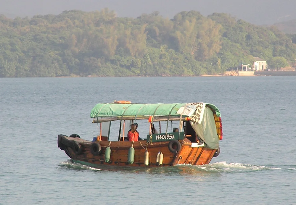
The MacLehose Trail begins at Pak Tam Chung and traverses 100 kilometres of Hong Kong terrain from east to west, with the Sai Kung Peninsula section forming its most dramatic opening stages. On summer evenings, local boats called kai-tos and sampans carry visitors through the island-dotted waters of Port Shelter, an inland sea of surprising calm behind the outer headlands. Popular destinations include Kau Sai Chau, Sharp Island, High Island, and Yim Tin Tsai — 'little salt field,' a reminder that salt production was once a significant local industry. The peninsula's seafood restaurants are an institution, their tanks of live fish and shellfish facing the water from the edge of Sai Kung Town. Hiking and eating, in Sai Kung, are pleasures that exist on the same day.
From the Air
The Sai Kung Peninsula extends northeast from Kowloon at approximately 22.43°N, 114.32°E, easily identified from altitude by the dramatic contrast between its undeveloped ridgelines and the dense urban fabric of the New Territories immediately to the west. The High Island Reservoir is clearly visible as a rectangular body of water enclosed by two dams on the eastern side of the peninsula. The island-dotted Port Shelter lies to the south. Sharp Peak, at 468 metres, is the highest point on the eastern ridgeline. Hong Kong International Airport (VHHH) is approximately 32 nautical miles to the west-southwest on Lantau Island. Viewing altitude 4,000 to 7,000 feet provides good coverage of the full peninsula.
Nearby Stories
- Sha Chau and Lung Kwu Chau Marine Park 5.9 km away
- Wanshan Archipelago 22 km away
- Hong Kong 12 25 km away
- Second Battle of Chuenpi 27 km away
- Mount Guanyin (Dongguan) 43 km away
- Battle of Penghu 474 km away
- Penghu Air Raids 482 km away
- Checheng Fu'an Temple 592 km away