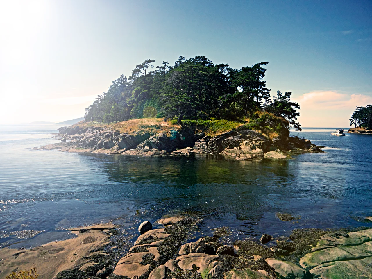

San Juan Islands National Monument
Most national monuments are somewhere you can drive to and stand in the middle of. This one is a list. The San Juan Islands National Monument consists of roughly seventy-five separate sites, scattered across three counties and dozens of miles of the Salish Sea, and together they total about a thousand acres - smaller than many city parks, and broken into pieces so fine that one of them, Cotton Point Island off Orcas, covers a quarter of an acre and ranks among the smallest holdings the Bureau of Land Management has anywhere in Washington. President Barack Obama signed it into existence on 25 March 2013 under the Antiquities Act, out of land the federal government already owned. Nothing was bought. What changed was the level of protection - and, more quietly, the recognition of what these fragments actually are.
A Monument Made of Rocks
Read the inventory and the character of the thing becomes clear. Mackaye Harbor Rocks. Danger Rocks. Kanaka Bay Islands. Bakers Reef. Unnamed Rocks off Lime Kiln Point. Site after site is a reef, a stack, or an islet too small and too exposed for anyone ever to have built on it, which is precisely why it survived intact while the shorelines around it filled with houses. The pieces lie off Lopez, San Juan, Orcas, Shaw, Stuart, Sucia, Matia, Clark, Fidalgo, Lummi and Eliza Islands, spread through San Juan, Skagit and Whatcom counties. A handful of names in West Sound on Orcas - Skull Island, Victim Island, Massacre Bay Rocks - record something the charts decline to explain. The Bureau of Land Management administers the whole assemblage as part of the National Landscape Conservation System.
Lights on the Edges
Not every piece is a rock. Some of the monument's most significant sites are headlands that mattered to anyone trying to get a ship through these waters alive. Cattle Point, at the southern tip of San Juan Island, carries its light above the meeting of Haro Strait and the Strait of Juan de Fuca, where tide and wind can make a mess of a calm afternoon. Turn Point, on Stuart Island, marks the elbow of Boundary Pass with the Canadian shore close enough to read. Patos Island keeps its light at the northern edge of the group. These are working aids to navigation with a century and more of service behind them, and they are also, now, protected relics - a rare case of the federal government conserving its own infrastructure as heritage.
Coast Salish Ground
The proclamation names archaeological sites of the Coast Salish peoples among the resources the monument exists to protect, and that is not incidental language. These waters were - and are - Coast Salish waters, worked for thousands of years for salmon, halibut, shellfish, camas and reef-net fishing grounds whose locations were held as property and passed down. The small islands and beach fronts that nobody wanted to develop are exactly the ones most likely to still hold an undisturbed record of that. Protecting a quarter-acre islet sounds like bureaucratic fussiness until you understand that the fussiness is the point: what survives on these fragments cannot be replaced, and a single afternoon with a shovel can end it.
Small Pieces, Large Consequence
Biodiversity is the third pillar of the designation, and here the arithmetic works in the monument's favour. Bare, predator-free rocks are the scarcest real estate in the Salish Sea for nesting seabirds; a reef with no raccoons on it is worth far more to a colony of glaucous-winged gulls or pigeon guillemots than a hundred acres of forested shoreline. Much of the monument is that kind of land. The designation came after sustained local pressure - islanders organised specifically for it, which is not how every monument comes about. The result is scattered, unvisitable in most of its extent, and almost impossible to photograph as a single subject. It is also, acre for acre, about as efficient a piece of conservation as the Antiquities Act has produced.
From the Air
The San Juan Islands National Monument's sites are scattered across the archipelago, with a representative reference at 48.5319 N, 123.0290 W near San Juan Island. This is the one monument best understood from the air, because only from altitude does the pattern read as a single entity. Fly the group at 2,000 to 4,000 feet AGL in clear air: Cattle Point light at the south end of San Juan Island, Lime Kiln Point on its west shore above Haro Strait, Turn Point on Stuart Island at the bend of Boundary Pass, and the northern outliers at Patos, Sucia, Matia and Clark. Friday Harbor Airport (KFHR) is under a mile from the reference point and Friday Harbor's seaplane base is on the waterfront; Orcas Island Airport (KORS) lies about 12 nm northeast and Bellingham International (KBLI) roughly 25 nm northeast. The Canadian border runs down Haro Strait and Boundary Pass immediately west and north - know exactly where it is. Expect strong tidal rips visible on the surface, summer haze from regional wildfire smoke, and fog off Juan de Fuca Strait in late summer mornings.
Nearby Stories
- Smith Island (Washington) 3.2 km away
- Montague Harbour Marine Provincial Park 3.8 km away
- John Dean Provincial Park 3.8 km away
- Nooksack, Washington 7 km away
- Race Rocks Ecological Reserve 11 km away
- Blaine Air Force Station 11 km away
- Whatcom Trail 14 km away
- USNS Sgt. George Peterson 40 km away