Sangiran
More than half of all known Homo erectus fossils on the planet have come from a single eroded dome in Central Java. Sangiran, a 56-square-kilometer expanse of rice paddies and low hills fifteen kilometers north of Surakarta, does not announce itself as one of the most important archaeological sites in human history. There are no dramatic cliff faces or canyon walls. The landscape is quiet, agricultural, unremarkable to the eye. But beneath the surface -- exposed by millions of years of tectonic uplift and erosion -- lie geological beds so rich in hominin fossils that UNESCO ranks Sangiran alongside Olduvai Gorge in Tanzania and Zhoukoudian in China, and considers it more fruitful in finds than any of them.
The Dome That Time Opened
Sangiran's secret is geological. Millions of years ago, tectonic forces pushed the earth upward here, creating a dome. Erosion then did what erosion does: it wore the dome down, peeling back layer after layer of sediment like pages in a book. Each layer corresponds to a different epoch, and within those pages lie the bones of creatures that lived in Java when the island was connected to mainland Asia by land bridges during ice ages. The Solo River valley, which cuts through the site, accelerated this exposure. What emerged was a stratigraphic record spanning roughly 1.5 million years -- from the late Pliocene through the Pleistocene -- readable to anyone who knew what to look for.
Dubois Passed It By
The Dutch paleoanthropologist Eugene Dubois arrived in the Dutch East Indies in 1887 and moved to Java in 1890, searching for evidence of early humans. He visited the Sangiran area but found little to hold his attention. Impatient, he moved on to Trinil in East Java, where he would discover the fossils he named Pithecanthropus erectus -- "Java Man" -- one of the most famous finds in the history of paleoanthropology. Sangiran waited another half-century for its moment. In 1934, the German-Dutch anthropologist Gustav Heinrich Ralph von Koenigswald began systematic excavations. What he found dwarfed anything Dubois had uncovered at Trinil: fossils of Homo erectus, the enigmatic "Meganthropus" specimens, and the remains of the animals that shared their world. Over the decades that followed, more than sixty hominin fossils emerged from Sangiran's beds. Dubois had been standing on a treasure and walked away.
Bones and Black Markets
Discovery brought complications. For decades, villagers in the area around Sangiran dug up fossils and sold them to local buyers -- a parallel economy sustained by the very bones that scientists traveled from around the world to study. The Indonesian government designated Sangiran a Protected Cultural Area in 1977, and the 1992 cultural heritage law strengthened enforcement, but the illegal trade proved difficult to stamp out entirely. In 2010, an American citizen claiming to be a scientist was arrested near the site, his truck loaded with forty-three different types of fossils in boxes and sacks, their estimated market value reaching two million dollars. The tension between preservation and poverty remains unresolved. The development of the Sangiran site has brought international recognition, a UNESCO inscription in 1996, and a modern museum -- but critics in the Indonesian media have noted that the rural communities living atop one of humanity's richest fossil beds have seen few tangible benefits from any of it.
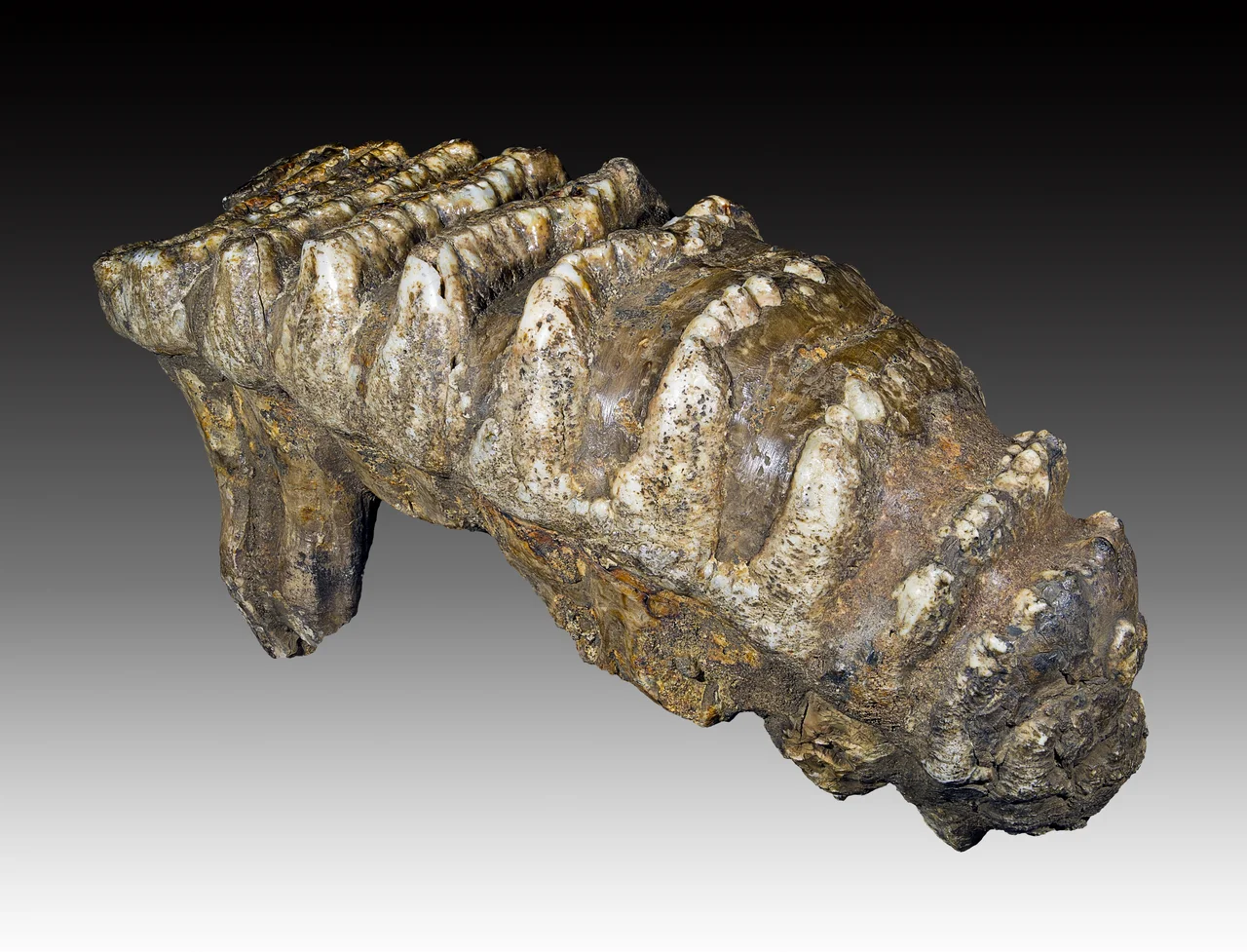
A Museum Among the Rice Fields
The current Sangiran museum and visitors' center, opened in December 2011, is a modern building housing three main halls. The first presents dioramas of the Sangiran landscape as it appeared roughly one million years ago -- a world of grasslands and volcanic horizons, populated by early humans and the megafauna they hunted or fled from. The second hall displays the fossil record in detail: skulls, teeth, stone tools, and the bones of stegodons and other extinct species, alongside the history of excavation from Dubois through contemporary Indonesian scholars like Teuku Jacob and Etty Indriati. The third hall contains a sweeping panoramic diorama with Mount Lawu rising in the background, re-creating the Pleistocene scene using sculptures by the internationally known paleontological artist Elisabeth Daynes. Getting there requires a 45-minute drive north from Surakarta on the Purwodadi road, then a four-kilometer turn through the surrounding rural landscape -- a journey that underscores how thoroughly this world-class site is embedded in everyday Javanese life.
Walking Where They Walked
What makes Sangiran extraordinary is not merely the quantity of fossils but their context. The eroded dome preserves a continuous stratigraphic sequence that allows scientists to place each find within a timeline spanning the early Pleistocene. This is not a site where bones were washed together by a river or jumbled by later activity; it is a place where the geological layers themselves tell the story of environmental change across deep time. Volcanic ash from ancient eruptions provides datable markers. Animal fossils establish ecological context. The hominin remains fit within a landscape, not just a display case. Standing in the Sangiran dome, surrounded by rice paddies and the quiet hum of rural Java, it takes an act of imagination to see the grasslands and megafauna that once occupied this ground. But the bones are real, and they are here -- more evidence of our deep ancestry gathered from this one unassuming patch of earth than from almost anywhere else on the planet.
From the Air
Located at 7.45°S, 110.85°E in the Solo River valley of Central Java, approximately 15 km north of Surakarta (Solo). The site spans about 56 km² of low hills and rice paddies with no dramatic topographic features visible from altitude. Mount Lawu (3,265 m) rises to the east and provides a useful landmark. Nearest airport is Adisumarmo International Airport (WARQ/SOC), approximately 20 km south. Approach from the south following the Solo River valley northward for the best perspective on the dome's eroded terrain.
Nearby Stories
- The Monument Between Mountain and Sea 6 km away
- Fort van den Bosch 9 km away
- Cepu Forest Railway 17 km away
- Tidar Valley: Where Indonesia Forges Its Officers 20 km away
- The School That Gave Itself Away 22 km away
- The Language That Built an Archipelago 25 km away
- Forty Thousand Hills 38 km away
- Dieng Temples: Java's Oldest Stone Shrines, Named for Heroes Nobody Built Them For 54 km away