_-_img_06.jpg)
The Monument Between Mountain and Sea
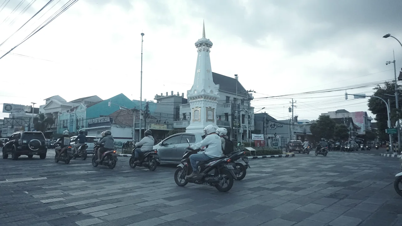
Stand at the intersection of Mangkubumi, Sudirman, A.M. Sangaji, and Diponegoro streets in Yogyakarta and you are standing on an invisible line. It runs from the Indian Ocean to the south, through the Kraton palace, through the monument in front of you, and north to the summit of Mount Merapi -- an axis that Sultan Hamengkubuwono I embedded in the layout of his city when he founded it in 1755. The Tugu Yogyakarta was the marker, a white pillar raised at the point where the sultan would face during meditation, aligning himself with the volcano's peak. The monument has been toppled by an earthquake, rebuilt by colonial administrators, and gilded with 22-carat gold, but the axis it marks has not moved. Merapi still smokes on the northern horizon. The ocean still pulls to the south. And the pillar still stands between them.
Golong-Gilig: Unity in Cylinder and Sphere
The original monument was called Tugu Golong-Gilig, and the name carried political weight. Golong means round, referring to the spherical top. Gilig means cylindrical, describing the smooth shaft below. Together the words evoke golong-gilig -- a Javanese philosophical concept expressing the unity of ruler and people, the alignment of purpose between the sultan and those he governed. The monument stood 25 meters tall, a slender white cylinder tapering toward the sky with a round finial at its peak, encircled at its base by a low fence. It was not merely decorative. The Tugu anchored the spiritual geography of the new sultanate, standing on the sacred axis that Hamengkubuwono I had drawn through his city. When the sultan meditated, he faced the monument, using it as a sighting benchmark for the distant peak of Merapi. The pillar was a compass needle for a cosmology that oriented the kingdom between the mountain's fire and the ocean's depth.
The Earthquake and the Dutch Rebuild
On June 10, 1867, a major earthquake shook Yogyakarta and the monument collapsed. For over two decades it lay in ruins. When the Dutch colonial government finally rebuilt it in 1889, they changed almost everything. The smooth cylinder became a square-sided pillar. The round top became a cone tipped with a small ball. The height dropped from 25 meters to 15. The Dutch called it De Witte Paal -- the White Pillar -- a name stripped of the Javanese cosmological meaning that had infused the original. Where Hamengkubuwono I had built a monument encoding the philosophy of unity between ruler and people, the colonial administration produced a traffic landmark. The redesign was practical, structurally sound, and entirely deaf to the monument's original purpose. It stands today as a record of that deafness -- a Dutch form imposed on a Javanese idea.
Gold on the Axis
In 2012, the monument was renovated once more, this time by Indonesian authorities. Ornamental painting was applied in yellow and gold, including the small ball at the tip, using paint made with 22-carat gold. A small park was laid out around the base. The Tugu had become what it remains today: a traffic landmark that is also a historical icon, a meeting point, a selfie backdrop, and a quiet assertion of Javanese identity at the center of a busy intersection. The Yogyakarta railway station nearby is itself commonly called Tugu Station, the monument's name spreading to swallow the surrounding geography. Tourists photograph it. Becak drivers idle beside it. University students meet beneath it. But the invisible line still runs through it -- south to the Kraton, south again to the Indian Ocean, north past the railroad tracks and the ring road and the rice paddies of Sleman Regency to the crater of Mount Merapi, 2,930 meters above sea level, where sulfur vents and the volcano last erupted in 2010.
A City's Compass Point
What makes the Tugu significant is not its height or its materials but its position. Yogyakarta was designed around a cosmological axis, and the Tugu is the visible marker of that design -- the point where the abstract geometry of sultan, mountain, and sea becomes a physical object you can touch. Other Indonesian cities have monuments. Few have one that serves simultaneously as a spiritual anchor, a navigational reference, a historical artifact recording the transition from Javanese sovereignty to Dutch colonialism and back again, and a functional landmark that every taxi driver in the city uses to orient themselves. The monument's simplicity -- it is, after all, just a pillar -- is precisely what makes it effective. It does not compete with the Kraton's complexity or Taman Sari's engineering. It simply marks a point in space and says: here is where the line runs. Everything else in Yogyakarta arranges itself around that fact.
From the Air
Located at 7.78S, 110.37E at the intersection of four major streets in central Yogyakarta, approximately 2 km north of the Kraton palace. The monument sits on the north-south axis connecting the Indian Ocean coast to Mount Merapi (2,930m). Visible from low altitude as a white/gold pillar at a major intersection. The Yogyakarta railway station (Tugu Station) is immediately southeast. Adisucipto International Airport (WARJ) is approximately 8 km to the east.
Nearby Stories
- Gamelan From Heaven 6 km away
- Tidar Valley: Where Indonesia Forges Its Officers 6.3 km away
- The River Runway 18 km away
- Through the Limestone Dark 35 km away
- A King's Canal, Carved in Stone 39 km away
- The Ghost Boat That Built an Empire 93 km away
- Shaken Foundations: The 2021 East Java Earthquake 203 km away
- Mahameru: The Great Mountain That Never Sleeps 297 km away