Serra dos Órgãos National Park
The Portuguese settlers who first climbed these slopes in the colonial era looked up at the ranked granite spires and saw the pipes of a cathedral organ. The name stuck. Serra dos Órgãos - Organ Mountains - has been the range's name in Portuguese for four centuries, and the central symbol on the flag of Rio de Janeiro state is one of those peaks, the Dedo de Deus, God's Finger, a 1,692-meter granite outcrop that genuinely does look like an upraised index finger pointing at heaven. In 1939, the Vargas government made this range Brazil's third national park. The reason was partly the scenery and partly something more practical: the headwaters of the rivers flowing into the Fluminense basin rise here, and Rio de Janeiro drinks what the mountains release.
Sixty Million Years Ago
The geological story begins a long time back. The most accepted theory traces the range to the same tectonic episode that raised the Andes about 60 million years ago, when the earthquake activity that lifted South America's western cordillera also uplifted the Atlantic margin on the eastern side. Serra dos Órgãos is part of the larger Serra do Mar coastal range that runs nearly the length of southeastern Brazil. What makes this section unusual is the vertical relief: ten peaks above 2,000 meters and another six between 1,500 and 2,000 meters, rising from a coastal plain where elevations start near sea level. The lowest point in the park is at the municipality of Magé, 145 meters above the Atlantic. The highest is Pedra do Sino, Bell Rock, at 2,263 meters. Climb the trail from one to the other and you cross through four distinct forest communities. No incident has ever been recorded on the fault line. The earthquakes finished their work a long time ago.
The Park That Vargas Created
Getúlio Vargas's government signed decree law 1822 on November 30, 1939, creating the Serra dos Órgãos National Park with an area of about 9,000 hectares. The park covered parts of Magé, Petrópolis, and Teresópolis. Infrastructure followed quickly: a natural swimming pool was built in the 1940s, along with administrative buildings, warehouses, a garage, staff quarters, and four shelters on the Bell Trail that let climbers overnight en route to the higher peaks. The park had roughly 250 employees at peak, including waiters stationed in the mountain shelters. Then in 1960, the federal capital moved from Rio de Janeiro to Brasília, and the flow of federal funding shifted with it. The park's infrastructure was allowed to deteriorate. The shelters fell. Some staff houses were lost. Restoration began in 1980, gradual and funded piecemeal. The 1984 decree formalized the park's current boundary at 10,527 hectares. New construction and rehabilitation have continued since.
God's Finger and Bell Rock
The Dedo de Deus gets the postcards. Seen from Teresópolis on a clear day, the peak really does resemble a left hand raised against the sky, with the index finger extended upward and the other fingers curled. Rio de Janeiro put it on the state flag. The geology behind the resemblance is a vertical dike of Cambrian granite, harder than the surrounding Neoproterozoic orthogneiss, which has resisted erosion while the softer rock weathered away. What remains is a finger of stone. Around it stand the other named peaks: Escalavrado at 1,406 meters, Dedo de Nossa Senhora at 1,320 meters, Cabeça de Peixe at 1,680 meters, Santo Antônio at 1,990 meters, and Agulha do Diabo - the Devil's Needle - at 2,050 meters. The names come from the same colonial imagination that saw organ pipes. Pedra do Sino, the highest point at 2,263 meters, takes its name from a bell-shaped profile and from the way thunderstorms striking the summit produce a ringing resonance that climbers say you can hear from the slopes below.
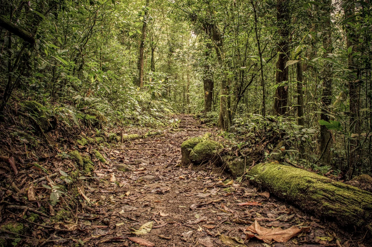
Cloud Forest and Christmas Cactus
The climate inside the park is tropical superhumid. Moist air from the Atlantic settles against the range most of the year, producing relative humidity of 80 to 90 percent. Temperatures average 13 to around 25 degrees Celsius, but they can spike to 38 in summer and drop below freezing on the highest peaks. Annual rainfall runs 1,700 to 3,600 millimeters depending on elevation and aspect, with the southeast-facing slopes catching substantially more than the northwest. The wet season runs December through March, the dry stretch June through August. More than 2,800 plant species have been recorded in the park, including 360 orchids and over 100 bromeliads. The vegetation stratifies by elevation: lowland rainforest below 500 meters, montane forest from 500 to 1,500 meters with a canopy of 25 to 30 meters, cloud forest from 1,500 to 2,000 meters with trees of 5 to 10 meters cloaked in moss and epiphytes, and high montane fields above 2,000 meters where 66 of the 347 recorded species are endemic to this ecosystem. Serra dos Órgãos is one of the few natural habitats for Schlumbergera, the wild ancestor of the Thanksgiving Cactus and Christmas Cactus grown as houseplants worldwide.
An Hour from the City
The BR-116 highway, the main north-south artery connecting Rio de Janeiro with the interior, runs directly through the park. This proximity is the defining fact of Serra dos Órgãos. Most protected areas in Brazil require a long drive from any major city; this one is about an hour from the Rio metropolitan region by road. Climbers, day hikers, and weekend tourists arrive in large numbers. The park was incorporated into the Central Rio de Janeiro Atlantic Forest Mosaic in 2006, a regional conservation framework connecting a network of protected areas across the state. The natural swimming pool from the 1940s still functions. The Bell Trail still climbs. Lake Comary sits in Teresópolis below the God's Finger peak, its surface reflecting the same granite silhouette the Portuguese colonists first described as organ pipes. The metaphor has outlasted the colony. The peaks have outlasted the metaphor.
From the Air
Serra dos Órgãos National Park is centered at 22.48 degrees south, 43.06 degrees west, about 60 km north of central Rio de Janeiro. The 10,527-hectare park covers portions of Magé, Petrópolis, Teresópolis, and Guapimirim. Peaks range from 145 m at the lowest point to 2,263 m at Pedra do Sino. Recommended viewing altitude 8,000-10,000 ft AGL for clearance over the highest peaks. Dedo de Deus (1,692 m) is the most visually distinctive feature, resembling an upraised finger against the sky - the peak appears on the Rio de Janeiro state flag. BR-116 runs through the park, useful for navigation. Rio de Janeiro Galeão (SBGL) is about 65 km south; Santos Dumont (SBRJ) is about 60 km south. Afternoon clouds frequently cap the higher peaks; clear viewing is usually best in the morning.
Nearby Stories
- Nova Friburgo 15 km away
- Rio de Janeiro 28 km away
- Juiz de Fora 53 km away
- Ibitipoca State Park 58 km away
- Desengano State Park 73 km away
- Military Academy of Agulhas Negras 89 km away
- Basilica of Our Lady of Aparecida 169 km away
- Grytviken 3551 km away