
Shakadang Trail
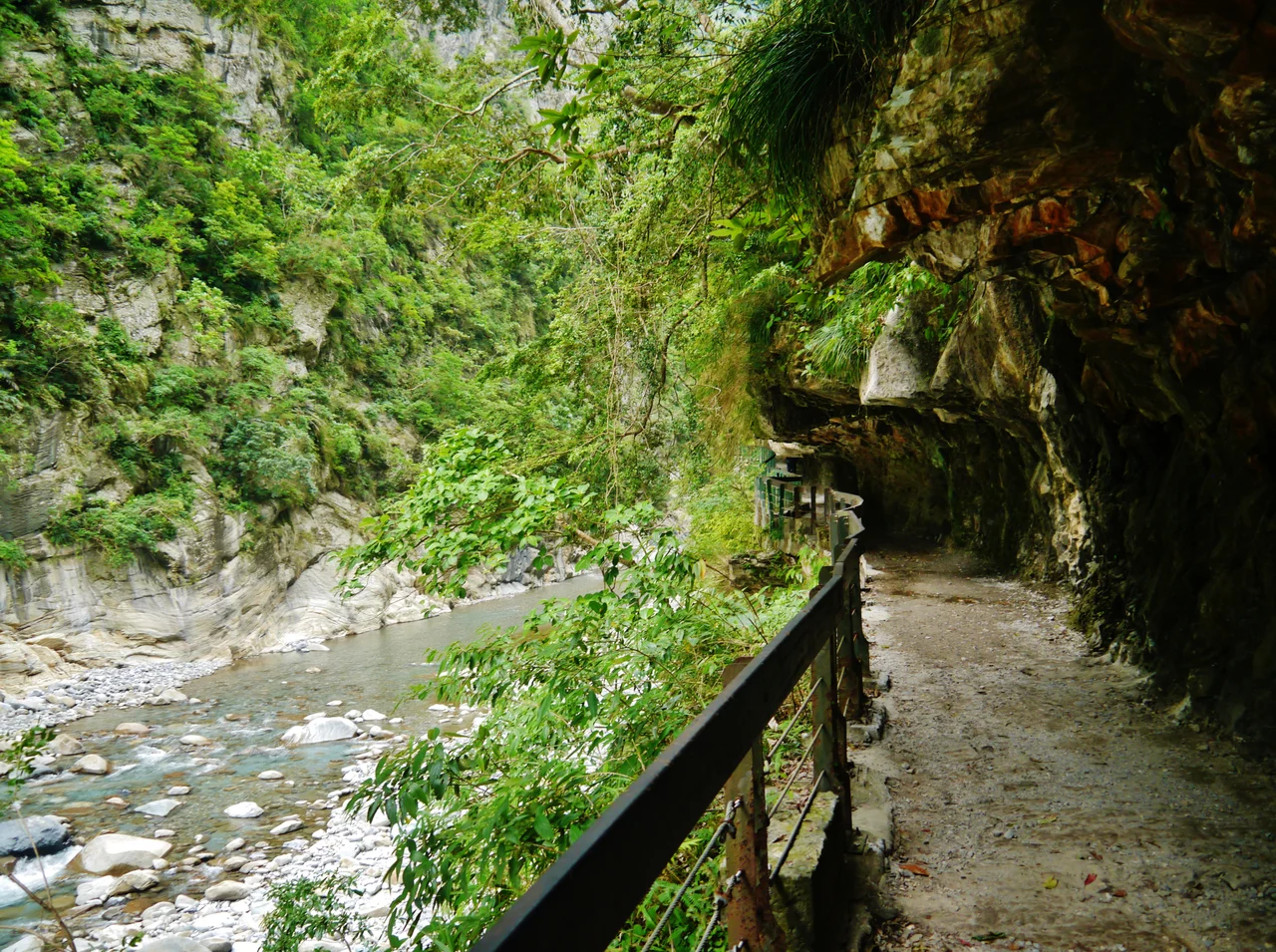
The boulders in the riverbed give this place its name. In the Truku language, *shakadang* means molar tooth, and the great rounded marble rocks in the stream below do indeed sit like teeth in a jaw of stone. Officially the Shakadang Trail, but still called Mysterious Valley Trail by many who have walked it, this 4.1-kilometer path follows the Shakadang Stream through one of the most visually arresting river canyons in Taiwan — where the water runs a vivid turquoise against polished marble walls, and the sound of the current never quite leaves you.
A Path Carved by Two Histories
The trail's origins lie in the Japanese colonial period, when workers cut this route through the gorge to reach the construction site of the Liwu Power Plant. They called it the Shenmigu Trail — the name that would eventually be translated and remembered as 'Mysterious Valley.' For decades the path served practical purposes, but the landscape it crossed was anything but ordinary. Taroko Gorge is a canyon sliced through marble by the Liwu River and its tributaries over millions of years, the limestone having been metamorphosed under enormous pressure into banded stone that now forms walls rising hundreds of meters on either side. In 2001, the trail was officially renamed for the Truku name of the stream it follows. The Shakadang Bridge at the trailhead marks the transition into the gorge with more than 100 marble lion sculptures lining its railings — an introduction to the stone that defines everything here.
The Color of the Water
What stops walkers in their tracks is not the walls, though the walls are extraordinary. It is the water. The Shakadang Stream runs in shades of blue-green that change with the angle of light — jade in shadow, turquoise where sun reaches the surface, nearly transparent in the shallows where the marble streambed shows beneath. The stream is shallow enough to wade and deep enough to reflect the canyon above. Large marble boulders shaped and smoothed by centuries of current break the flow into pools and channels. The path hugs the southern bank on carved ledges and wooden walkways, sometimes barely wider than a single person, with the stream below and the canyon face to one side. The air is cool even in summer, the light filtered by canyon walls into something slant and particular to this specific hour and this specific gorge.
April 2024
On April 3, 2024, a magnitude 7.4 earthquake struck near Hualien — the largest to hit Taiwan in twenty-five years. The tremor set off massive landslides throughout Taroko National Park, and the Shakadang Trail did not escape. Seven people hiking along the trail were killed by rockslides. The trail was buried under debris and remained closed as repair efforts began. Estimates for full reopening range to years rather than months — a reminder that this landscape, for all its beauty, is geologically active and fundamentally unstable. Taiwan sits at the collision zone of the Philippine Sea Plate and the Eurasian Plate, and the mountains here are still rising. The gorge was cut by the river because the land was rising fast enough for water to keep pace. That same force, concentrated and sudden, is also what brought the hillside down.
What the Trail Offers
Before April 2024, the Shakadang Trail was one of the most accessible walks in Taroko National Park — flat enough for most visitors, dramatic enough to satisfy serious trekkers. The full 4.1-kilometer route from the bridge took roughly two hours one way. Along the path, the canyon narrows and widens, the stream disappears and reappears, and the marble underfoot ranges from pure white to grey-green to rust-streaked pink. Side pools collect where small tributaries join the main stream. The gorge architecture does something interesting with sound: water is ever-present but at times seems to come from everywhere and nowhere. Hikers who have made the journey describe it as one of those rare trails where the destination and the walking are equally the point — where getting somewhere matters less than being inside this particular place.
Stone and Time
The marble of Taroko is the same marble used to build the Chiang Kai-shek Memorial Hall in Taipei. That the stone beneath your feet is prized enough to quarry and ship elsewhere tells you something about its quality — the banding, the color, the texture. But in the gorge itself the scale becomes personal. You are not looking at cut slabs in a building. You are standing inside a mountain that the river decided to open. The Shakadang Stream made this particular canyon by finding weaknesses in the rock and widening them, year by year, millennium by millennium, until the path you walk existed. There is something clarifying about that scale — the patience of water against stone, the slowness of the process that made something this beautiful, and the sudden violence that, in April 2024, reminded visitors that the process is still very much underway.
From the Air
The Shakadang Trail is located at approximately 24.16°N, 121.61°E in eastern Taiwan's Hualien County, within Taroko National Park. From altitude, the deep gorge of Taroko is visible as a dark cleft cut into the Central Mountain Range, with the Liwu River visible where it exits toward the Pacific. The nearest airport is RCYU (Hualien Airport), approximately 20 km to the south-southeast. Approach from the east over the Pacific is typical; mountains here rise sharply from sea level to above 3,000 m within 25 km of the coast. Pilots should note rapidly changing weather in the gorge and severe terrain in all directions. Recommended viewing altitude for overflying this area is 12,000 feet or above.
Nearby Stories
- Sun Moon Lake Wen Wu Temple 4.2 km away
- Taiping Mountain Forest Railway 9.9 km away
- Miaoli Ceramics Museum 13 km away
- Nuomi Bridge 13 km away
- 2024 Hualien Earthquake 14 km away
- Sinking of MV Sewol 1153 km away
- Yellow Sea 1208 km away
- Twin Forts of Romblon 1260 km away