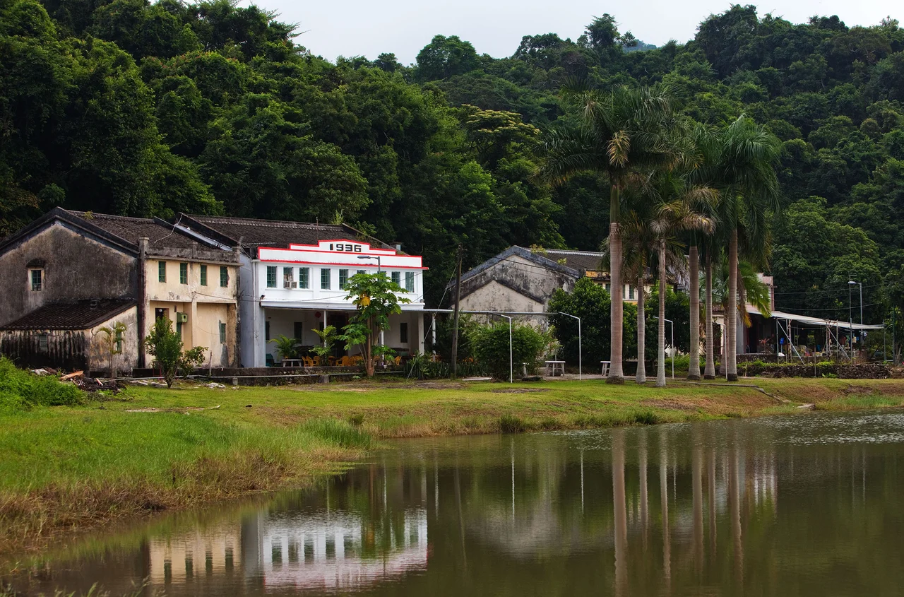

Sham Chung
There is no road to Sham Chung. Getting there requires a small ferry, a kai-to, threading through the islands and inlets of Tolo Channel — or a hike through the hills that link it to neighboring valleys. That absence of a road is why Sham Chung still exists the way it does: a Hakka village on the southern edge of a sea channel in the northeastern New Territories, where the fossils in the coastline are older than the farmers who once worked the land above them.
Older Than Memory
People have been at Sham Chung for a very long time. Archaeological excavations at the nearby Wong Tei Tung site have uncovered evidence of Late Paleolithic and Early Neolithic occupation, suggesting human presence stretching back thousands of years before any written record. The Hakka villagers who settled here in more recent centuries were themselves part of a long migration — Hakka communities moved south through China over many generations, settling the rougher coastal terrain that others left behind.
The village eventually divided into five sub-areas: Ha Wai, Shek Tau King, Pao Wai Tsai, Wan Tsai, and Dui Min Tsuen. At its center stood a chapel that also housed a small school called Kung Man School, which once served about 50 pupils with two teachers. The chapel's name — the Epiphany of Our Lord — arrived with a Catholic missionary in 1870. Father Luigi Piazzoli, who would later serve as Apostolic Vicar of Hong Kong from 1895 to 1904, came to Sham Chung from the mission station at Ting Kok and helped the farmers build a dam.
A Coast Written in Stone
The shoreline below the village tells a different kind of story. The stretch of coast between Sham Chung Wan and Tung King Pai — a 26-hectare belt designated a Site of Special Scientific Interest in 1985 — contains one of Hong Kong's richest fossil assemblages. Bivalves, ammonites, gastropods, crinoids, plant fossils, and microfossils are embedded in the rock faces along the southern shore of Tolo Channel and the northeastern edge of the Sai Kung Peninsula.
The fossils here record ancient marine environments laid down over geological time, now exposed at the water's edge for those who know how to look. The site's designation protected it from casual development, though its remoteness had already done much of that work. This stretch of coast is part of why Sham Chung was named one of the 12 Most Ecologically Valued Conservation Sites in Hong Kong in 2004 by the government.
Saved From the Fairway
In the late 1990s and early 2000s, the future of Sham Chung looked rather different. Sun Hung Kai Properties, one of Hong Kong's largest developers, planned to build a golf course and recreation center on the land. In 1999, part of the natural wetland was converted to a grass field in anticipation. The plan sparked a conservation battle that drew attention to the site's ecological value.
The Town Planning Board ultimately rejected the application for change of land use. The wetland conversion was not reversed overnight, but the development was stopped. Today, Sham Chung's fields and hillsides remain undivided by fairways, and the coastal SSSI continues to hold the fossils that the rock has kept for millions of years. The grass field remains a visible scar of what almost happened, a reminder of how close it came.
Life at the End of the Ferry Route
For visitors, reaching Sham Chung is part of the experience. The scheduled kai-to ferry service runs a route from Ma Liu Shui through Sham Chung, Lai Chi Chong, Tap Mun, Ko Lau Wan, and Chek Keng to Wong Shek Pier — a journey that passes through some of the least-developed coastal scenery remaining in Hong Kong. Sham Chung Pier was built in the 1960s and has served the village ever since.
Hiking paths also connect Sham Chung to Lai Chi Chong, Pak Sha O, and Yung Shue O, threading through the hillsides of the Sai Kung North area. The trails are not marked for crowds; they wind through secondary forest and past abandoned agricultural terraces that the land has slowly begun to reclaim. Arriving by either boat or foot, travelers find a place that Hong Kong's relentless development somehow passed by — not by accident, but through the effort of people who understood what was worth keeping.
From the Air
Sham Chung sits at approximately 22.44°N, 114.29°E on the southern shore of Tolo Channel, in the northeastern corner of Hong Kong's Sai Kung Peninsula. From the air at 3,000–5,000 feet, the village is visible as a small cluster near a small pier on the inlet's shore, surrounded by forested hillsides and the blue-green water of the channel. Tolo Harbour opens to the west; the outer islands of northeastern Hong Kong are visible to the east. The nearest major airport is Hong Kong International Airport (VHHH) to the southwest; the Chinese University of Hong Kong at Ma Liu Shui, where the ferry originates, is a visual landmark to the west.
Nearby Stories
- Sha Chau and Lung Kwu Chau Marine Park 5.9 km away
- Wanshan Archipelago 22 km away
- Hong Kong 12 25 km away
- Second Battle of Chuenpi 27 km away
- Mount Guanyin (Dongguan) 43 km away
- Battle of Penghu 474 km away
- Penghu Air Raids 482 km away
- Checheng Fu'an Temple 592 km away