
Sicao Wetlands
A flat-bottomed boat moves through a tunnel of green. On both sides, mangrove roots knit the water's edge into something between land and sea, and the canopy closes overhead so completely that the sky disappears. This is what visitors call the 'green tunnel' — the signature experience of Sicao, a stretch of mangrove waterway through the wetlands of Tainan's Annan District that has become one of the most photographed natural features in southern Taiwan. The Sicao Wetlands are approximately 515 hectares of mangrove swamps, salt marshes, rivers, canals, and drainage ditches set aside by the Tainan City Government in 1994. In 2009, they became part of Taijiang National Park.
Where the River Meets the Sea, Slowly
Sicao sits at the intersection of three water systems: the Luermen River to the southeast, the Yan-Shui River to the north, and the Taiwan Strait just beyond the coastal barrier. This is transition territory — the kind of landscape that is neither fully river nor fully ocean but something between, where salinity fluctuates with the tide and the soil is neither firm ground nor open water but a negotiated middle state. Mangroves are built for exactly this condition. Their aerial root systems trap sediment, slow erosion, and create the dense, oxygen-poor mud that supports a community of organisms found nowhere else. Taiwan has several significant mangrove areas along its western coast, but Sicao is among the most accessible, and the canal system that threads through it has made the interior reachable by boat in a way that most wetlands are not.
The Black-Faced Spoonbill's Winter Ground
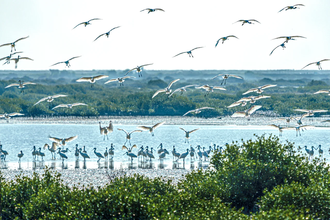
Every winter, Sicao becomes one of the most important staging grounds in Asia for the black-faced spoonbill (Platalea minor), a large wading bird characterized by its black face and spatula-shaped bill. The species is vulnerable, with a small total population concentrated in a handful of East Asian wintering and breeding sites. Taiwan's western coast — particularly the tidal flats and wetland edges south of Tainan — hosts a substantial portion of the world population each winter, with Sicao among the most significant gathering points. The birds arrive in autumn and depart in spring, spending months probing the shallow water for fish and crustaceans with the characteristic side-to-side sweep of their distinctive bills. For birdwatchers, seeing a flock of spoonbills working the Sicao shallows is the reason to come.
The Green Tunnel
The attraction that brings the largest number of general visitors is not the spoonbills but the mangrove canal. The 'green tunnel' — a stretch of waterway completely overhung by mangrove canopy — is reached by small flat-bottomed boats that depart from the Sicao area. Underneath the canopy, the light changes: filtered green-gold through the leaves, dimmer and cooler than the open sky outside. The roots create a kind of visual architecture on both banks, the arching prop roots of the gray mangrove (Avicennia marina) forming repetitive curves above the waterline. For urban Taiwanese visitors arriving from Tainan's concrete streets, the transformation is stark enough to feel theatrical. The wetlands are real and ecologically serious, but the green tunnel has also become a cultural fixture — an experience people photograph, discuss, and recommend to visitors the way other cities recommend a restaurant or a viewpoint.
From Mudflat to National Park
Sicao's protection began in 1994, when the Tainan City Government set aside the area — a decision that may have seemed modest at the time but proved prescient as Taiwan's western coast came under increasing development pressure. The 2009 expansion into Taijiang National Park gave Sicao a larger institutional framework. Taijiang National Park, established that year, covers the coastal zone north of Tainan including Sicao, the Luerhmen estuary, and former lagoon areas that have been reclaimed or converted over centuries. Within the park, Sicao is the ecological anchor — the zone where wild habitat remains continuous and where species that have disappeared from the surrounding farmed and urbanized coast still persist. Salt marshes, drainage ditches, and fish pond edges within the protected area all contribute additional habitat layers beyond the mangroves themselves.
Reading the Landscape from Above
From the air, Sicao is unmistakable. At 23.030°N, 120.138°E, the wetlands appear as a green intrusion into the tan and gray of the reclaimed coastal plain west of Tainan — a dense, dark-green patch threaded by silver water channels, set apart from the geometric fish ponds and agricultural fields that surround it. The mangrove cover is visible as a textured canopy distinct from the surrounding wetland grassland. Kaohsiung International Airport (RCKH) is approximately 28 kilometers south-southwest. Tainan Airport (RCNN) is about 7 kilometers to the east. On final approach to RCNN from the west, the Sicao wetland complex is directly in the flight path at low altitude — one of the clearest aerial views of a functioning mangrove wetland available from a commercial approach corridor anywhere in Taiwan.
From the Air
Located at 23.030°N, 120.138°E in Annan District, Tainan, along the western coastal plain. Nearest major airport: Kaohsiung International (RCKH), approximately 28 km south-southwest. Tainan Airport (RCNN) is roughly 7 km east — on approach from the west, the Sicao mangrove wetland complex is directly visible at low altitude as a dense green canopy threaded by silver water channels. Best viewed from 1,500–2,500 feet. The contrast between mangrove cover and surrounding fish ponds and reclaimed land is sharp and distinctive from the air.
Nearby Stories
- Battle of Penghu 1.2 km away
- Xiaolin Village Memorial Park 7.1 km away
- Maolin National Scenic Area 12 km away
- Fenqihu 18 km away
- Republic of China Air Force Academy 23 km away
- Southern Branch of the National Palace Museum 26 km away
- Penghu Air Raids 42 km away
- Daya Bay 512 km away