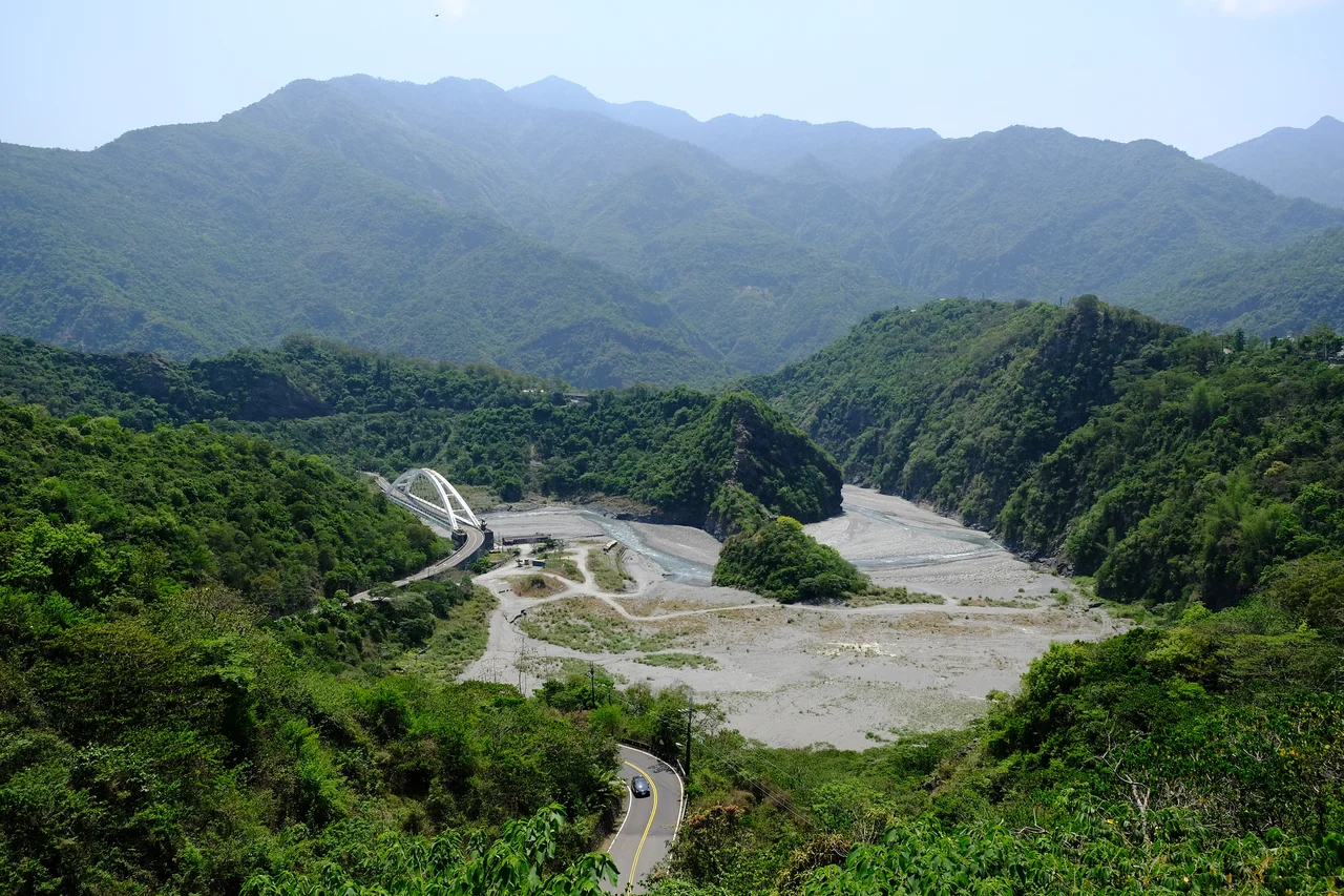

Maolin National Scenic Area
Every winter, the ridges and river gorges of the Maolin area fill with wings. Millions of purple crow butterflies — members of the genus Euploea — descend from across the region to spend the cooler months in the sheltered valleys where the Central Mountain Range's western foothills catch just enough warmth and moisture to sustain them through the season. The sight has drawn naturalists and visitors for decades. But the butterflies are not the only story here. The Maolin National Scenic Area spans the boundary between Kaohsiung and Pingtung County, spreading across terrain that has been home to the Rukai people for generations — a community with a living culture, a distinctive architectural tradition, and a relationship to this mountain landscape that long predates any designation on a government map.
The Rukai and Their Mountains
The Rukai are one of Taiwan's recognized indigenous peoples, with traditional territories concentrated in the mountains of southern Taiwan. In the Maolin area specifically, Rukai communities have maintained their connection to the mountain landscape through centuries of change — through periods of Qing Dynasty administration, Japanese colonial rule, and the governance of the Republic of China. Rukai culture is expressed in forms that are rooted in this particular terrain: traditional slate-stone architecture uses locally quarried flat stones to build homes whose walls and floors carry the coolness of the mountain even in summer heat. Rukai artistic traditions include intricate beadwork and woodcarving, with motifs — the lily, the hundred-pacer snake — that carry specific cultural meanings within the community. The Maolin District takes its name from this heritage, and the area's indigenous communities are not historical footnotes but living neighbors whose cultural practices are active expressions of who they are and where they come from.
A Landscape of Three Rivers
The scenic area sits on the western slope of the Central Mountain Range's foothills, encompassing terrain drained by several rivers cutting westward toward the Pingtung Plain. The average temperature of 24 degrees Celsius reflects the area's subtropical character — warm enough for year-round greenery but with enough seasonal variation to make the mountain valleys genuinely cooler than the coastal lowlands. The terrain ranges from the relatively open foothills accessible from Kaohsiung's Liouguei District — which holds more hot spring resources than anywhere else in southern Taiwan, with nearly forty hot spring establishments — to deeper gorge country toward the higher ridges. The three main administrative areas that make up the scenic area — Sandimen Township in Pingtung County, and Maolin and Liouguei Districts in Kaohsiung — each contribute different characters to the broader landscape, from agricultural transition zones to deep mountain terrain.
Wings Over the Valley
The purple crow butterflies are the feature that most distinctively marks Maolin in Taiwan's seasonal calendar. From November through March, thousands — in peak years, millions — of these butterflies concentrate in the area's sheltered gorges, roosting on vegetation and moving through the valley corridors in flows that can be dense enough to obscure the sky above certain trails. Purple crow butterflies are members of the Euploea genus, dark-winged insects with iridescent purple sheen that become visible when light catches them at the right angle. Their annual convergence on Maolin is one of Asia's notable wildlife spectacles, drawing visitors who come specifically to watch the butterflies stream through the valley on calm winter mornings. The phenomenon is tied to the specific microclimate of the Maolin gorges — sheltered enough from wind, warm enough through winter, and sustaining the host plants the butterflies need to survive the season.
Ceremonies and Seasons
The scenic area's calendar of cultural activities includes ceremonies that bring together the Paiwan and Rukai communities from across the northern Pingtung mountain townships. Traditional wedding ceremonies, organized with participation from Majia Township, Sandimen Township, and Wutai Township, take place in March — events that involve the full cultural dress, music, and ritual of the communities involved. These are not performances staged for outside visitors. They are ceremonies that the communities themselves organize and hold, in which participants from multiple villages come together in ways that have deep roots in the social and kinship structures of Paiwan and Rukai life. The Maolin National Scenic Area Management Office participates in the organization of these seasonal activities, but the cultural content and meaning belong to the communities that hold them.
Hot Springs at the Mountain's Edge
Where the mountains give way to the western foothills in the Liouguei area, the ground yields something unexpected: hot springs in exceptional quantity. The Liouguei area of Kaohsiung County holds more hot spring resources than anywhere else in southern Taiwan, with nearly forty hot spring establishments ranging from rustic bathing spots to full resort hotels. The springs emerge from the geological complexity of the mountain-plain transition zone, where deeply circulating groundwater is heated by geothermal activity before rising to the surface. The Liouguei hot springs draw visitors who combine mountain scenery with therapeutic bathing — a combination the Japanese colonial period institutionalized and that continues to draw visitors today. From Kaohsiung Main Station, the scenic area is reachable by bus, making it accessible without private transport for visitors who want to spend a day in the mountains and return to the city by evening.
From the Air
Maolin National Scenic Area centers around approximately 22.752°N, 120.635°E, spanning mountain terrain east of the Pingtung Plain. Flying into RCKH (Kaohsiung International Airport), the Central Mountain Range forms the dramatic eastern horizon — Maolin's valleys are tucked into the western foothills of that range, roughly 30–40 kilometers northeast of the airport. From altitude, the Kaohsiung basin gives way eastward to crumpled ridge country rising toward peaks exceeding 3,000 meters. The Liouguei area is visible as a valley corridor cutting into the mountains north of Sandimen. Recommended viewing altitude: 5,000–8,000 feet MSL for a broad view of the mountain-plain transition; descend to 2,000–3,000 feet for gorge detail on a calm day. Terrain rises steeply — maintain awareness of elevation and mountain weather.
Nearby Stories
- Sicao Wetlands 9.9 km away
- Baolai Spring Park 11 km away
- Chenggong, Taitung 12 km away
- Ten Drum Rende Creative Park 20 km away
- Lüdao Lighthouse 21 km away
- Fangliao 23 km away
- Orchid Island 56 km away
- Hong Kong 12 586 km away