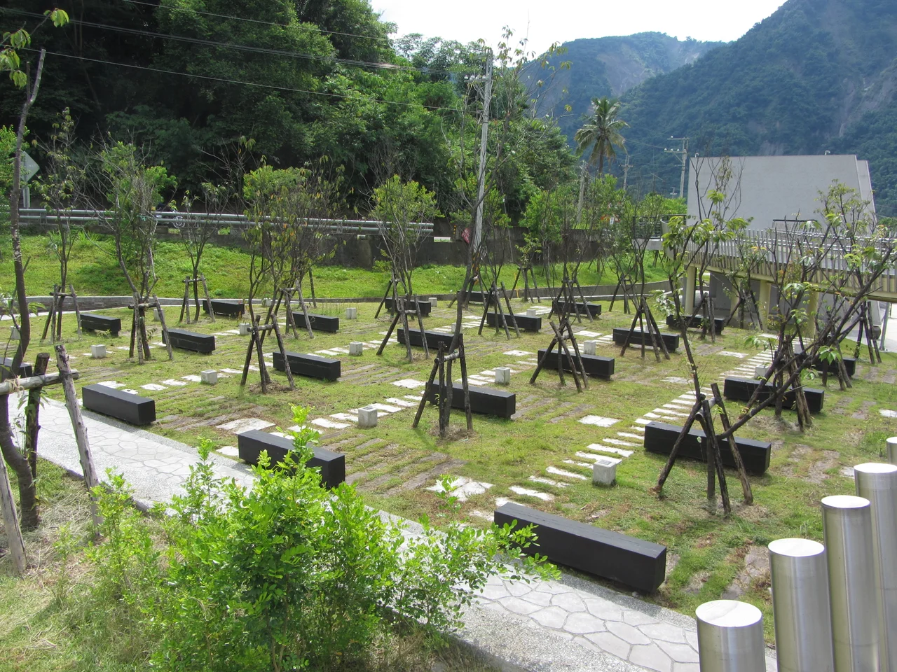

Xiaolin Village Memorial Park
On the morning of August 9, 2009, at approximately 6:17 a.m., a massive landslide broke loose from the mountain above Xiaolin Village. Typhoon Morakot had been depositing rain for two days — in some nearby mountain areas, more than 2,700 millimeters fell in 72 hours, among the heaviest rainfall events ever recorded in Taiwan. The saturated hillside gave way in a movement covering roughly 2.5 square kilometers and a volume of 27 million cubic meters of debris. It crossed a valley, dammed the Chishan River, and buried most of Xiaolin Village. When the natural dam failed shortly after, the surge buried the rest. More than 400 people died — many of them Taivoan indigenous community members whose families had lived in this valley for generations.
The People of Xiaolin
Xiaolin Village, also spelled Siaolin, was home to members of the Taivoan people — one of the Taiwanese plains indigenous groups whose presence in the river valleys of southern Taiwan predates the Han Chinese migrations by centuries. The Taivoan had survived successive waves of outside rule: Dutch colonization, the Kingdom of Tungning, Qing Dynasty administration, Japanese colonial governance, and the Republic of China. Through each transition they had adapted, resisted, and persisted. Xiaolin was one of the communities that maintained a degree of Taivoan cultural continuity into the twenty-first century. What the typhoon took was not only lives but the accumulated knowledge, relationships, and memory that a living community carries — things that cannot be memorialized in stone, only in people. The village had around 500 residents before August 9. Most of them were home when the landslide came.
The Scale of the Loss
Typhoon Morakot was the most destructive typhoon to hit Taiwan since modern records began. Across southern Taiwan, more than 670 people died in the storm and its aftermath, with Xiaolin accounting for the largest single loss of life. Estimates of the Xiaolin death toll range in the sources from around 400 to more than 500; the most commonly cited figures fall between 474 and 491 people killed, with additional missing persons who were never accounted for. The landslide buried over 100 homes. The disaster was described as the most devastating event in Taiwan since the typhoon warning system was established in 1992, and it triggered extensive debate about indigenous community relocation policies, early-warning systems, and the government's emergency response. Survivors were relocated to new housing developments in the years that followed, their connection to the ancestral land permanently altered by the catastrophe.
A Memorial Built from Stones That Fell
In the immediate aftermath, Kaohsiung County Magistrate Yang Chiu-hsing proposed establishing a memorial park on the site. The design that resulted is spare and deliberate. The park covers 1.7 hectares and includes an ancestral hall, a bridge, a memorial square, a monument, and a viewing platform. At the center stands a 9-meter monument constructed from stones that came down in the landslide itself — the mountain's own material, reshaped into an act of remembrance. Around the park, 181 mountain cherry trees have been planted, one for each of the 181 families who lost members in the disaster. In winter, when the cherry trees bloom, the pink blossoms carry a weight that ornamental plantings rarely do. The park was officially dedicated on January 15, 2012, in a ceremony attended by President Ma Ying-jeou, Kaohsiung Mayor Chen Chu, and Premier Lin Join-sane.
Bearing Witness
The Xiaolin Village Memorial Park exists not as a tourist attraction in the ordinary sense but as a place of bearing witness — for survivors, for descendants, for anyone who comes to understand something about what happened here. The ancestral hall acknowledges the Taivoan heritage of the community; the monument does not minimize what was lost. What a memorial can do, and what this one attempts, is to insist that the people who died here are remembered as people — with names, with families represented by those cherry trees, with an indigenous history that this valley held for centuries before the morning of August 9, 2009. The landscape around the site still shows the marks of the disaster: reshaped hillsides, the altered course of the Chishan River, the absence where a village once stood. These things speak more plainly than any inscription.
From the Air
The Xiaolin Village Memorial Park is located at approximately 23.155°N, 120.640°E in Jiasian District, Kaohsiung, in the upper Chishan River valley. From altitude, the landslide scar on the hillside above the former village site may still be visible as a large altered slope face. The valley is narrow and flanked by steep mountain ridges typical of the eastern Kaohsiung interior. The nearest major airport is RCKH (Kaohsiung International Airport), approximately 55 km to the southwest. Approach from the west along the Chishan River valley, which cuts inland from the Kaohsiung plain.
Nearby Stories
- Chenggong, Taitung 6.2 km away
- Dutch Pacification Campaign on Formosa 7.2 km away
- Yuli 9 km away
- Lulin Observatory 15 km away
- Maolin National Scenic Area 17 km away
- Lüdao Lighthouse 27 km away
- Taixi, Yunlin 36 km away
- Daya Bay 584 km away