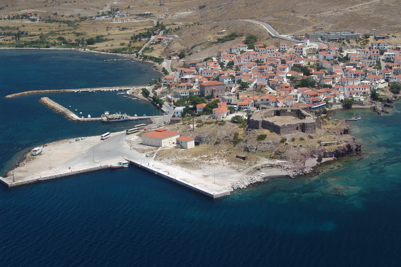

Sigri (village)
Nineteen million years ago, volcanoes buried a living forest in ash and lava, and then time did something patient and strange: it replaced the wood, cell by cell, with stone, preserving trunks and roots and even the colors of the bark in yellow, red, and brown silica. That petrified forest is now a UNESCO Global Geopark, and the village that watches over it is Sigri, at the windswept western tip of Lesbos. Its name promises calm. Through the Greek word for sure or certain, it traces back to the Venetian siguro, meaning "safe," a tribute to the sheltered harbour that gave the village its reason to exist.
A Harbour Worth a Name
Sigri earned its name honestly. The long, low island of Nissiopi stretches across the mouth of the bay like a natural breakwater, blunting the prevailing winds and giving ships a refuge on a coast that offers few. The port is deep enough to take large vessels, even ferries the size of cruise ships, though in practice almost all traffic to Lesbos still docks on the gentler eastern side of the island. Watching over the water is a stone Turkish castle, built in 1746 during the Ottoman period, square and solid above the bay. This is the dry, sparsely peopled end of Lesbos, light on vegetation and farms, heavy on wind, with a near-180-degree sweep of volcanic grey sand for a village beach. Visitors are few. The restaurants here favor the sea, serving fresh fish and horta, a wild spinach boiled and dressed simply with lemon and salt.
A Forest Turned to Stone
The true wonder of Sigri lies in the land itself. Between roughly 17 and 20 million years ago, repeated volcanic eruptions smothered western Lesbos in lava and ash, entombing whole trees where they stood. Mineral-rich water seeped through the buried wood and, over unimaginable spans of time, swapped living tissue for silica, fossilizing the trees so faithfully that many survive with their root systems intact, frozen exactly where they grew. The fossils glow with yellows, reds, and browns. The protected forest joined the European Geoparks Network as a founding member in 2000, entered the UNESCO Global Geoparks Network in 2004, and in 2015 the whole island was recognized as a UNESCO Global Geopark. It stands among the finest petrified forests on Earth, a slice of the early Miocene preserved in glittering stone.
Where Deep Time Is on Display
At the heart of the protected area sits the Natural History Museum of the Lesvos Petrified Forest, founded in 1994 and overseen by Greece's Ministry of Culture and Sports. Its two great halls trace an enormous arc of time. The first follows the evolution of plants, from the first single-celled organisms to the towering trees that became the forest, displaying petrified trunks, branches, roots, seeds, and leaves drawn from more than forty species. The second, "The Evolution of the Aegean," reconstructs twenty million years of geological history through models and charts, alongside quartz crystals, the skulls of extinct primates from Greece and Lesbos, and flint tools from the Stone Age. A seismological station lets visitors watch real earthquakes recorded as they happen, and an earthquake simulator recreates past tremors so that visitors can feel, and learn to survive, the forces that shaped this island.
The Quiet Edge of the Island
Sigri rewards those willing to reach the far edge of Lesbos. The wind that scours this coast keeps the crowds away and the air clean, though it has not yet brought the windsurfers who would surely love it. The open sea can be rough, but inside the wide bays the currents soften, and the village beach shelves so gently that it is normally safe for children, provided their inflatables are tethered against the breeze. Six clothing-optional sandy beaches lie within walking distance, scattered along a shore that feels genuinely remote. It is a place where the ordinary rhythms of a fishing village, the boats, the fish tavernas, the slow afternoons, sit beside one of the planet's most extraordinary fossil landscapes, the everyday and the nearly eternal side by side.
From the Air
Sigri lies at 39.21°N, 25.85°E at the western tip of Lesbos, Greece, on a windy, sparsely vegetated coast. Key landmarks include the island of Nissiopi sheltering the bay, the 1746 Ottoman castle above the harbour, the broad grey-sand village beach, and the surrounding Petrified Forest UNESCO Global Geopark. The nearest airport is Mytilene International (LGMT) on the east of the island, roughly 90 km away by road. Best viewed at low to medium altitude in clear weather; expect strong prevailing winds along this exposed western shore.
Nearby Stories
- Agios Isidoros, Lesbos 6.5 km away
- Solar eclipse of May 20, 1966 10 km away
- Antandrus 36 km away
- Destruction of Psara 55 km away
- Troy 57 km away
- Aegean Sea 58 km away
- Battle of Athos 66 km away
- Skyros 82 km away