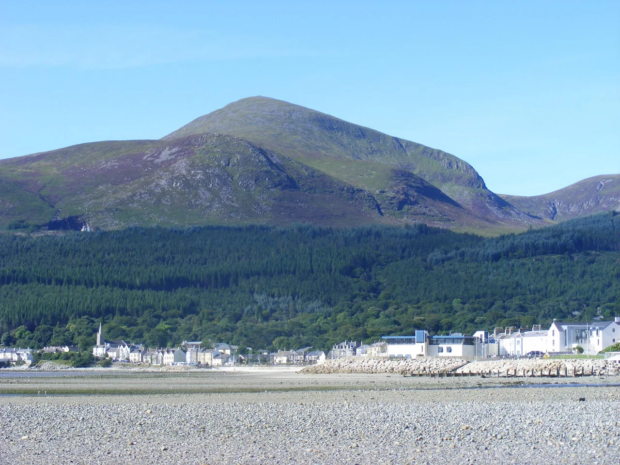

Slieve Donard
On the summit of Northern Ireland's highest mountain, a circle of stones rises about a metre off the ground. It does not look like much. Hillwalkers add fresh pebbles to it; weather and the Royal Engineers have flattened most of what was once there. But this scrappy cairn, 850 metres above the Irish Sea, is the remains of a Neolithic passage tomb built between 3300 and 3000 BC. It is the highest known passage tomb in Britain and Ireland. Whoever raised it carried every stone up the mountain by hand, five thousand years ago, because they believed something about the high places that we have largely forgotten.
Twelve Chief Mountains, Three Great Heights
Irish mythology never treated Slieve Donard as ordinary terrain. The medieval tale Cath Maige Tuired lists it among the twelve chief mountains of Ireland. The Triads of Ireland name it as one of the three great heights, paired with Croagh Patrick and the Great Sugar Loaf. The Irish name Beann Boirche means Boirche's Peak, after a mythical cowherd-king with supernatural powers; the plural Beanna Boirche became the name of the Mourne Mountains as a whole. An older name, Sliabh Slángha, attributes the summit cairn to Slángha, son of Partholón and reputedly Ireland's first physician. According to the Annals of the Four Masters, Slángha died in Anno Mundi 2533 - 2533 years after the creation of the world - and was buried in the passage tomb on the peak.
Saint Donard and the King Asleep in the Mountain
Sometime in the fifth century, tradition says, a follower of Saint Patrick named Donard came to live on the mountain. He converted the Great Cairn into a hermit's cell and used the smaller Lesser Cairn as an oratory. Patrick was said to have blessed Donard in the womb, declaring that the saint would not die but would abide inside the mountain as its perpetual guardian. Folklore added that a cave runs from the seashore up to the summit cairn, and that Donard - or Boirche, depending on which version you trust - still lives inside it. The pilgrims who climbed the peak each late July, well into the 1830s, were participating in what was likely an older Lughnasadh harvest ritual that Christianity had absorbed without ever quite replacing.
The Royal Engineers on the Summit
In 1826, the Royal Engineers arrived to use Slieve Donard as a triangulation point for mapping Ireland. They camped on the mountaintop from late July until late November - four months of weather that did not entirely cooperate. The engineers used the two cairns as survey markers, dismantling parts of them in the process. Two of their men died in a snowstorm on the descent. Others were injured during storms on the summit. The maps they produced were the basis of British cartographic knowledge of Ireland for generations, but they came at a cost to the mountain itself. The cairns have never been the same. The cartography survived. The men, mostly, did not.
The Mourne Wall
Between 1904 and 1922, eighteen years of stonework, masons built a granite wall across the Mournes that passes over fifteen summits including Slieve Donard. It climbs the western slope, meets a small stone tower at the peak, then descends the southern slope toward Slieve Commedagh. The wall was built to enclose the catchment of the Silent Valley Reservoir, protecting Belfast's water supply from grazing animals. Masons worked from March to mid-October each year, sleeping in shelters on the high ground. Some stones from the cairns ended up in the wall. The wall today is one of the great long-distance hill-walking objectives in Ireland, but its origins are entirely practical: stone, sweat, and a city's thirst.
The View From the Top
On a clear day the summit reveals what Donard's monks saw and the surveyors mapped. Belfast Lough lies thirty miles to the north. Dublin Bay sits fifty-five miles south. The Isle of Man rises from the sea to the east. The Mourne Wall traces away to neighbouring summits, and below the eastern slopes the town of Newcastle stretches along Dundrum Bay. In April 2021, a gorse fire deliberately set ravaged the eastern slopes, destroying habitat and killing wildlife before firefighters finally suppressed it after three days. The mountain absorbed even that. It has been a sacred place, a survey point, a pilgrimage site, a wall-builder's challenge, and the highest ground in Ulster. Pilgrims still walk up. Hillwalkers still add stones to the cairn that should not really be added to. The mountain endures the company.
From the Air
Slieve Donard rises to 850 metres (2,789 ft) at 54.180N, 5.921W, dominating the eastern Mourne Mountains. Maintain minimum safe altitude well above the summit - mountain wave, rotor turbulence, and orographic cloud are routine in south-southwesterly flow. Best photographic profile from 4,000 to 6,000 feet on a track from the east, with the Mourne Wall visible as a thin grey line tracing the ridges. Belfast City (EGAC) 30 nm north, Newtownards (EGAD) 25 nm north-northeast. The summit is often in cloud even when surrounding lowlands are clear.
Nearby Stories
- Newry 6 km away
- Comber 7.2 km away
- Castlebellingham 8.1 km away
- Lough Neagh 15 km away
- Pasages (steam trawler) 25 km away
- Calf of Man 35 km away
- German submarine U-1024 38 km away
- Mornington 41 km away