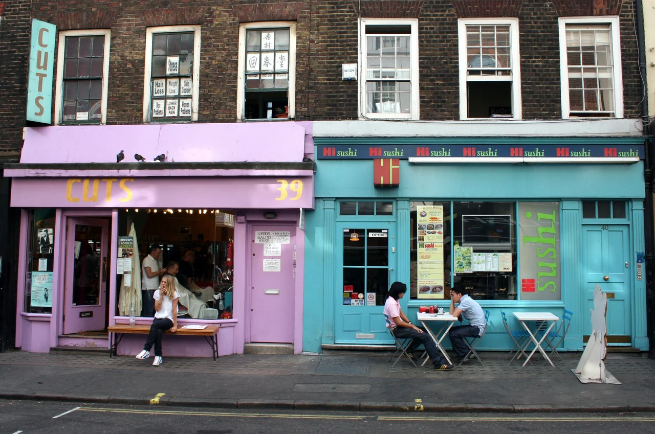

Soho
On 31 August 1854, a cholera outbreak began in a few houses around Broad Street in Soho. Within ten days, more than 500 people were dead. A local doctor named John Snow, sceptical of the prevailing theory that disease drifted through the air as miasma, walked the streets with a notebook and marked the addresses of the sick on a map. The clusters all converged on a single public water pump. Snow persuaded the parish authorities to remove the handle, and the outbreak slowed. The spring below had been contaminated by sewage. The episode became one of the founding moments of modern epidemiology and public health, and a small replica pump still stands by the John Snow pub on what is now Broadwick Street, the handle deliberately missing. The story of Soho is full of moments like that: ordinary streets where something extraordinary happened.
From Hunting Cry to Neighbourhood
The name Soho first appears around 1636, derived from a former hunting cry. The land was royal park under Henry VIII, who in 1536 turned the farms into hunting ground. By the late 17th century it had been parcelled into streets, with Soho Square laid out in the 1680s as one of the first fashionable addresses in London. The area is unevenly bounded: Shaftesbury Avenue to the south, Oxford Street to the north, Regent Street to the west, and Charing Cross Road to the east, all but the first of which are 19th-century improvements. Soho is roughly a square mile in size and has never had a formal administrative existence. It is not an entity. It is a name people gave to a quarter that didn't fit anywhere else, and that has kept that uncategorisable quality through almost every change.
Layers of Arrival
Soho has always taken in newcomers. French Huguenots fleeing persecution after 1685 founded the French Protestant Church and filled Dean Street and Greek Street. Greek and Italian immigrants in the 19th century opened the cafes and restaurants that gave the area its food culture; the 1924 guide noting that "of late years, the inexpensive restaurants of Soho have enjoyed an extraordinary vogue" was describing the work of those communities. By the 1950s Chinese Londoners, many of them displaced from Limehouse in the East End, were settling on Gerrard Street; by 1970 the street had become the centre of London's Chinatown, pedestrianised and gated with painted dragons, and is so today. Karl Marx wrote much of Das Kapital while living at 28 Dean Street in conditions that were, by every account including his own, miserable. Mozart lived in Frith Street with his father in 1764 and 1765, playing for paying audiences at the age of eight.
The Sex Industry, Honestly
For more than two centuries Soho was at the centre of London's commercial sex trade. Between 1778 and 1801, the house at 21 Soho Square ran as the White House brothel; the magistrate Henry Mayhew called it notorious. The trade waxed and waned with the law. After the Street Offences Act of 1959 drove women off the streets, clubs and "clip joints" took over. The 1970s and early 1980s were the peak: 54 sex shops, 39 sex cinemas, 16 strip and peep shows, and a corrupt Metropolitan Police vice squad accepting bribes to look the other way. A series of corruption trials in 1975 and a community organisation called the Soho Society pushed back. By the time of the 1982 City of Westminster crackdown, the number of licensed sex industry premises fell from 185 to about 30. The women who worked in these businesses were largely poor and often coerced, frequently migrants without papers, frequently invisible to the people who wrote the area's histories. To tell Soho's story honestly is to acknowledge that they were here too, and that the gentrification which has now nearly emptied them out did not make their work better or safer, only less visible.
Music, Comedy, Film
From 1948 onwards, Soho was the cradle of modern music in Britain. Club Eleven, on Carnaby Street, hosted the first bebop performances in Britain. The Marquee Club on Wardour Street, opened in 1958, gave early stages to the Rolling Stones, the Who, David Bowie, Led Zeppelin, Pink Floyd, Jethro Tull, AC/DC, and Iron Maiden. The 2i's Coffee Bar at 59 Old Compton Street was one of the first rock venues in Europe. Ronnie Scott's Jazz Club opened on Gerrard Street in 1959 and moved to 47 Frith Street in 1965, where it still operates. Trident Studios at 17 St Anne's Court recorded The Beatles' White Album, the first four Queen albums, and early work by David Bowie. The British film and post-production industries clustered in the same square mile: 20th Century Studios at 31-32 Soho Square, the BBFC at 3 Soho Square, De Lane Lea Studios on Dean Street. By the 2010s, 23 percent of Soho's workforce was in the creative industries.
Old Compton Street and the Admiral Duncan
Old Compton Street, named after the Bishop of London Henry Compton, was laid out in the 1670s and is today the centre of London's most prominent gay village. The Admiral Duncan pub on the corner of Old Compton and Dean Street has served the gay community for decades. On 30 April 1999, a nail bomb planted there by the neo-Nazi David Copeland killed three people and injured 30, the third of three bombs Copeland set off in London in an attempt to incite ethnic and homophobic violence. The pub reopened. The community held its ground. Soho today is, by another count from 2019, the unhealthiest place to live in Britain by some metrics: too many takeaways, too much air pollution, too little green space. It is also one of the most densely loved square miles in the country, the place where you might in a single evening eat at a Cantonese kitchen on Gerrard Street, hear jazz at Ronnie Scott's, drink at a French House that once hid the Free French during the war, and walk past a pump with no handle that quietly changed how we think about disease.
From the Air
Coordinates 51.514 N, 0.135 W in the West End of central London. Soho occupies roughly a square mile bounded by Shaftesbury Avenue, Oxford Street, Regent Street, and Charing Cross Road. Recommended viewing altitude 1000-1500 ft. From above, look for the open green of Soho Square in the north and the geometry of Golden Square in the south-west. Carnaby Street runs north-south through the western side, and Old Compton Street cuts east-west through the middle of the district. Nearest airports: London City (EGLC) about 6 nm east, London Heathrow (EGLL) about 14 nm west. Class D airspace under the London City CTR; transit clearance required. Best visibility in the early evening when the West End's lights come up.
Nearby Stories
- Stevenage 5.7 km away
- Malling Abbey 5.7 km away
- 1952 Farnborough Airshow Crash 7.7 km away
- Ingatestone Hall 8.2 km away
- Hellfire Caves 9.1 km away
- The Carrington Event: The Solar Storm That Could Happen Again 9.8 km away
- Bletchley Park 16 km away
- Castle Hedingham 23 km away