Sonoma Coast State Park
The rubbing marks are too high for cattle. Two to four meters up a blueschist sea stack south of the Russian River, deep grooves score the rock at a height no modern bovid could reach. Mammoths made them, possibly as recently as 40,000 years ago, using these coastal pillars the way an elephant uses a tree. Fossil remains at Bodega Head confirm what the scratches suggest: this stretch of Sonoma County shoreline has been hosting oversized visitors for a very long time. Today the visitors are human, drawn to seventeen miles of alternating sandy beaches and rocky shore that California designated Sonoma Coast State Park. The coastline runs from just north of Jenner south to Bodega Head, threaded by Highway 1 and named in pieces - Arched Rock Beach, Gleason Beach, Goat Rock Beach - each pocket of sand separated by headlands and sea stacks that stand like sentinels along the marine terrace.
A Coastline Coming Apart
The land here is losing ground, literally. Marine and wind erosion strip one to three feet of coastline annually, an average that spikes in heavy storm years. The result is a marine terrace elevated fifty to a hundred feet above sea level, its edge a steep bluff dropping to the littoral zone below. The San Andreas Fault runs roughly parallel to the shore, a geological reminder that this coast is not merely eroding but actively shifting. Sea stacks - vertical rock formations of sandstone layered with quartz - have resisted the erosion that consumed the softer soils around them. They appear standing in the surf, perched on the beach, and occasionally stranded atop the terrace itself, ancient seafloor monuments lifted by uplift and left behind by the retreating land. At Gleason Beach, Highway 1 had to be rerouted 400 feet inland, the first Caltrans project undertaken specifically because of sea level rise.
Creatures of the Margin
The park's ecology spans three distinct zones, each with its own community. Offshore, gray whales migrate along the coast while harbor seals and California sea lions haul out on the rocks. Kelp beds, though modest compared to those farther south, shelter marine organisms in the cold northern California water. The tidepools, fewer and less populated than warmer zones support, are still rich with flora and fauna clinging to the intertidal rock. Above the bluffs, California coastal prairie takes over - moderately acidic loamy soils that stunt some plants while nurturing rare species. Lupine, thistle, and wild oats bloom across the grasslands in spring. California mule deer browse the prairie, and the adjacent Ocean Song preserve extends the habitat corridor to the ridge-top forests of the California Coast Ranges. The acidity that limits growth also creates opportunity: rare plants that cannot compete in richer soils find refuge here.
Layers Beneath the Grass
Long before European settlement, the Coast Miwok and Pomo peoples inhabited this coastline. Archaeological evidence dates back to at least 1849, when the first formal finds were recorded, though the habitation itself stretches much further. Dozens of prehistoric kitchen middens and other traces of tribal life have been documented across the property, which falls within the boundaries of the Mexican land grant Rancho Bodega. Russians began logging the old-growth forests above the coastal prairie in the early 19th century, part of the same colonial enterprise that established Fort Ross to the north. European settlers followed, and their agricultural presence left remains of barns and outbuildings scattered across the prairie. At Duncans Point, iron pins driven into the sandstone bluffs testify to a once-active shipping industry. The underwater zone, extending a thousand feet from shore, holds its own secrets: records suggest seventeen vessels may have been lost in these waters, though no wrecks have yet been found.
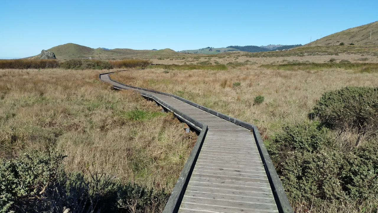
A Veterinarian's Trail
The Kortum Trail connects Goat Rock, Shell Beach, and Wright's Beach along the coast, its wooden walkways bridging wetlands and its side paths descending to the shore and the bouldering routes at Sunset Boulders. The trail bears the name of Bill Kortum, a Sonoma County environmentalist whose unlikely path to conservation began on a Petaluma poultry farm. Kortum's mother was a descendant of the Donner Party; his father's parents made wine in the upper Napa Valley. After studying veterinary medicine at UC Davis, Kortum spent years traveling as a bovine veterinarian, and watching California's rural landscape disappear beneath development changed him. He became a driving force behind the creation of the California Coastal Commission, the body that has shaped the state's relationship with its shoreline ever since. He died in 2014 at eighty-seven, but the trail that carries his name still offers what he fought to protect: whales offshore, wildflowers underfoot, and seventeen miles of coast that belong to everyone.
From the Air
Located at 38.37°N, 123.07°W along the Sonoma County coastline. The park stretches 17 miles from north of Jenner to Bodega Head, following Highway 1. From the air, the marine terrace is clearly visible as a flat shelf 50-100 feet above the surf, punctuated by sea stacks. Goat Rock Beach at the mouth of the Russian River is a prominent landmark. Nearest airports: Charles M. Schulz-Sonoma County Airport (KSTS) approximately 25 miles east; San Francisco International (KSFO) approximately 70 miles south. Coastal fog is common, especially mornings; the coastline often clears by afternoon.
Nearby Stories
- Neon and Nostalgia at the Flamingo 4.9 km away
- Museum of the American Indian 8.7 km away
- The Swede on Cobb Mountain Road 11 km away
- Cordell Bank: The Invisible Island 15 km away
- The Sea Ranch 21 km away
- Pixieland 706 km away
- Neskowin Ghost Forest 744 km away
- ʻAkaka Falls State Park 3641 km away