South Papua
The Asmat carver works on a bisj pole taller than himself, chiseling ancestor figures into tiers of merbau wood. Three meters high, the pole will stand in the village as a connection between the living and the dead. This is South Papua, Indonesia's youngest and least populous province, formally established on 25 July 2022 from the four southernmost regencies of the former Papua province. Covering roughly 118,000 square kilometers — an area comparable to Pennsylvania — it is home to barely half a million people, many of them members of indigenous groups like the Asmat, Marind, Muyu, and Korowai who have shaped this swampy lowland for centuries.
Where Rivers Rule
South Papua is defined by water. The Digul and Maro rivers and their tributaries carve through lowland rain forests and freshwater swamp forests fed by rainfall from the New Guinea Highlands to the north. Much of the terrain is so waterlogged that land roads barely exist; as of 2023, only two of the four regencies — Merauke and Boven Digoel — are connected by the Trans-Papua Highway. Reaching the capitals of Mappi and Asmat requires a boat or a plane. In Asmat Regency, even the journey from the airport at Ewer to the capital town of Agats requires a speedboat, because there are no roads at all. Rivers in Mappi Regency are choked with tebu rawa, a wild plant resembling sugarcane that grows so densely it blocks navigation, forcing boats to be pushed through by hand while mud accumulates beneath the hull.
Headhunters and Colonizers
Before Europeans arrived, the Marind people lived along the rivers of the Merauke region in groups organized around hunting, gathering, and farming. They were also feared headhunters who traveled by boat along rivers and coasts to raid distant settlements, bringing back severed heads to be preserved and celebrated in their villages. In 1902, the Dutch established a military base near the Maro River to strengthen the border with British New Guinea and suppress headhunting. They named it Merauke. Catholic missionaries followed, and Javanese settlers were brought in to cultivate rice fields. In the 1960s, Indonesia took control of all of Dutch New Guinea, reorganizing the territory. The single Merauke Regency was split into four — Merauke, Mappi, Asmat, and Boven Digoel — on 11 December 2002, and these were reunited under the new South Papua province two decades later.
Ancestors in Wood and Air
The Asmat are renowned internationally for their woodcarving, a practice inseparable from their spiritual life. Carvings are not decorative objects but conduits to the ancestors, crafted from local merbau and nutmeg wood with motifs drawn from nature and daily life. The bisj pole is the most iconic: a pillar of stacked ancestor figures, topped with a wing-like projection, standing more than three meters tall. Other tribes build upward in a different way. The Korowai and Kombai construct treehouses at three levels: near ground level for daily living and ceremonies, between 5 and 15 meters for ordinary dwellings, and the tallest — the rumah pengintai, or lookout houses — at 30 meters or higher, used for surveillance, refuge during attacks, and hiding women during the practice of bride kidnapping. Sago, the starchy pith of the sago palm, is the staple food across the province, processed into pancakes, congee called papeda, or baked into lempeng wafers.
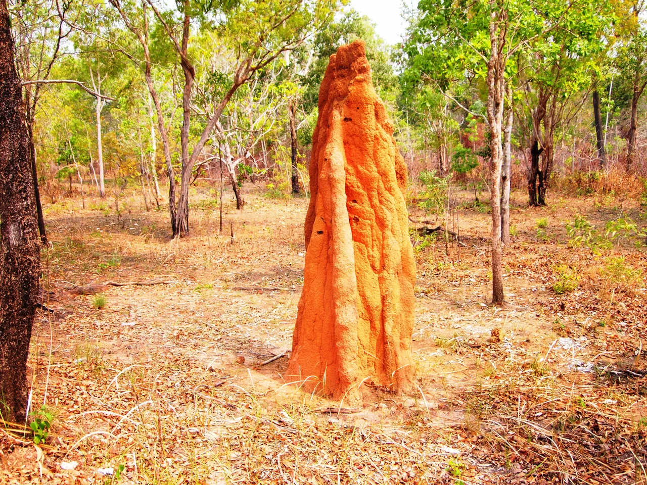
The Wallaby Park and the Arafura Sea
South Papua contains Wasur National Park, a Ramsar wetland of international importance where the Trans-Fly savanna and grasslands create an ecosystem unlike anything else in Indonesia. Agile wallabies graze across flooded savannas. Mound-building termites, known locally as musamus, construct towering earthen structures. Birds of paradise display in the forest margins, and magpie geese migrate seasonally from Australia. Offshore, the Arafura Sea holds significant fisheries, though the presence of an estimated 20,000 non-local fishing vessels has marginalized local fishermen. In July 2023, Indonesia's first marine protected area in South Papua was established around Kolepom Island, covering 356,337 hectares. The province's most prized marine product is fish maw — the swim bladder of the croaker fish — which commands prices of approximately 18 million rupiah per kilogram and is exported to Malaysia and Singapore for use in traditional medicine and luxury cuisine.
From the Air
Coordinates: 7.00°S, 140.00°E, in the lowland interior of South Papua. Best viewed from 10,000–20,000 ft where the river systems, swamp forests, and Wasur National Park's savanna create visible contrasts. Nearest airports: WAKK (Merauke/Mopah), WAKT (Tanah Merah). The Trans-Papua Highway is visible as a thin thread along the PNG border between Merauke and Boven Digoel.
Nearby Stories
- Boven-Digoel Concentration Camp 42 km away
- New Guinea Mangroves 54 km away
- Baliem River 95 km away
- Asmat Regency 97 km away
- Asmat 125 km away
- 2016 Sunbird Aviation Britten-Norman Islander Crash 154 km away
- Wasur National Park 236 km away
- Western Papua New Guinea 398 km away