Western Papua New Guinea
In Western Province, villagers catch young crocodiles from the rivers, fatten them in enclosures, and sell the skins. It is a living drawn directly from the landscape, and the landscape here is vast beyond easy comprehension. Western Papua New Guinea, encompassing the country's Gulf and Western Provinces, covers nearly 135,000 square kilometers of dense forest, jungle, marshes, and mountain-flanked river deltas, yet holds fewer than 260,000 people. Barges travel the Fly River and its tributaries, but they carry only cargo. If you want to move through this country, you fly or you walk.
The Fly and Its Kingdom
Western Province alone sprawls across almost 100,000 square kilometers, making it the largest province in Papua New Guinea. The Fly River dominates the geography, fed by its major tributaries the Strickland and Ok Tedi. These are not gentle waterways. Crocodiles inhabit the river systems in numbers large enough to sustain a commercial skin trade, and barges and cargo vessels navigate the channels, though passenger service does not exist. Lake Murray, the country's largest lake, sits within the province. The major economic engine is the Ok Tedi Gold and Copper Mine, an operation that has generated both revenue and fierce opposition from traditional landowners who have watched the mining reshape their ancestral land.
Where the Rivers Meet the Sea
Gulf Province is a different world, smaller at 34,500 square kilometers and even more thinly populated, with fewer than 110,000 inhabitants as of its last major census count. Mountains give way to lowland river deltas and grassland flood plains. The Kikori River delta, where a small fishing center serves as an outpost for birdwatchers, marks one of the few places visitors are likely to encounter. Traditional crops here are sago and betelnut, locally called buai. Some oil exploration and logging operations punctuate the jungle, but the province remains one of the least-visited in the entire country. The Lakekamu Basin draws the occasional intrepid traveler, though reaching it requires determination and tolerance for rough conditions.
A Birdwatcher's Obsession
Near Kiunga in Western Province, the forest canopy holds one of the richest concentrations of bird species in the world. The list reads like an ornithological fever dream: Palm Cockatoos, multiple species of Birds of Paradise, Southern Crowned Pigeons, Pesquet's Parrots, Flame Bowerbirds, the Flightless Rail, Blyth's Hornbill, the Red-bellied Pitta, and the Common Paradise-Kingfisher, among dozens of others. Honeyeaters flit through the understory while the Lesser Black Coucal lurks in dense cover. Ecotourism Melanesia offers guided tours from Kiunga, and daily flights connect the town to Port Moresby, making this one of the few places in the region that a visitor can reach with relative ease. For birders, the area around Kiunga is not merely good. It is among the finest birding destinations on Earth.
The Geography of Remoteness
What defines western Papua New Guinea is not any single feature but the sheer scale of its emptiness. Dense forest and marshland make overland travel nearly impossible in many areas. Communities are scattered along riverbanks and airstrips, connected more by small aircraft than by roads. The two provinces together have fewer people than many individual suburbs of the world's large cities, spread across an area larger than many European countries. This remoteness has preserved the jungle and its wildlife, but it has also left communities isolated, dependent on river transport and the irregular schedules of bush pilots. It is a region where the land remains firmly in charge, and human settlement exists on its terms.
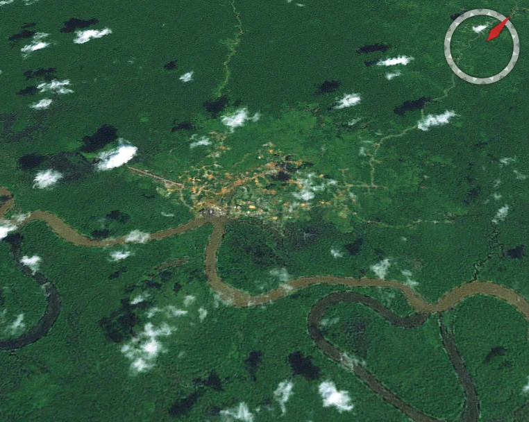
From the Air
Located at approximately 7.29S, 142.95E in Papua New Guinea's western lowlands. The Fly River and its vast delta system are the primary visual landmarks from altitude, snaking through unbroken jungle canopy. Kiunga Airport (AYKK) in Western Province serves as the main entry point. Daru Airport (AYDP) sits on the coast. The region between the Fly River and the coast is predominantly flat, swampy, and featureless from the air except for river channels. Gulf Province's coast along the Gulf of Papua is visible as a broad, muddy shoreline. Moro Airport (AYMR) in the Southern Highlands is the nearest paved runway to the north.
Nearby Stories
- Great Papuan Plateau 59 km away
- Goaribari Island 90 km away
- Diocese of Mendi 101 km away
- Mendi 130 km away
- 2016 Sunbird Aviation Britten-Norman Islander Crash 158 km away
- Daru 173 km away
- Wasur National Park 206 km away
- Fly River 241 km away