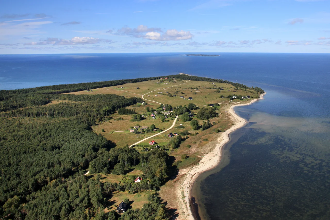

Spithami
The sign at the edge of the village reads Spithami, and beneath it, Spithamn. Estonia made this corner of Lääne County officially bilingual in 1997, so a settlement with eight registered residents carries its name in two languages — the second belonging to a community that has almost finished disappearing. Swedish-speaking families farmed, fished, and built wooden boats on this headland for centuries. They left for Sweden during the war, the Soviet army knocked down most of their houses and closed the coastline for the next forty-seven years, and what stands here now is a handful of rebuilt summer houses scattered among concrete bunkers.
Spear-Harbour
The name is a fossil of the language that used to be spoken here. It comes from Old Swedish — spit, a spear, for the long thin cape, and hamn, a harbour — and clerks have been mangling it in writing since at least 1514, when it appears as Spithaven, Spithave, and Spithaff in the same period of record. Later scribes tried Spythave in 1564, Spiuthampn and Spithaven in 1565, Spiuthambre in 1798. The Swedes over on Vormsi called the cape Spjute and the village Spjutamb. There was an Estonian name too, Põõsaspea, written down as Põesapi in 1922, but it has since retreated to describe only the headland at the village's northern edge. The current Estonian spelling of the village is simply the Swedish word, transliterated — a name that outlasted the people who coined it.
Aiboland
Swedish-speakers had been on this coast a very long time. The first written mention of them in Estonia comes from 1294, in the town laws of Haapsalu, and they stayed for some 650 years. They called themselves aibofolke, island people, and their territory Aiboland: the offshore islands and the low, stony western shore, including the parish of Noarootsi that Swedish-speakers knew as Nuckö. In the 1934 census that parish held 4,388 people, of whom 2,697 — 64 percent — were Estonian Swedes. Nationally there were 7,641 of them that year, and close to 10,000 by the outbreak of the Second World War. They fished, farmed thin stony soil, and built wooden boats, and in Spithami they were still doing all three as late as 1945.
The Leaving
Between 1943 and 1944 nearly all of them went. Occupation and the border restrictions that came with it had made their traditional work impossible, and a second Soviet occupation was visibly coming. Families crossed the Baltic to Sweden. By 8 June 1945 there were 6,554 Estonian Swedes registered as refugees in Sweden, alongside nearly 22,000 ethnic Estonians. What they left behind was a coastline of empty villages. Soviet forces made the whole strip a closed military zone from 1945 until 1992, banned civilian entry, and demolished most of the standing houses; the concrete observation posts they built instead are still there in the pines. In the 2021 census, 811 people in all of Estonia identified as Swedish.
The Night of 2 September 1951
Four Estonian men came ashore on the beach here in darkness on 2 September 1951. They had been trained in Sweden and sent back to move inland and gather intelligence — Lembit Ustel, who led them, Aksel Pors, Friedrich-Priidu Põld, and a fourth recorded under the surname Kreums. Soviet border guards were waiting for them. In the firefight on the sand all four were killed, along with at least one Soviet officer, Senior Lieutenant Mikhail Kozlov. The Soviet authorities made a hero of Kozlov, named a border post after him, and turned the night into a propaganda story that ran for decades. The four men who died on the other side of it got nothing until 2014, when a monument was finally raised on the beach, pushed for by Hugo Tõrs, whose uncle was Lembit Ustel.
What the Cape Is For Now
Põõsaspea neem is the northwesternmost cape of mainland Estonia, a narrow rocky ridge running out into the sea in the direction of Osmussaar, with a small light on its tip. Every spring and autumn, an enormous volume of Arctic waterfowl funnels past it, which has made this one of the best migration-watching stations in northern Europe — people sit on the stones for hours in the cold, counting. The cape and the water around it are protected as part of the Nõva landscape reserve and the Nõva-Osmussaare marine area, and there is a glacial erratic boulder under protection nearby. Estonian land reform in the 1990s returned the old plots to the families who had fled or to their descendants; some rebuilt, some sold. Eight people were registered as living here at the end of 2021.
From the Air
Spithami sits at approximately 59.22°N, 23.53°E on the northwestern corner of the Estonian mainland, at about 4 metres above sea level — flat, forested, and easy to overfly without noticing. The navigational feature is Põõsaspea cape immediately north of the village, a thin rocky spit with a light, pointing toward the island of Osmussaar about 8 km offshore across a shallow strait. That island-and-cape pair is one of the cleanest visual fixes on this whole stretch of coast. Fly it at 1,500–4,000 ft; low light picks out the shingle ridges and the pale line of the shallows. Nearby airports: EETN (Tallinn) about 75 km east, EEKA (Kärdla, Hiiumaa) 60 km southwest, EFHN (Hanko) 65 km north across the Gulf of Finland, EFHK (Helsinki-Vantaa) 120 km north-northeast. Spring and early summer bring sea fog; in migration season the airspace here carries heavy bird traffic at low level.
Nearby Stories
- Padise Abbey 16 km away
- Russian cruiser Pallada (1906) 22 km away
- Russian Battleship Slava 23 km away
- German submarine U-745 23 km away
- Peter the Great's Naval Fortress 28 km away
- Saaremaa 56 km away
- Sinking of the MS Estonia 71 km away
- Siege of Fellin (1560) 114 km away