
Stonehenge Avenue
Long before Stonehenge, before any human placed a stone on Salisbury Plain, the last ice age scratched a set of parallel grooves into the chalk. The grooves ran from north-east to south-west, and by sheer geological accident they aligned almost exactly with the midsummer sunrise and the midwinter sunset. Three thousand years after the ice retreated, Neolithic people seem to have noticed. They built a ceremonial avenue along those grooves. Then, where the avenue ended, they built Stonehenge.
An avenue, by definition
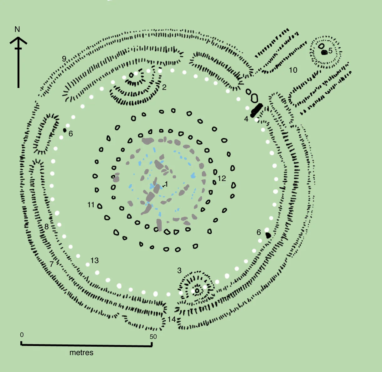
In archaeological language, an avenue is a pair of parallel banks and ditches running between two points. The Stonehenge Avenue runs for nearly three kilometres, from the north-east entrance of the monument down to the River Avon at West Amesbury. It was first noticed in the 18th century by the antiquary William Stukeley. Excavations have dated its construction to the Stonehenge 3 period, between 2600 and 1700 BCE, the same span during which the great sarsen settings were raised. At its terminus by the river, archaeologists in 2009 found Bluestonehenge, a vanished ring of bluestones inside its own small henge. The avenue links the two monuments. It is part of the same listed UNESCO World Heritage Site, Stonehenge, Avebury and Associated Sites, that protects the whole landscape.
The midsummer sunrise
For at least part of its length, the avenue is aligned on the sunrise of the summer solstice. Stand at Stonehenge on the morning of 21 June, look down the avenue past the Heel Stone, and the sun comes up directly along it. Reverse the direction and the same axis catches the midwinter sunset. This alignment is the most famous fact about Stonehenge. Tens of thousands of people gather each solstice to watch it. What is less famous is how unusual it is that an enormous earthwork built five thousand years ago happens to lie on exactly the right line for an event that recurs only twice a year.
The ice age noticed first
Excavations along the avenue have revealed natural features called periglacial stripes, parallel rills cut into the chalk during the last ice age by repeated freezing and thawing of waterlogged ground. The rills happened to run in the direction of the solstitial sun. Mike Parker Pearson of the Stonehenge Riverside Project has argued that this is the key to the whole monument. The Neolithic builders did not pick a site and then engineer it to point at the sun. They found a place where nature already pointed at the sun. They venerated the alignment, built their avenue on top of it, and then anchored the avenue with a stone circle. In his words, Stonehenge sits upon a series of natural landforms that, by chance, form an axis between the directions of midsummer sunrise and midwinter sunset.
Walking the line today
Most of the avenue is now invisible. The banks have eroded down, the ditches have silted in, and only crop marks and excavation trenches reveal where it ran. The most visible stretch is the section just outside the north-east entrance to the stone circle, where you can still see the two parallel banks curving towards the Heel Stone. From the air the route is clearer: it bends, kinks down a dry valley called Stonehenge Bottom, and then runs straight again towards the river. Walking it now, even where there is nothing to see, is to follow a procession that was a thousand years old when the Pyramids were new.
From the Air
Coordinates 51.179 N, 1.825 W. The Stonehenge Avenue runs from the north-east entrance of the stone circle for about 3 km to the River Avon at West Amesbury. From altitude the avenue is visible mainly as low parallel banks crossing open chalk grassland, with a kink down Stonehenge Bottom about halfway. Stonehenge itself anchors the western end; Bluestonehenge marks the river terminus. The A303 cuts across the avenue's middle reach. Nearest airports: Boscombe Down (EGDM) is 5 nm south-east; Old Sarum (EGLS) is 8 nm south; Bournemouth (EGHH) is 30 nm south. Best aerial viewing is in spring crop conditions when archaeological features show as differential colouring in growing grass.
Nearby Stories
- Sherborne Castle 4.4 km away
- Highclere Castle 10 km away
- Camper and Nicholsons 11 km away
- Museum of the Great Western Railway 12 km away
- Wells Cathedral 13 km away
- Severn Bridge 17 km away
- Abingdon-on-Thames 21 km away
- 1958 BOAC Bristol Britannia Crash 26 km away