
Strathfoyle
There is a stretch of woodland behind Strathfoyle that locals call The Quarry, though no stone has ever been cut there. What hides among the trees is concrete: low, half-buried bunkers from a war that ended eighty years ago, when this quiet bend of the River Foyle was one of the most strategically important deep-water ports in the British Atlantic. The houses came later, in waves of post-war optimism in the late 1950s and early 1960s, a planned village built on flat ground between the railway and the river. Today Strathfoyle is a discontiguous outpost of the Derry Urban Area, with a chapel, a library, and a small parade of shops that took the residents decades of lobbying to win.
A Village by Committee
Strathfoyle did not grow the way most Irish villages grew, around a crossroads or a market square or a holy well. It was named by committee. Professor Robert Lyons Marshall of Magee College submitted the name to Londonderry Rural District Council, drawing on the Gaelic word strath, a wide river valley, and the Foyle that flows beside it. The first houses went up in the late 1950s. More followed through the 1970s, 80s, and 90s, the area locals still call The New Estate. The 2001 census counted 1,581 people. By 2008 the estimate had climbed to around 2,011. Newer additions, Old Fort and Butler's Wharf among them, took names that sound borrowed from London but belong, in fact, to local farmers and forgotten landmarks.
Echoes of the Atlantic
During the Second World War, Strathfoyle's quiet location beside Londonderry Port made it briefly central to the longest battle of the war. Allied warships hunting German U-boats used the port as a base for refit and resupply. When the war ended, captured U-boats were towed up the Foyle to Lisahally, just downriver, where many were scuttled. Walk through The Quarry today and you will find the remnants of that effort: collapsed concrete shelters, bramble-choked foundations, the rusting hardware of an emergency that has long since ended. The jetty ruins at Lisahally are still visible from the water. The village, when it came, was built almost on top of this military landscape, residents looking out their kitchen windows at fields where antiaircraft batteries once stood.
Living Beside Industry
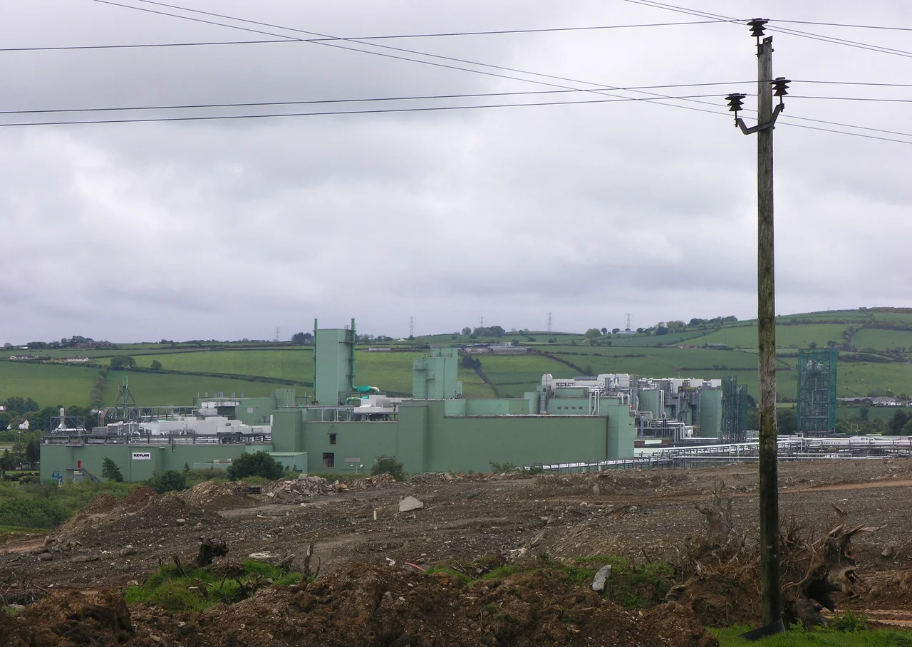
Strathfoyle's economy is bound to its neighbours. Du Pont, Coolkeeragh ESB, and Foyle Meats have all provided employment to Derry workers for decades, and Lisahally Docks, named Irish Port of the Year in 2005, anchors the eastern end of the village. The relationship has not always been easy. The foul smell from Foyle Meats has been the subject of complaints and youth-led protest films. In 2005, more than thirty Polish workers at the plant walked out after being subjected to sectarian abuse, a stark reminder that the religious fault lines of Northern Ireland did not vanish at the Belfast Agreement. A small retail unit was finally built in 2005 after years of community pressure: a supermarket, a pharmacy, a take-away, a beauticians. Small wins, but locally significant.
Sport and the Slow Building of Place
Strathfoyle has produced more than its share of athletes. Lisahally FC takes its name from the nearby port. Top of the Hill Celtic draws players from across the small communities along this stretch of the Foyle. The City of Derry Rugby Club sits on the outskirts, though Strathfoyle itself leans more to soccer and Gaelic football. Enagh GAC, the local Gaelic football team, has since folded, and many of its players moved on to St Mary's Slaughtmanus. St Oliver Plunkett's Primary School, opened in 1975, sends most of its 176 pupils on to Oakgrove Integrated College, one of the early non-denominational schools that grew out of the Troubles. In a village that started as planners' lines on a drawing, identity has had to be built deliberately, generation by generation.
The View from the Foyle
Stand on the riverbank at Enagh Lough, just outside the village, and the geography reveals itself. To the west, the city of Derry rises along its hills, walled and ancient. To the north, the Foyle widens toward Lough Foyle and the open Atlantic. To the east, Northern Ireland's narrow neck stretches toward Donegal across an invisible border that defined two centuries of conflict and is now crossed without ceremony every working day. Strathfoyle sits in the middle of all of this, neither rural nor urban, neither Derry city nor independent village. It is one of those places that exists because someone decided it should, and which has spent the decades since arguing, quietly and persistently, for the right to be more than the sum of its planning documents.
From the Air
Located at 55.03N, 7.27W, on the east bank of the River Foyle about 5 nm northeast of Derry city centre. Nearest airport is City of Derry (EGAE) just 3 nm south at Eglinton. Belfast International (EGAA) lies about 50 nm east-southeast. From cruising altitude, look for the wide silver ribbon of the Foyle estuary north of Derry, with Lisahally's industrial docks marking the village's eastern edge. The Donegal mountains rise west of the river.
Nearby Stories
- Killowen Castle 2.7 km away
- Castledawson 11 km away
- Creeslough Explosion 11 km away
- German submarine U-218 12 km away
- Gortin 15 km away
- SS Devonian (1900) 22 km away
- St Patrick's Purgatory 28 km away
- Port Ellen Distillery 42 km away