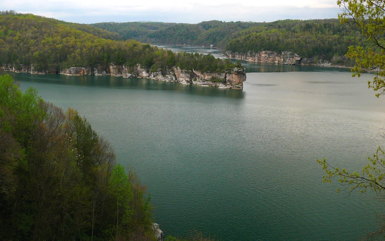

Summersville Lake
President Lyndon Johnson came down for the dedication on September 3, 1966. He cut the ribbon at the new Summersville Post Office and then officially opened the dam: 390 feet of rock-fill earthwork plugging the Gauley River, the second-largest dam of its kind in the eastern United States. Behind it the water was already rising. Within a few months it would back the Gauley up into a reservoir of 2,700 acres - the largest lake in West Virginia. Two small communities, Gad and Sparks, had been bought out and bulldozed to make room. Today the lake holds them at depths of up to 327 feet, while above the water surface, climbers chalk up on sandstone cliffs, scuba divers practice in some of the clearest fresh water in the state, and the only working lighthouse anywhere in West Virginia flashes from the north shore.
Building the Dam
Summersville Dam was authorized by federal flood-control legislation, designed in the late 1950s, and built between 1960 and 1966 by the United States Army Corps of Engineers. The numbers are impressive: 390 feet tall at the spillway, 2,280 feet long at the crest, holding back 12 million cubic yards of dirt and rock. The watershed it controls covers 803 square miles, primarily reducing flood risk on the lower Gauley and the downstream Kanawha. The lake created behind it has 60 miles of shoreline at summer pool and depths to 327 feet at the dam face. Lyndon Johnson dedicated the dam in September 1966. In 2001, a hydroelectric installation was added to the outflow works, producing up to 80 megawatts at peak flow; the plant was originally operated by Enel North America and later acquired by Hull Street Energy in 2020.
Sport Climbing on the Rim
The sandstone cliffs surrounding Summersville Lake have become one of the great American sport-climbing destinations. The rock is Nuttall sandstone - the same formation that defines the New River Gorge - and at Summersville it forms vertical and overhanging faces that climbers have spent four decades developing into hundreds of established routes. The area called Coliseum, with its huge sweeping overhang, is among the most famous sport crags east of the Mississippi. The Long Wall, Pirates Cove, Orange Oswald, and dozens of other cliff faces each offer their own catalogs of climbs. In August 2023, Governor Jim Justice announced that 177 acres of the lake's northern shore would become Summersville Lake State Park, with rock climbing explicitly identified as a primary recreational focus, alongside hiking, biking, water activities, and camping.
Underwater and Above
The lake's clear water - among the clearest in West Virginia, thanks to the bedrock-lined Gauley headwaters - makes it one of the East's better freshwater scuba destinations. Divers come for the visibility, the underwater rock walls, and the deliberately sunk small boat that local dive shops use as an underwater attraction. Snorkelers and free divers explore the shallows. Above water, fishermen pursue smallmouth bass, walleye, and various trout species. The area beyond the WV Route 19 bridge crossing the lake is designated as a no-wake zone for canoes, kayaks, and quiet boating. Cliff jumping has been banned at the lake since 2007 after several drownings. The lighthouse on the cliffs - the only working lighthouse in West Virginia - was built privately in the early 2010s and is operated as a tourist destination.
The Towns Beneath
When the dam closed in 1966, two small communities went under: Gad, on McKee's Creek, and Sparks just downstream. Residents had been bought out, relocated, and given notice. The houses were demolished, but the foundations, roads, and graveyards remained. They are still down there. Each fall, when the Army Corps draws the lake down to winter pool for dam inspection and to prepare for Gauley Season releases, the upper margins of the old townsites emerge - in some years dramatically. Visitors who walk the exposed shoreline find old roadbeds, concrete pads, occasionally an artifact in the mud. The reservoir made the modern recreation economy of Nicholas County possible. It also displaced families whose descendants still live in the area. Summersville Lake holds both things at once, the way every reservoir of its era does.
From the Air
Summersville Lake sits at 38.22 N, 80.89 W, in Nicholas County, West Virginia, impounded behind Summersville Dam on the Gauley River. Recommended viewing altitude is 3,000 to 5,000 feet AGL. The lake's irregular shoreline against sandstone cliffs is distinctive from the air, as is the massive earth-fill dam at the southwest end. WV Route 19 crosses the lake at the bridge. Nearest airport is Summersville Lake Airport (KSXL) just north. Note that during winter drawdown (typically October through April), the lake's actual surface can be significantly below its summer-pool footprint.
Nearby Stories
- New River Gorge National Park and Preserve 4.2 km away
- Greenbrier County, West Virginia 5.5 km away
- End of the World Turn 7.9 km away
- Kanawha State Forest 8.8 km away
- Webster Sycamore 13 km away
- Cranberry Wilderness 16 km away
- Buffalo Creek Flood 21 km away
- Battle of Winfield 29 km away