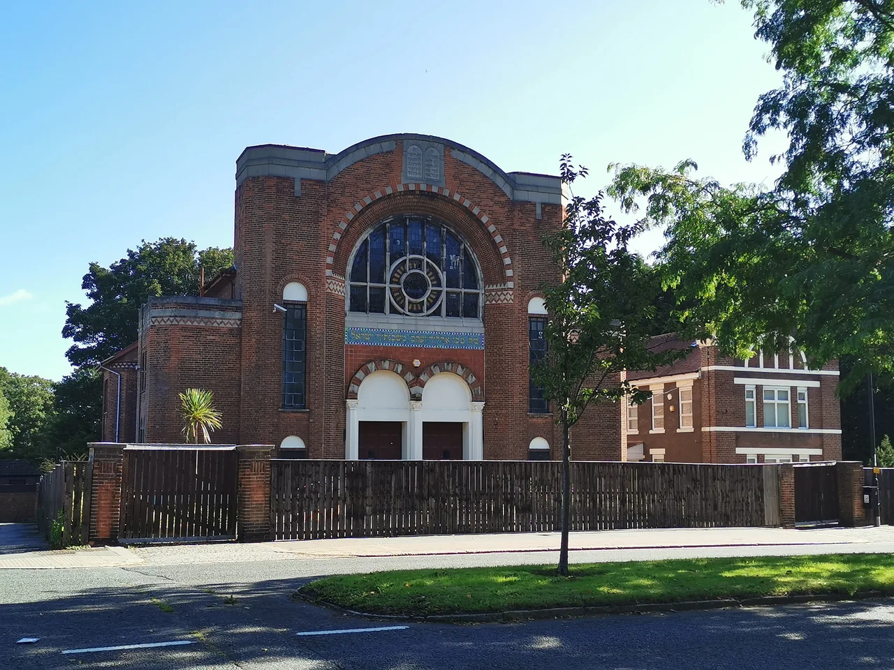

Sunderland Synagogue
Look up from the central aisle inside the synagogue on Ryhope Road, and the architectural historian Sharman Kadish saw a star-spangled sky. The deep barrel vault was painted to imitate one - dark, studded with gold, the kind of dome painted to remind worshippers that the heavens were watching. The Ark canopy below it was plasterwork gilded and decorated with cushion capitals of Islamic origin and chevron shafts of Byzantine inspiration. It is a small marvel hidden behind a Sunderland street wall, and as of May 2021, it sat unoccupied, its future under dispute. The congregation that built it no longer exists.
A Wearside Congregation
The Sunderland Hebrew Congregation formed in 1861, part of the wave of Ashkenazi Jewish settlement that reshaped industrial Britain in the Victorian era. Jewish merchants had been in the town since around 1750, drawn to the shipping trade and the coal-and-glass economy of the Wear. By the mid-19th century there were enough families to form a congregation; by the 20th century there were yeshiva, a school, and several synagogues. The Ryhope Road building, designed by Marcus Glass and opened in 1928, became the community's main place of worship. The earlier Sunderland Beth Hamedresh at the corner of Mowbray Road and The Oaks West closed in 1984, leaving Ryhope Road as the last functioning shul in a city whose Jewish population was slipping away to Gateshead and Israel.
The Last Glass Synagogue
Marcus Glass designed several synagogues across the North East in the early twentieth century. Sunderland is the last of them still standing, which is why it earned Grade II listing in 1999. The building reads from outside as a confident interwar synagogue: classical lines, dignified scale. Inside is where the imagination went. The barrel vault painted as night sky, the gilded Ark canopy, the gallery on three sides supported by slender iron columns with palmette capitals - this was the work of a designer who knew how to give a small congregation a space that felt large in spirit. For the Twentieth Century Society it is a significant building. For the people who prayed there, it was simply where they went.
Ending And Argument
The congregation dissolved in 2006. Sunderland's Jewish population had been declining for decades - 114 people at the 2001 census, 87 by 2021. The Menorah primary school had closed in 1983, the yeshiva moved to Gateshead in 1988. By the new millennium the maths no longer worked for a permanent shul. The congregation sold the building to a Jewish charitable trust in 2000 and leased it back for a peppercorn rent until the final service. Businessman George Fraser bought the building in 2010 with plans for twelve luxury apartments while keeping the exterior. Local councillor Mel Spedding objected that the conversion would be inappropriate and that no planning application had even been received. The building has sat unoccupied through the decade since, its star-painted vault waiting in the dark for someone to decide what comes next.
What Remains
A community is more than its building, but a building is what survives when the community has gone. The Ryhope Road synagogue is a sealed memory of the lives once lived around it - the families that filed in for Shabbat, the bar mitzvah ceremonies under the painted heavens, the slow farewells as children moved south or east. The Twentieth Century Society fights to preserve it. Local heritage bodies catalogue it. It appeared in an Orthodox Jewish film in 2013, and the same year it was the target of swastika graffiti, a heritage row of a different kind. The starry vault is still there. Whether anyone will pray beneath it again is a question Sunderland has not yet answered.
From the Air
Located at 54.90°N, 1.38°W on Ryhope Road, in the southern portion of central Sunderland, North East England. The synagogue is a discrete brick building, hard to pick out from cruising altitude but visible at low level among the Victorian street pattern south of the city centre. Nearest airport: Newcastle (ICAO EGNT), 14 nautical miles north-northwest. The North Sea coast lies 2 miles east. Coastal cloud and haze are common.
Nearby Stories
- Seaton Carew 2.7 km away
- HMS Unity (N66) 6 km away
- George Stephenson's Birthplace 6.1 km away
- Raby Castle 9 km away
- Cragside 15 km away
- Whitby Abbey 21 km away
- German submarine U-2367 46 km away
- Alexander L. Kielland (Platform) 277 km away