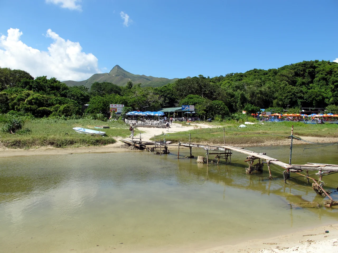

Tai Long Wan, Sai Kung
The name translates as Big Wave Bay, and the ocean here earns it. Tai Long Wan stretches three kilometres along the eastern coast of the Sai Kung Peninsula, a wide open bite out of the land where four beaches — Sai Wan, Ham Tin Wan, Tai Wan, and Tung Wan — face the South China Sea without any natural barrier between them and the Pacific. Three small islands, Tsim Chau, Tai Chau, and Lan Tau Pai, sit near the centre of the bay, looking decorative and doing nothing to calm the swell. Hong Kong is famous for density, noise, and vertical ambition. This bay is famous for none of those things. It is considered one of the most beautiful places in the territory, and the journey required to reach it — no ferry pier, no road, just trail — is part of what makes it so.
Rock Old Enough to Remember Dinosaurs
The cliffs along the southern coastline of Tai Long Wan are not ordinary coastal erosion. They are the product of a volcanic eruption during the Cretaceous Period, when hot ash cooled and contracted into columnar-jointed tuffs — fine-grained volcanic rock split by geometric fractures into tall, regular columns. Those columns now form high, steep cliffs penetrated by sea caves and natural arches, a landscape that has been designated a Site of Special Scientific Interest since 1979 and forms part of the Hong Kong Global Geopark's High Island volcanic rock region. The rock underfoot is roughly 140 million years old. The hikers crossing it on Stage 2 of the MacLehose Trail are a recent addition to the scenery.
Five Centuries of Farming and Fishing
The genealogy of the Li family records settlement at Tai Long Wan between 1465 and 1487. By the time colonial surveyors took an interest, there were four villages here — Tai Long Tsuen, Ham Tin Tsuen, Lam Uk Wai, and Cheung Uk Wai — with about 600 to 700 residents across ten family names including Zhan, Zhang, Li, Dai, Kong, and Lin. Tai Long Tsuen was the largest, and the Antiquities and Monuments Office has confirmed the villages have more than 200 years of documented history, with roughly 90 percent of structures more than a century old. Life was hard and transport was harder. Villagers walked four or five hours to Ngau Chi Wan in Kowloon to sell fish and crops. Some loaded timber onto boats and rowed it to Shau Kei Wan and Aberdeen, trading wood for daily necessities. The ancestor of the Cham clan — Cham Kai-ming, from Xintang in Guangdong province — had settled here during the Qing dynasty, and his descendants became one of the founding surnames of Tai Long Tsuen.
The Missionaries and the Mountain Catholics
Beginning in the 1860s, Catholic missionaries arrived and began addressing what the villages most lacked: medical care. Malaria and smallpox were serious threats, particularly for children. The missionaries offered treatment, food, and practical help, and over six years the community's connection to the Church deepened until most residents had been baptised. By the 1950s, at the population's peak of 600 to 700 people, more than 500 were Catholic, and Tai Long Village's Immaculate Conception Chapel — originally founded in 1867 as the Holy Family Chapel, rebuilt in 1931, renamed in 1954 — had become the largest Catholic church in Sai Kung by number of followers. A Sister House stood near the chapel. Yuk Ying School, the only primary school, stood next to it. When the chapel closed in 1988 as the last villagers moved to the city, the school closed with it. But the arrangement did not entirely end: whenever a Catholic from the village dies, a priest returns to the chapel and celebrates a mass.
Emptied Villages, Living Landscape
The exodus began in the 1960s as industrial Hong Kong offered wages that farming and fishing could not match. Transportation to the city was inconvenient and the villages offered few jobs. One by one, Lam Uk Wai and Cheung Uk Wai were abandoned entirely, swallowed by vegetation. Today fewer than ten people remain in Tai Long Tsuen, and many former villagers have emigrated to Britain. The structures they left behind — pre-war stone buildings, a chapel with no congregation, a school with no students — have become an accidental heritage site. Tai Long Wan has no ferry pier. It probably never will. The MacLehose Trail, Stage 2, is still the primary way in, threading through peaks and bays to deliver walkers to a place that feels genuinely remote despite sitting within 40 kilometres of one of the world's densest cities.
Approaching from the Air
Tai Long Wan sits at approximately 22.41°N, 114.39°E on the eastern face of the Sai Kung Peninsula. From the air at 3,000 feet, the bay's four-beach arc is clearly legible — white sand between dark headlands, with the three central islands visible as small dots near the bay's midpoint. Sharp Peak, at 468 metres, marks the northern boundary of the bay and is the most prominent summit in view. Sai Kung East Country Park covers the surrounding hills, green and largely uninhabited. No major roads penetrate the peninsula's eastern side, which makes the bay's apparent remoteness real. Nearest major airport is VHHH (Hong Kong International), approximately 30 nm to the west.
From the Air
Tai Long Wan, Sai Kung: 22.41°N, 114.39°E. Recommended altitude 2,500–4,000 ft to appreciate the full bay and surrounding volcanic landscape. Sharp Peak (468 m) at the northern rim of the bay is the primary orientation landmark. The columnar volcanic cliffs along the southern coastline are most visible from lower altitudes in clear conditions. Four distinct beaches readable from above: Sai Wan (west), Ham Tin Wan, Tai Wan, Tung Wan (east). Three small central islands — Tsim Chau, Tai Chau, Lan Tau Pai — provide depth reference. Nearest major airport: VHHH (Hong Kong International), ~30 nm west. No instrument approaches to this area; VFR only.
Nearby Stories
- Sha Chau and Lung Kwu Chau Marine Park 5.9 km away
- Wanshan Archipelago 22 km away
- Hong Kong 12 25 km away
- Second Battle of Chuenpi 27 km away
- Mount Guanyin (Dongguan) 43 km away
- Battle of Penghu 474 km away
- Penghu Air Raids 482 km away
- Checheng Fu'an Temple 592 km away