
Taijiang National Park
Once, the sea filled all of this. A great tidal lagoon called Taijiang stretched along what is now the southwestern coast of Taiwan, sheltering the anchored ships of Dutch colonists and Fujianese merchants in the 17th century. Over the following centuries, silt and sediment crept in from the rivers and the lagoon slowly became land — farmland, fish ponds, salt flats, mangrove forest. Today Taijiang National Park exists precisely to protect what remained and what is returning: a living mosaic of wetland, intertidal mudflat, and open water that forms one of the most ecologically important coastlines in East Asia.
A Lagoon Remembered
The park takes its name from a body of water that no longer exists. The Taijiang Lagoon formed a natural harbor along the southwestern coast of Taiwan, and by the 17th century it had become a hub of maritime activity — the Dutch East India Company established Fort Zeelandia on its shores, and Fujianese fishing communities settled around its edge. Then the rivers began doing what rivers do: depositing silt, building delta, slowly displacing the sea. By the late 18th century the lagoon had largely filled in. The land it left behind passed through centuries of agricultural use — rice paddies, aquaculture ponds, salt production — before anyone thought to ask what ecological value those wetlands held. The park established on October 15, 2009 was partly an answer to that question, and partly an acknowledgment that coastal habitats don't protect themselves.
Land, Sea, and Everything Between
Taijiang National Park covers 393.1 square kilometers in total, but the breakdown is revealing: only 49.05 square kilometers is land. The rest — 344.05 square kilometers — is a long coastal marine zone stretching 54 kilometers from the Yanshui River mouth to Dongji Island, extending to the 20-meter depth isobath offshore. That strip of nearshore water is not empty or incidental. It connects to the tidal mudflats and mangrove edges that make the park work as a habitat. The westernmost point of the main island of Taiwan, marked by the Guosheng Port Lighthouse, falls within the park's boundaries. The park runs 20.7 kilometers from north to south — not a vast expanse by national park standards, but its narrow coastal profile holds an outsized ecological punch.
Where the Birds Come
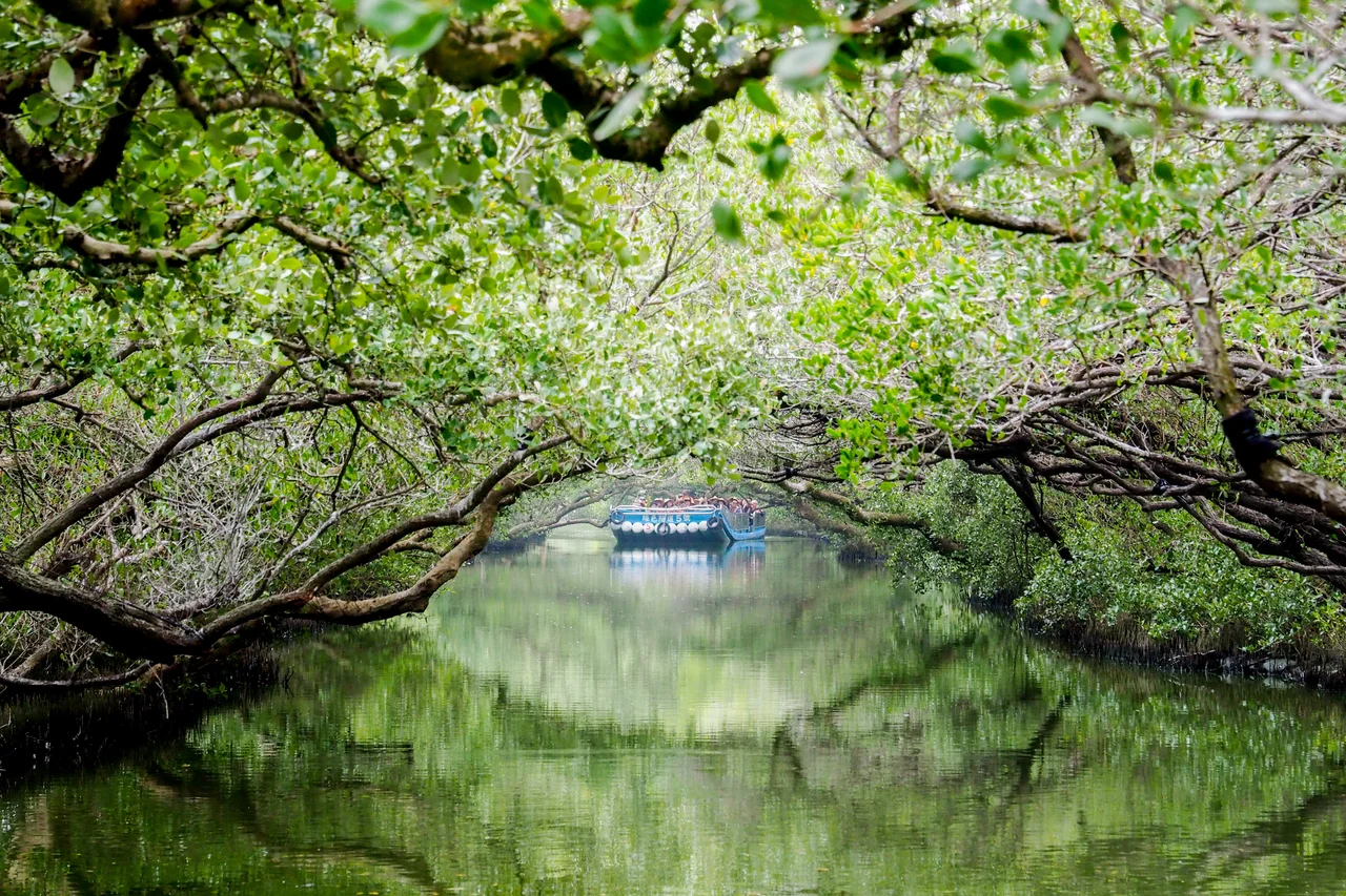
Taijiang sits along the East Asian-Australasian Flyway, one of the world's great migratory corridors, and the wetlands here serve as critical stopover habitat for shorebirds and waterfowl crossing between breeding grounds in the north and wintering areas in the south. The intertidal mudflats offer feeding grounds for species traveling thousands of miles. Mangrove forests line the inner edges of the wetlands, providing nursery habitat for fish and shelter for nesting birds. The fish ponds and tidal channels that remain from earlier aquaculture use have been incorporated rather than erased — managed now to balance human use with wildlife needs. Walking the elevated boardwalks that thread through the mangroves in the early morning, with herons picking their way through shallow channels and egrets dotting the mudflats, is to witness the logic of a landscape that has been many things and is still becoming.
History at the Water's Edge
The coastline here carries centuries of layered human history. The Dutch-era Fort Zeelandia stood near what is now Tainan city, at the edge of the old lagoon. Later, the same wetlands that the Dutch saw as a harbor became the salt-producing flats that supported Tainan's economy for generations. The Cigu salt fields — among the most productive in Taiwan — once spread across what is now part of the national park's buffer area. As salt production declined in the late 20th century, those vast flat expanses became available for ecological restoration. The park's founding in 2009 reflected a broader recognition in Taiwan that coastal ecosystems had been eroded — not just by sediment, but by development — and that recovery required active commitment.
The Return
What makes Taijiang unusual among national parks is that much of it is in the process of being reclaimed by nature rather than simply preserved. Former aquaculture ponds are being converted back to tidal wetlands. Mangrove forests, once cleared for agriculture, are spreading again. Black-faced spoonbills — among the world's rarest large wading birds — winter here in internationally significant numbers, using the shallow lagoons and fish ponds as feeding territory. The park is not pristine wilderness; it never will be. Too much happened here across too many centuries for that kind of fiction. What it is, instead, is a working coast where fishermen still cast nets and conservation managers still move dikes — a place negotiating, season by season, between what was lost and what might be recovered.
From the Air
Taijiang National Park lies at approximately 23.06°N, 120.06°E along the southwestern coast of Taiwan, west of Tainan city. From the air at 2,000-4,000 feet, the coastal wetland mosaic is clearly visible — a patchwork of water, mudflat, mangrove green, and the geometric outlines of former aquaculture ponds. The coastline runs roughly north-south. The nearest international airport is RCNN (Tainan Airport), approximately 8 kilometers to the east. RCKH (Kaohsiung International Airport) lies about 60 kilometers to the south. On a clear day the park's thin coastal strip is visible against the open Taiwan Strait.
Nearby Stories
- Battle of Penghu 1.2 km away
- Xiaolin Village Memorial Park 7.1 km away
- Maolin National Scenic Area 12 km away
- Fenqihu 18 km away
- Republic of China Air Force Academy 23 km away
- Southern Branch of the National Palace Museum 26 km away
- Penghu Air Raids 42 km away
- Daya Bay 512 km away