Coral Over the Sands
The name tells you exactly what you are looking at: taka means coral, bone means sand, and rate means on top. Coral over the sands. It is a precise description of a place that defies easy comprehension from above -- a constellation of reef platforms and turquoise lagoons scattered across 220,000 hectares of the Flores Sea, south of Sulawesi's sprawling arms. Taka Bonerate is the third-largest atoll on the planet, smaller only than Kwajalein in the Marshall Islands and Suvadiva in the Maldives. Yet most of the world has never heard of it. From cruising altitude, the atoll appears as a pale smudge against the deep blue, a place where the ocean floor rises just enough to catch the light. Down below, it harbors one of the richest marine ecosystems in Southeast Asia.
An Architecture of Living Stone
The atoll is not a single ring of coral but a mosaic of separate table reefs enclosing a lagoon studded with massive reef formations. Within this underwater labyrinth, the Indonesian Department of Forestry has cataloged 261 species of coral, 295 species of reef fish, and 244 species of mollusc. Hawksbill turtles glide through the shallows. Olive ridley and green turtles nest on the low sandy islands that barely break the surface. Manta rays cruise the deeper channels between reef platforms, and dolphins arc through the open water beyond the atoll's edge. Indonesia designated the area a national park in 1992, and in 2015 UNESCO added it to the World Network of Biosphere Reserves, recognizing Taka Bonerate as the core zone of a biosphere spanning the entire Selayar Islands Regency. The designation was overdue. Few places on Earth concentrate this much marine biodiversity in a single atoll system.
The People Between Sea and Shore
The Bonerate people are the atoll's original inhabitants, and their relationship with the sea is mediated through an ancient partnership with the Bajau -- the semi-nomadic seafarers sometimes called sea nomads. For centuries, the two peoples have sustained an exchange rooted in ecological necessity: the Bajau, who spend their lives on or in the water, bring fish and sea products to Bonerate's islands. In return, the Bonerate provide freshwater and cultivated crops that cannot be grown on boats or stilted houses over the reef. It is a symbiosis as elegant as anything in the coral below. The Bonerate speak their own Celebic language, closely related to the tongues of neighboring Buton, Wakatobi, and Muna Island in Southeast Sulawesi. They are predominantly Muslim, though traditional beliefs still thread through daily life. Most also speak Indonesian, the lingua franca that connects this remote atoll to the archipelago's broader world.
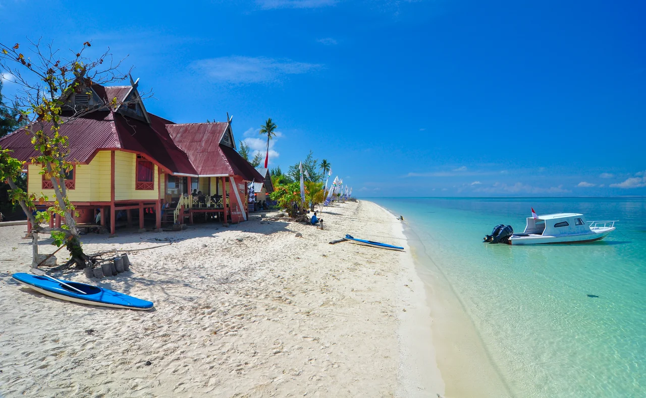
A Distant Paradise
Reaching Taka Bonerate requires commitment. The nearest major city is Makassar, the capital of South Sulawesi, and from there the journey takes roughly sixteen hours by boat -- first to Selayar Island, then onward across open water to the atoll. There is no airport, no resort strip, no easy access. This remoteness is both the park's greatest vulnerability and its strongest protection. The reefs have not suffered the tourist pressures that have degraded more accessible Indonesian marine parks. Divers who make the journey describe walls of coral dropping into blue voids, visibility stretching beyond thirty meters, and the uncanny silence of a reef system that has not learned to fear humans. Administered as part of Selayar Regency in South Sulawesi province, Taka Bonerate sits in a geographic crossroads -- west of the Wakatobi Islands, far north of Komodo across the breadth of the Flores Sea. It is a place defined by what surrounds it: water in every direction, and beneath that water, an entire world built by organisms no larger than a fingernail.
Fragile Geometry
From the air, an atoll looks permanent -- a fixed feature of the ocean floor. But Taka Bonerate is a living structure, built and maintained by billions of coral polyps extracting calcium from seawater and depositing it as limestone. The process is slow, measured in millimeters per year, and it is vulnerable to the same pressures threatening reefs worldwide: warming seas, ocean acidification, and destructive fishing practices. Indonesia's national park designation and UNESCO's biosphere reserve status provide frameworks for protection, but enforcement across 220,000 hectares of open ocean is a different matter entirely. The Bonerate and Bajau communities, whose livelihoods depend on healthy reefs, remain the atoll's most effective stewards. They have sustained this place for centuries through practices that took what was needed and left the rest. Whether that ancient balance can hold against modern pressures is the question Taka Bonerate poses to everyone who flies over it, dives beneath its surface, or simply learns that it exists.
From the Air
Located at 6.68S, 121.15E in the Flores Sea, south of Sulawesi. The atoll is visible from cruising altitude as a pale turquoise smudge against deep ocean blue. Nearest major airport is Sultan Hasanuddin International Airport (WAAA) in Makassar, approximately 400 km to the northwest. The atoll sits between Selayar Island to the west and the Wakatobi Islands to the east, with Komodo far to the south across the Flores Sea. Best visibility in dry season (April-October).
Nearby Stories
- The Bluff That Worked and the Storm That Didn't Care 18 km away
- Four Sails in the Selayar Strait 104 km away
- Rokatenda: The Volcano That Is the Island 143 km away
- The Ferry That Tipped When Everyone Reached for a Signal 149 km away
- The Bird Letters of Sulawesi 150 km away
- The Village That Said No to the Modern World 155 km away
- Wae Rebo: Seven Houses Above the Clouds 164 km away
- The Fortress That Swallowed a Hilltop 179 km away