
Tap Mun
The cattle do not move for you. They stand on the grassy hillocks and watch as the ferry from Wong Shek Pier rounds the headland and ties up at the small pier, and they continue watching as visitors disembark, uncertain how to proceed around animals that clearly have never been told to make way for pedestrians. This is Tap Mun — also called Grass Island, 塔門 in Chinese — and the feral cattle are the island's most immediate statement of character. At 1.69 square kilometres, positioned at the mouth of Tolo Harbour where it opens into Mirs Bay, the island sits close to mainland China in geography and far from urban Hong Kong in atmosphere. A population of roughly 100 people, descended from Hakka and Tanka communities, shares the island with the cattle, a handful of seafood restaurants, a 400-year-old temple, and a view of the Dapeng Peninsula that appears on clear days like a promise of something beyond.
The Temple and the Legend
The Tin Hau Temple on Tap Mun has been classified as a Grade II historic building and dates to 1737, making it nearly 300 years old. Tin Hau is the goddess of the sea — patron deity of fisherfolk throughout coastal South China — and her temple here reflects the island's entire historical purpose: this was a community of people whose lives and livelihoods depended entirely on the water. Local legend holds that the temple's altar is connected by a hidden tunnel to Tap Mun Cave on the far shore of the island, a geographical claim that has never been verified and may not need to be. The temple functions as the island's spiritual and communal centre, its incense and red lanterns a persistent signal that the fishing culture it was built to serve has not entirely disappeared. Steps beside the temple climb to a hillside sitting-out area with panoramic views across Mirs Bay — one of the better viewpoints in the eastern New Territories for those willing to make the climb.
When Five Thousand People Lived Here
At its peak, Tap Mun supported a community of around 5,000 fisherfolk, a figure that is difficult to reconcile with the island's size until you understand what kind of economy it once anchored. The surrounding waters of Mirs Bay and Tolo Channel were productive fishing grounds, and the island's position gave it natural shelter and access to both. Two distinct communities — land-based Hakka villagers and the Tanka boat people who traditionally lived on the water — both found reasons to settle or anchor here. The Tanka, historically marginalised by land-owning communities, built their lives around the harbour and its floating world of junks and sampans. The population has since declined to around 100, most of the fishing economy drawn away by industrialisation and the larger catches available from distant-water fleets. What remains is the village street, the harbour, the skiffs, and a few seafood restaurants that exist partly for day-trippers who arrive on the Tsui Wah Ferry and partly because the remaining residents still eat.
The Cattle and the Coast
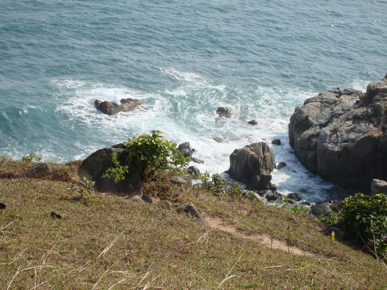
The feral cattle on Tap Mun are not a quirk — they are a defining feature. Herds roam across the open, grassy upland of the island's southern portion, largely indifferent to human presence, moving at their own pace between grazing areas and the cliff edges where the wind is cooler. How exactly they came to live wild on Tap Mun is unclear, but their presence gives the island a quality that is hard to find elsewhere in Hong Kong: a genuinely unmanaged landscape shared between humans and large animals on roughly equal terms. The island can be circumnavigated on foot in approximately two hours along a trail that passes through the village, climbs past the Tin Hau Temple viewpoint, and continues around the rocky coastline. Balance Rock, a distinctive geological formation, is one of the landmarks along the southern circuit. The rocky shoreline and clear waters of the surrounding bay are noted for their calm — suitable conditions for the small fishing vessels that still work out of the harbour.
Getting There, Getting the Point
Tap Mun is reached by the Tsui Wah Ferry Service from two departure points: Wong Shek Pier in Sai Kung, with departures roughly every two hours and higher frequency on weekends and public holidays; and Ma Liu Shui Pier near the Chinese University of Hong Kong campus in Tai Po, twice daily with an extra sailing on weekends. The journey itself is part of the experience. The route from Wong Shek threads through the islands of the Sai Kung Hoi, past rocky outcrops and fish rafts, before emerging into the wider waters of the channel. There is no bridge to Tap Mun and no plan for one. The ferry schedule sets the rhythm of the day, and most visitors structure their visit around the return crossing. The seafood restaurants near the pier do their best business in the two hours before the last boat back.
Out Over the Bay
From the air, Tap Mun reads clearly as an island apart — a green wedge at the northern end of the Sai Kung island chain, surrounded by water on all sides, with the mouth of Tolo Harbour visible to its west and the open expanse of Mirs Bay to the north and east. The grassy upland that gives it the English name Grass Island is visible even from altitude. On clear days the Dapeng Peninsula of mainland China is distinct to the north, providing geographic scale to the relatively small territory of Hong Kong's own waters. The island's coordinates place it at approximately 22.48°N, 114.36°E. Nearest major airport is VHHH (Hong Kong International), approximately 35 nautical miles to the southwest.
From the Air
Tap Mun (Grass Island): 22.476°N, 114.363°E. Viewing altitude 1,500–2,500 ft. The island's grassy upland is distinctive from the air; the small harbour and village are on the southwestern shore. Tolo Harbour entrance visible to the west; Mirs Bay opens to the north. On clear days the Dapeng Peninsula (mainland China) is visible ~15 nm to the north. Nearest major airport: VHHH (Hong Kong International), ~35 nm SW. The waters around Tap Mun are within Hong Kong airspace but near the boundary with Shenzhen FIR — monitor frequencies appropriately. No instrument approaches in this area; VFR operations only.
Nearby Stories
- Sha Chau and Lung Kwu Chau Marine Park 5.9 km away
- Wanshan Archipelago 22 km away
- Hong Kong 12 25 km away
- Second Battle of Chuenpi 27 km away
- Mount Guanyin (Dongguan) 43 km away
- Battle of Penghu 474 km away
- Penghu Air Raids 482 km away
- Checheng Fu'an Temple 592 km away