
Thetford Castle
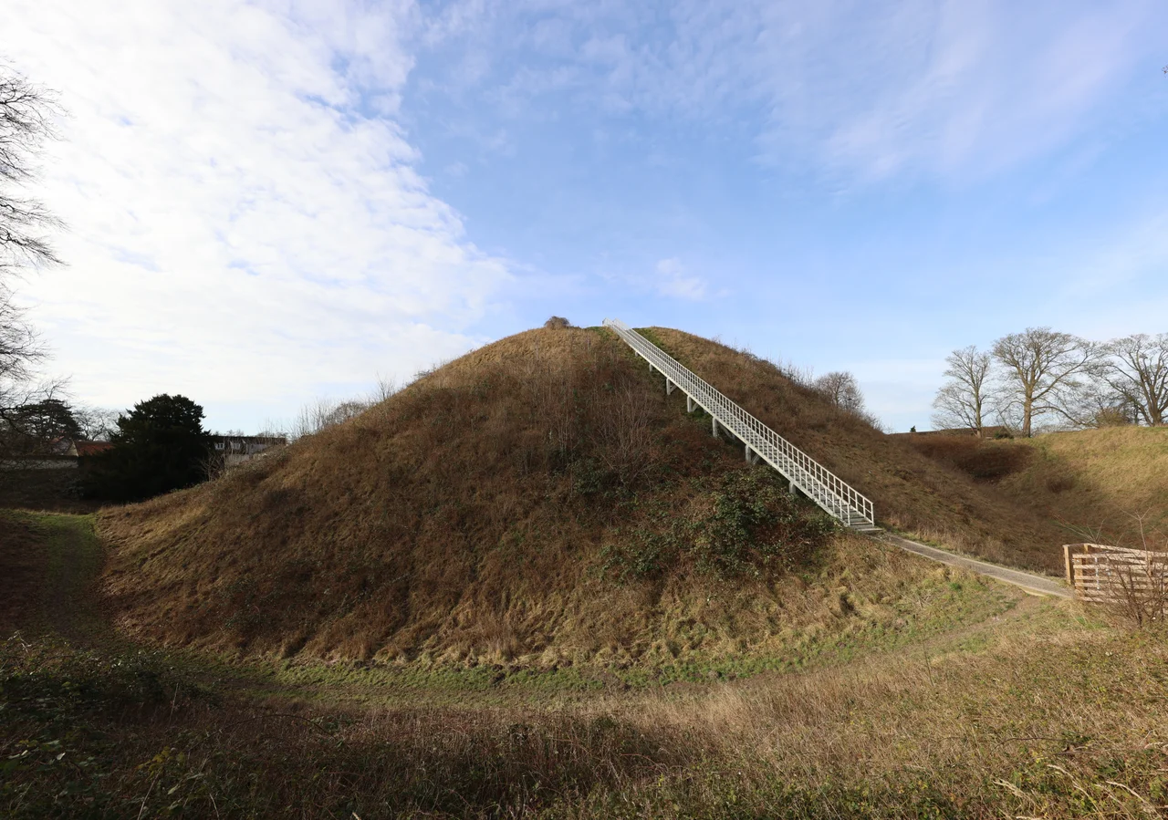
The mound at the heart of Thetford doesn't announce itself gradually. It simply rises — 19.6 metres of packed chalk, a hundred metres wide at the base — from the flat Breckland landscape like a fist thrust up from the earth. Local medieval legend said the devil built it, having already finished the dykes at Narborough and Newmarket, apparently with energy to spare. The truth is nearly as strange: 24,000 man-days of labour, dug and hauled by hand without pickaxes, built by the Bigod family to declare their grip on one of the most important towns in 12th-century England. They succeeded spectacularly, and then they lost it all.
Before the Normans
Thetford's name derives from 'Thaetford' — the ford — a crossing point on the ancient Icknield Way where the River Thet and the Little Ouse converged. By the 11th century this was no minor settlement. It was the second-largest town in East Anglia, a hub of international trade and pottery production, protected by a Saxon burgh: a ditched enclosure that ringed the town. An Iron Age earthwork occupied the same hill where the castle would eventually rise, already ancient and already partly decayed.
When William de Warenne arrived after the Norman conquest, he built the first castle on this site — a ringwork called Red Castle — positioning it directly across the line of the old Saxon ditch. The construction cut off a local church from the town and built over part of the cemetery, which is one way to announce that a new order has arrived. But Red Castle was only the beginning.
The Bigod Ambition
By 1100, Thetford belonged to Roger Bigod, Earl of Norfolk. He was not content with Red Castle. Bigod commissioned an entirely new fortification on the opposite side of town: a motte-and-bailey castle of staggering scale. At the centre was the mound — built up from chalk quarried, by local tradition, from the Gallows Pits nearby — sunk into a deep surrounding ditch and flanked on the north by two sets of ancient ramparts, repurposed from the Iron Age. A timber keep almost certainly crowned the summit. A rectangular bailey, roughly 105 metres long, stretched away from the mound.
The Bigods used this fortification as one anchor of their power, alongside their castles at Framlingham, Bungay, and Walton. Roger's son Hugh played a central role in the civil war known as the Anarchy, rebelling against King Stephen from these East Anglian strongholds. Walls — possibly stone ones — went up. A stone keep may have followed. For decades the family treated the region almost as their personal kingdom.
Henry's Reckoning
The Bigod grip did not survive Henry II. When he took the throne in 1154, he made it his business to recover royal authority over the barons who had accumulated too much during the Anarchy. In 1157, Henry seized the Bigod castles. He eventually returned Framlingham and Bungay, but kept Thetford. Then in 1173, with the castle implicated in a wider rebellion, he ordered it slighted — reduced to uselessness.
The walls could be knocked down. The mound could not. It proved, in the words of historians who studied it centuries later, effectively indestructible. Henry could dismantle everything built on top of the chalk, but the chalk itself simply sat there, massive and mute, outlasting every scheme imposed upon it. By 1558, the Castle Yard still had stone walls standing around it. In 1823, elm trees were planted near the summit. The devil's work endures.
Legend, Archaeology, and the Park
For centuries, people forgot what the mound actually was. Medieval tradition said the devil made it. Later, Victorians debated whether it was Celtic or Norman — a question that seems obvious now but was genuinely uncertain then. Other traditions insisted the mound concealed a palace full of treasure, or six silver bells from nearby Thetford Priory, buried safe from some forgotten catastrophe.
Archaeologists eventually sorted it out. Excavations by G. Knocker between 1957 and 1958, and by R. R. Clarke and Barbara Green in the early 1960s, revealed the true design and dating of Red Castle. The great mound's Norman origins were confirmed. Today the motte is a scheduled monument, owned by the local authority, and forms the centrepiece of Castle Park. The bailey is now called Military Parade. Children climb the chalk slopes for the view; the names of the builders have mostly faded. The hill, which cost 24,000 days of human effort to raise, remains.
From the Air
Thetford Castle sits at 52.4113°N, 0.7538°E in the Breckland of Norfolk, roughly 30 miles southwest of Norwich. The motte is best seen from low altitude — it rises unmistakably from the flat surrounding terrain. Norwich Airport (EGSH) is the nearest significant airfield, approximately 28 miles to the northeast. Flying over at 1,500 to 2,000 feet in clear conditions, the distinctive circular outline of the mound and its surrounding ditch is visible from the air, flanked by the River Thet to the south.
Nearby Stories
- Ding Family Murders 1.5 km away
- Bungay Castle 2.6 km away
- Ely and Littleport Riots of 1816 4 km away
- Aldeburgh Festival 7.9 km away
- Bed Burial 12 km away
- Happisburgh Lighthouse 13 km away
- Walsingham Priory 18 km away
- Chain Bridge Forge, Spalding 34 km away