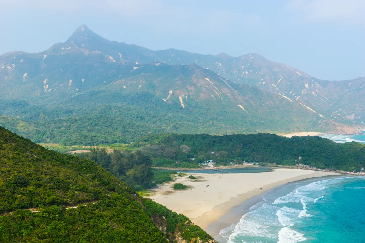

Three Sharp Peaks of Hong Kong
Hong Kong is not supposed to be a hiking destination. The city fills every mental image — towers, harbour, neon, density — leaving little room for the idea that within its borders there are ridges steep enough to seriously test experienced walkers. The Three Sharp Peaks correct that assumption. Castle Peak at 583 metres in Tuen Mun, Sharp Peak at 468 metres in Sai Kung, and High Junk Peak at 344 metres above Clear Water Bay: none of these would qualify as mountains anywhere with real altitude, but altitude is not the point. The point is the combination of loose rock, steep inclination, and in some cases genuine remoteness. Hong Kong hikers treat them as a collective challenge, a three-part test that separates the casual trail walkers from those who can handle terrain where the path effectively disappears.
Three Peaks, Three Different Problems
Castle Peak is the tallest of the three at 583 metres, rising above Tuen Mun in the western New Territories. Its height means the views are extensive — on a clear day the PRD stretches out to the north — but the summit itself is accessible via multiple routes and is generally considered the most straightforward of the trio. High Junk Peak, at 344 metres, is the lowest and the closest to urban infrastructure, perched above Clear Water Bay Peninsula near Tseung Kwan O. It offers a classic rocky summit scramble with strong sea views, but the approach is relatively short. Sharp Peak is neither the tallest nor the lowest, but at 468 metres it is widely regarded as the hardest. Its reputation rests on two factors: the trail leading up its final approaches is genuinely steep and loose, and the mountain sits in the middle of Sai Kung East Country Park, a long walk from any road. By the time you are on the sharp upper ridge, you have already committed a considerable amount of the day.
Sharp Peak: The One That Earns Its Name
Sharp Peak (蚺蛇尖 in Chinese, a name that translates roughly as Sharp Snake Peak) rises at the northern end of Tai Long Wan bay, its narrow summit pyramid visible from the beaches below and from boats in the South China Sea. The mountain is a local milestone — hikers describe completing it with the seriousness that alpinists reserve for more famous summits. The Chinese hiking press has called it a 考牌 (driving-test) route, meaning a benchmark hike that certifies competence. The final ascent involves scrambling on loose volcanic rock at angles that require hands. There is no cable, no fixed rope, no infrastructure. What makes it achievable rather than merely dangerous is the quality of the surrounding landscape: the approach through the Sai Kung East Country Park offers some of the finest coastal walking in Hong Kong, and the summit view — Tai Long Wan's four beaches below, the South China Sea beyond, the Sai Kung islands scattered north — is proportionate to the effort.
The Sai Kung Variant
Within the broader concept of the Three Sharp Peaks, Hong Kong hikers have developed a regional variant: the Three Sharp Peaks of Sai Kung District. This list swaps Castle Peak (which is in Tuen Mun, not Sai Kung) for Tai Yue Ngam Teng, a more remote 233-metre peak in the northeast of the district. The Sai Kung trio — Sharp Peak, High Junk Peak, and Tai Yue Ngam Teng — can theoretically be combined into a single ambitious day by those with experience and early starts, though the distances involved mean most people spread the peaks across multiple visits. Tai Yue Ngam Teng rarely appears on visitor maps and requires navigational confidence to locate. Its inclusion in the local list reflects how seriously Sai Kung's hiking community takes the concept of difficulty-through-remoteness rather than difficulty-through-altitude.
The Appeal of Things That Are Hard
Hong Kong's trails are well-used. The MacLehose Trail, the Wilson Trail, the Dragon's Back — these routes carry enough hikers on weekends that solitude is rarely available. The Three Sharp Peaks resist mass tourism precisely because they require more than a comfortable pair of trainers and a good phone signal. Castle Peak's most direct routes involve sustained climbing. Sharp Peak's loose upper section will turn back anyone who is not comfortable with unroped scrambling. High Junk Peak's rocky summit requires at least some scrambling confidence. The rewards scale accordingly: these are the peaks people come back from talking about, photographs in hand, already planning the next one. In a city where the extraordinary has been industrialised, a mountain that still asks something in return has particular value.
From the Cockpit
The Three Sharp Peaks span a wide area of the New Territories and eastern Hong Kong. A general overview position of approximately 22.43°N, 114.38°E captures the Sai Kung peaks, with Sharp Peak's pyramidal summit identifiable from altitude above the Tai Long Wan area. Castle Peak is visible to the northwest near Tuen Mun, and High Junk Peak to the south above Clear Water Bay. At 3,000 to 5,000 feet, the geographic spread of the peaks illustrates how much mountainous terrain Hong Kong contains beyond its urban core. Nearest major airport is VHHH (Hong Kong International), approximately 25 nm to the west. The terrain around Sharp Peak rises abruptly from sea level — maintain adequate separation when flying the Sai Kung East coastline in reduced visibility.
From the Air
Three Sharp Peaks of Hong Kong. Reference coordinates for Sharp Peak (the most prominent): 22.43°N, 114.38°E. Castle Peak (583 m) visible ~40 nm northwest near Tuen Mun; High Junk Peak (344 m) visible south above Clear Water Bay. Sharp Peak's narrow summit pyramid is identifiable from the air above Tai Long Wan. Recommended altitude for a Sai Kung overview: 4,000–6,000 ft. Nearest major airport: VHHH (Hong Kong International), ~25 nm west. Terrain rises sharply from sea level throughout the Sai Kung Peninsula — watch for terrain clearance on the eastern approaches to Hong Kong's TMA.
Nearby Stories
- Sha Chau and Lung Kwu Chau Marine Park 5.9 km away
- Wanshan Archipelago 22 km away
- Hong Kong 12 25 km away
- Second Battle of Chuenpi 27 km away
- Mount Guanyin (Dongguan) 43 km away
- Battle of Penghu 474 km away
- Penghu Air Raids 482 km away
- Checheng Fu'an Temple 592 km away