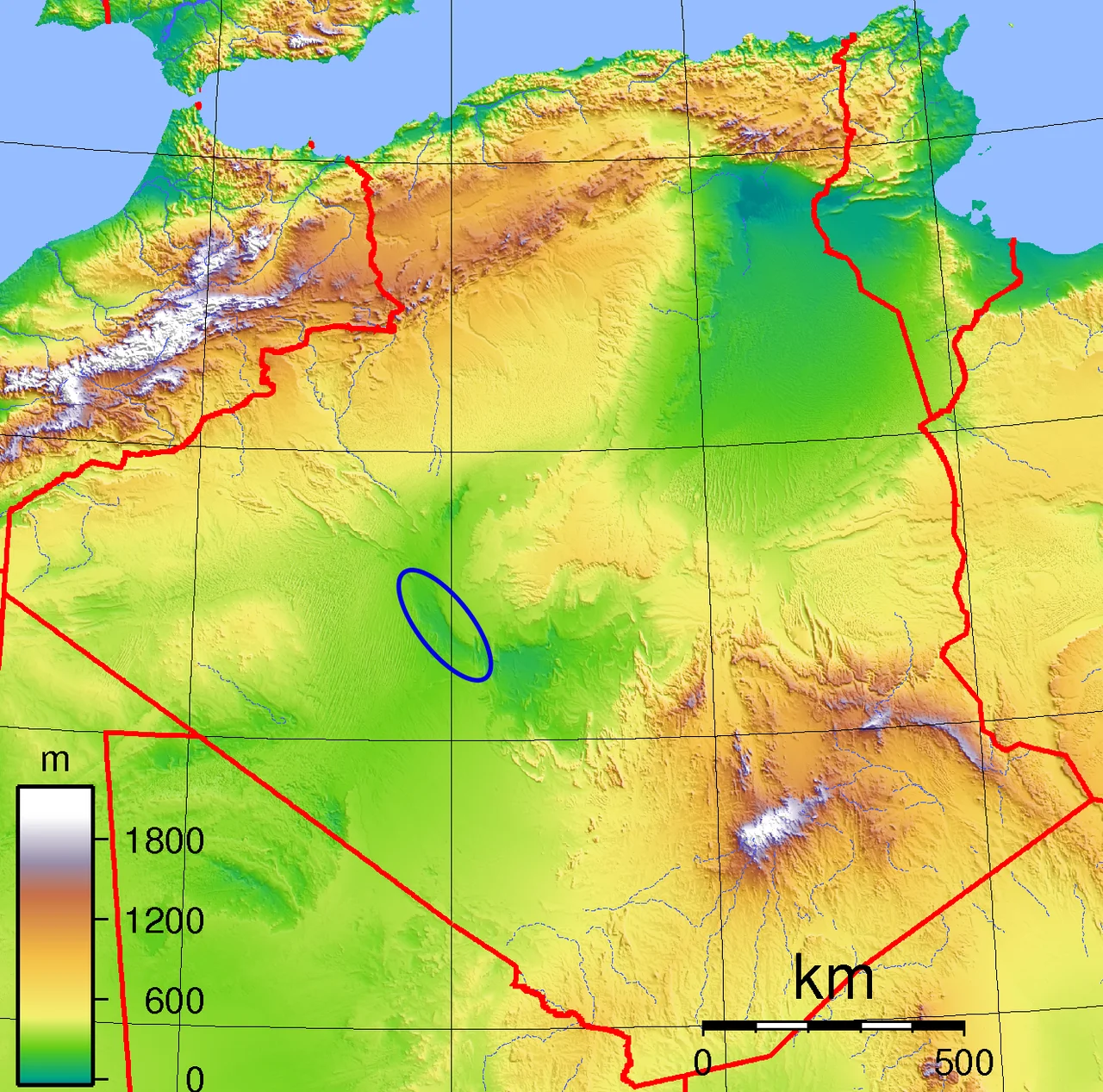

Touat
There is almost no rain here, yet there are nearly a million date palms. That contradiction is the whole story of Touat. Strung along a dry riverbed in central Algeria, this string of oases turns one of the planet's most pitiless deserts into a thread of green, and it does so with a feat of engineering older than most of recorded history: the foggara, a tunnel that walks water out of the ground and downhill to the gardens by gravity alone. For a thousand years the trick worked, and Touat became a place where caravans rested, scholars argued, and fortunes in gold and dates changed hands.
Water from the Dark
Touat sits at the southwestern edge of a vast underground reservoir, the Continental Intercalaire, a layer of porous sandstone holding water beneath the Sahara. The foggara taps it ingeniously. Diggers cut a tunnel on a gentle upward slope from the low ground near the wadi into the water-bearing rock under higher land, then let gravity do the rest, the water trickling out into the palm groves day and night without a single pump. Vertical shafts pock the desert surface above each tunnel, dug for air and access. In 1963 the region counted 531 foggaras, though only 358 still ran. They are exhausting to build and to keep, and as they collapse they are often abandoned for electric wells, a quiet erosion of a craft that watered this desert for centuries.
The Ribbon of Palms
From the district of Bouda in the north to Reggane in the south, the oases run for 160 kilometers along the eastern edge of the Wadi Messaoud. Between 700,000 and 800,000 date palms grow here across some 4,500 hectares, their fronds shading smaller crops below. Scattered among them are the ksour, the singular ksar, fortified mud-walled villages the color of the sand they rise from, and the kasbahs, the old forts, most now standing empty. The largest town, Adrar, is a relative newcomer, laid out by the French after their conquest in 1900. The rest is far older, built up palm by palm and tunnel by tunnel over many lifetimes.
Crossroads of the Sahara
Touat owed its wealth to its position at the northern end of the Tanezrouft route, the desert road to the Sahel. Reggane lies roughly 1,150 kilometers from Gao and a similar distance from Timbuktu, and caravans coming up from the south rested in these oases before pushing on to Sijilmasa or Tlemcen. In 1353 the great traveler Ibn Battuta crossed the desert and stopped at Bouda, arriving with a caravan that, by his own account, included 600 enslaved girls. That detail is no aside. Touat was a key waystation on the trans-Saharan slave trade, and the gold and dates that made it rich moved alongside human beings carried north against their will, their suffering woven into the prosperity the merchants celebrated.
The Jews of Tamentit
For centuries Touat was also home to a thriving Jewish community, traders and craftsmen whose presence here is recorded as early as a Hebrew tombstone from 1329. A 15th-century visitor, the Italian Antonio Malfante, wrote from Tamentit that its Jews lived well, protected by local rulers, with trade largely in their hands and their word trusted with the greatest confidence. That security did not last. Around 1492, the jurist Muhammad al-Maghili preached against them and incited a mob that destroyed the synagogue at Tamentit and turned on its Jewish residents, killing many and driving the survivors out. Some fled south along the caravan roads toward the Niger. A community that had helped build Touat's wealth was erased from it in a season of violence.
Coveted Ground
Touat's gardens made it a prize, and empires reached for it again and again. The Fatimids took it in the 10th century, the Moroccan Saadis seized it in the 1580s, and Alawite sultans claimed it in the 17th, ruling through governors until central authority frayed and the oases drifted into the bled es-siba, the land outside the sultan's effective control. Then came the French, who folded Touat into their Territoire des oasis sahariennes after hard fighting; at El Moungar in 1903, a nomad ambush left 38 French soldiers dead. Today the desert beneath the palms yields a different treasure. Natural gas is pumped from the rock around Adrar, and the old water tunnels share the landscape with refineries and pipelines, the ancient and the industrial drawing on the same buried ground.
From the Air
Touat stretches roughly from 27.3°N, 0.2°W near Bouda and Adrar south toward Reggane in Adrar Province, southwest Algeria. The regional airport is Adrar (Touat-Cheikh Sidi Mohamed Belkebir, ICAO DAUA), set among the oases themselves. From altitude the chain reads unmistakably: a narrow green-and-tan ribbon of palm groves and mud-walled ksour threading along the wadi, with the dunes of the Grand Erg Occidental to the north and the bare Tademait plateau to the northeast. Skies are typically cloudless with very long visibility, though seasonal dust storms can erase the ground entirely.
Nearby Stories
- Kassbet Lahrar 14 km away
- Reggane 53 km away
- Erg Chech 335 km away
- Erg Iguidi 568 km away
- Béryl Incident 577 km away
- Tin Hinan Tomb 672 km away
- Sahara International Film Festival 728 km away
- Siege of Laghouat 731 km away