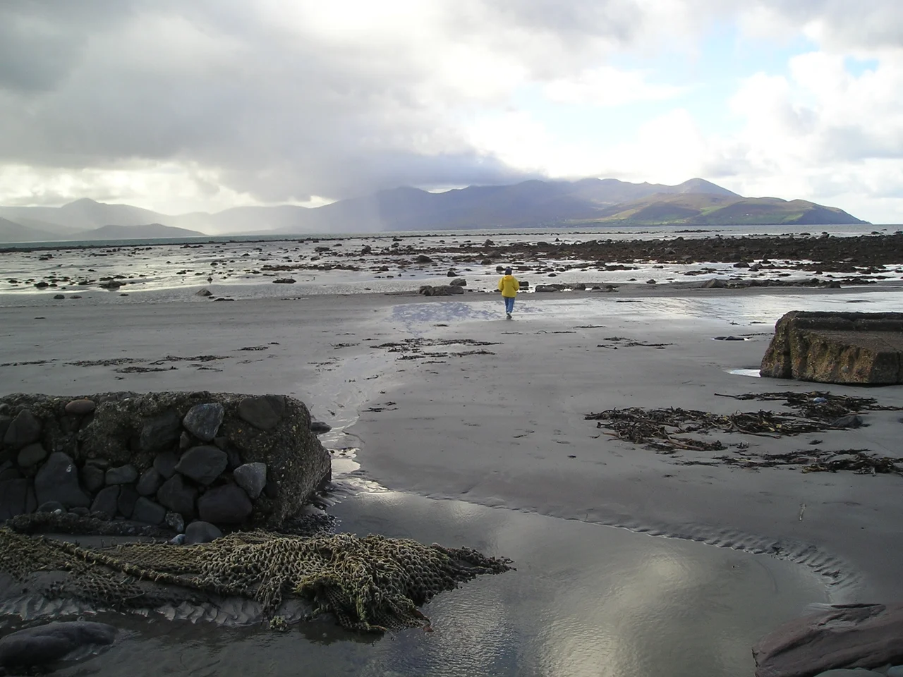

Tralee Bay
On Easter Sunday morning in 1916, three days before the Dublin Rising began, a German freighter called the Aud sat off Banna Strand on the north side of Tralee Bay with twenty thousand rifles in her hold. The rifles were for the Irish Volunteers. The Royal Navy intercepted her. Her captain scuttled the ship rather than surrender the cargo. The same week, the Irish republican Roger Casement was put ashore from a German U-boat on the same beach and was arrested within hours. He was tried for treason in London and hanged in August. The rising went ahead, much weakened, without the rifles. Tralee Bay - this wide sheltered sweep of water that looks so peaceful from any of the surrounding hills - has been the entry and exit point for many of the most consequential moments in Irish history. Saint Brendan left from here. Famine emigrants left from here. Modern container ships still come and go.
The Shape of the Bay
Tralee Bay sits between Kerry Head on its northern shore and the Maharees peninsula on the west. It extends inland to the bridge at Blennerville, where the River Lee enters from the Slieve Mish mountains behind the town of Tralee. The bay is broad - perhaps fifteen kilometres across its mouth, eighteen kilometres deep - and relatively shallow over most of its area. Several small rivers feed in: the Lee, the Trench, and others draining the Slieve Mish and the Dingle hills. Brandon Bay sits to the southwest behind the shelter of the Maharees. The Shannon estuary opens to the north past Kerry Head. The bay is a Ramsar wetland of international importance, designated for the rich tidal habitat it sustains.
Lighthouses and Islands
Two small rocks in the bay bear the name Samphire, after the rare golden samphire plant that grows on them. Great Samphire Island, just offshore from the village of Fenit, is now the foundation of the modern Fenit Harbour, with the working port and marina built up around it. At the apex of Great Samphire stands a monument to Saint Brendan the Navigator, looking out toward the Atlantic he is said to have crossed in a leather curragh. Little Samphire, further out in the bay, is a low rocky islet topped by an Irish Lights lighthouse - still operated and maintained by the Commissioners of Irish Lights, marking the harbour limit and warning shipping off the underlying rocks. Fenit Island itself, joined to the mainland by a tidal sandbar, sits in the western part of the bay.
Saints and Emigrants
The bay's connection to Saint Brendan is foundational. Brendan was born on Fenit Island around the year 484, sailed to monasteries across the western islands and possibly across the Atlantic to the New World, and is honoured today by the statue at Great Samphire and by the great cathedral at Ardfert, just inland from the north shore. A different kind of departure marked the bay's nineteenth century: Blennerville at the eastern end was a major embarkation port during the Great Famine, with thousands of emigrants leaving for North America between 1845 and 1855. The Jeanie Johnston - a sailing barque originally built in Quebec in 1847, used to carry famine emigrants from Tralee to Baltimore and New York - never lost a passenger on any of her sixteen Atlantic crossings, an unusual record in the famine fleet. A full-size replica of the Jeanie Johnston was launched in 2002 and now sits at a quay in Dublin as a floating museum.
Wrecks Along the Coast
The bay's history is also written in wrecks. The barque Saint Lawrence went ashore in Ballyheigue Bay on the north side in February 1840. The Dingle hooker Brothers, carrying potatoes for the Protestant colony at Dingle, was lost in May 1841. The Integrity, en route from Tarbert to the Clyde, was lost off Brandon Head in March 1837. The Port Yarrock sank in adjacent Brandon Bay in January 1894, having come all the way from Santa Rosalia in Baja California - all twenty-two of her crew drowned. The trawler Audrey Anne was lost off Brandon Head in December 1998 - the more recent reminder that the sea here is still dangerous. Each wreck is a story. The Irish Wrecks Online catalogue lists scores more along this coast.
Working Bay, Living Bay
Today Tralee Bay is many things at once. The container terminal at Fenit ships Liebherr cranes, manufactured in nearby Killarney, out to the world. Oyster beds on the bay's south side, around Spa and Derrymore Island, produce a small but renowned harvest. A bird sanctuary on Derrymore Island protects breeding waders and wintering wildfowl. Tralee Bay Sailing Club, the marina at Fenit, and Tralee Bay Sea Angling Club - the largest sea angling club in Ireland - all share the same water. Walkers stroll the Blennerville canal towpath toward the windmill that still grinds occasional grain. The Slieve Mish range stands behind everything. The bay holds the past and the present together in the same wide circle of water.
From the Air
Located at 52.28 degrees N, 9.93 degrees W on the west coast of County Kerry between Kerry Head and the Maharees. Recommended viewing altitude 3,000 to 6,000 feet AGL to see the full sweep of the bay - Fenit Harbour and the two Samphire islands in the centre, Banna Strand on the north shore, Blennerville and the river outflows at the east, and the Maharees peninsula on the west. Nearest airport is Kerry (EIKY), about ten kilometres east-southeast near Farranfore. The bay is shallow and tidal - sandbanks emerge at low water. Atlantic weather rolls in from the west; expect strong winds and reduced visibility in winter.
Nearby Stories
- Castleisland 7.4 km away
- Kilrush 9.1 km away
- Ring of Kerry 12 km away
- Kilgarvan 15 km away
- Inishtooskert 18 km away
- SM U-68 27 km away
- Kilkee 29 km away
- RMS Carinthia (1925) 74 km away