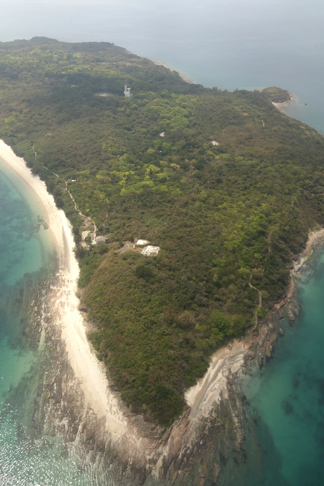

Tung Ping Chau
Hong Kong is built on volcanoes. Almost every island in the territory — the towering ridges of Lantau, the dramatic coastlines of Sai Kung — consists of igneous rock pushed up from ancient eruptions during the Jurassic Period. Tung Ping Chau is the exception. Out here in the far northeastern corner of Mirs Bay, where Hong Kong territory comes within 4 kilometres of the Chinese mainland, the rock underfoot is sedimentary: pale siltstones and cherts laid down in a brackish lake after the volcanoes went quiet, during the early Paleogene period. Nowhere else in Hong Kong does the earth look quite like this.
The Flat Island at the Edge of Everything
Ping Chau means 'flat island' in Chinese, and the name is accurate. Where other Hong Kong islands surge upward in dramatic ridgelines, Tung Ping Chau lies low — kidney-shaped, its concave side facing northeast toward the Chinese shore. The name requires qualification: Tung (meaning 'east') distinguishes it from Peng Chau, another Hong Kong island with an identically pronounced name in Cantonese. In administrative terms, Ping Chau belongs to Tai Po District, a geographic stretch from the suburban New Territories all the way to this outlier in the bay. The island's five oldest historical villages — Chau Mei, Chau Tau, Nai Tau, Sha Tau, and Tai Tong — were settled by fishermen who sold their catch at Tai Po Market and at the coastal village of Shayuchong, now absorbed into Longgang District of Shenzhen. At its peak, the community numbered around 3,000 people.
Layers of Time
The geology of Tung Ping Chau is what draws scientists and hikers alike. The island's sedimentary layers — visible as horizontal bands in the cliffs — represent a record of conditions in this corner of the world during the early Paleogene, tens of millions of years ago. Wave-cut platforms, eroded from these layered rocks, extend into the sea at the island's margins. At the northwestern tip, a chunk of land called Cham Keng Chau — which translates as 'Chop Neck Islet' — has broken away from the main island; the Chinese say it represents the head of a dragon. On the southwestern coast, a rock formation called Lung Lok Shui ('Dragon Descend into Water') resembles the spine of a dragon entering the sea. These are not just poetic names: the layered, sinuous quality of the sedimentary rock does invite that kind of imagination. The island has been designated a Site of Special Scientific Interest since 1979 and is one of the eight Geo-Areas of the Hong Kong UNESCO Global Geopark.
A Community That Dispersed
The Korean War (1950-1953) severed trade between Hong Kong and the mainland, and Tung Ping Chau felt that severance acutely. The fishermen of Chau Mei had always sold their catch to markets on both sides of the border. When that trade ended and fish stocks in the surrounding waters began to decline, the economic case for living on a remote island 40 kilometres from the urban centre collapsed. Families left through the 1950s and 1960s. By the early 1970s, only a few elderly residents remained. In 2004, the last permanent resident moved out. The island is not entirely empty — some residents return on weekends, and the five historical village names are still recognized under the New Territories Small House Policy — but the daily life that filled these lanes for three centuries has gone. A Tin Hau temple, built in 1765, still stands in the village of Sha Tau. The Tam Tai Sin Temple and an Old House built in the 1940s round out the island's three Grade III Historic Buildings.
What the Sea Remembers
The waters around Tung Ping Chau are among the most ecologically rich in Hong Kong. The Tung Ping Chau Marine Park, designated in 2001 as the fourth marine park in the territory, covers about 270 hectares of sea enclosing the island. Coral communities grow on the rocky substrate beneath the clear, relatively unpolluted water — farther from major shipping lanes and urban runoff than most of Hong Kong's coast. The many early residents of the island came from Shantou (Swatow) on the mainland coast, bringing with them the tradition of worshipping Tam Kung, a sea deity. They even developed their own island dialect, the Ping Chao dialect. It is rarely heard today, though you might still catch a few words in conversation at one of the small restaurants in the village of Tai Tong, where basic meals are available for those who have made the journey.
The Long Ferry Ride
Getting to Tung Ping Chau takes commitment. The ferry from Ma Liu Shui pier, near the Chinese University of Hong Kong campus at Shatin, runs on Saturdays, Sundays, and public holidays only. The journey takes 1 hour 40 minutes. The landing point is the Tung Ping Chau Public Pier at Wong Ye Kok, near the island's centre. From there, visitors walk the country trail that circles the island's coast, following the layered cliffs and wave-cut platforms to formations like Lung Lok Shui and the passage between Cham Keng Chau and the main island. Basic dormitory accommodation is available at Tai Tong Wan and A Ma Wan for those who want to stay the night. In 2005, some 57,000 people made the trip. For an island without a single permanent resident, that is a considerable number — testament to the pull of a place that has traded its population for its solitude.
From the Air
Tung Ping Chau sits at approximately 22.54°N, 114.43°E at the far northeastern margin of Hong Kong's territory in Mirs Bay, within 4 km of the Dapeng Peninsula of Shenzhen. The island's low, flat kidney-bean silhouette makes it unmistakable from the air — markedly different from the jagged volcanic ridgelines of most Hong Kong islands. From 3,000–5,000 feet, the layered horizontal banding of the sedimentary cliffs may be visible on the island's southern face. The small islet of Cham Keng Chau is visible off the northwest tip. Primary airport: VHHH (Hong Kong International Airport), approximately 65 km to the west-southwest. Shenzhen Bao'an International (ZGSZ) lies across Mirs Bay to the northwest. The island marks the eastern boundary of Hong Kong's territorial waters in this sector.
Nearby Stories
- Basalt Island 7.1 km away
- Ngong Ping 360 7.5 km away
- China Southern Airlines Flight 3456 11 km away
- Huizhou (Guangdong) 27 km away
- Dongguan 27 km away
- Battle of Penghu 471 km away
- Penghu Air Raids 477 km away
- Checheng Fu'an Temple 593 km away