Tunku Abdul Rahman National Park
From an aerial view over Kota Kinabalu, the five islands arrange themselves across the South China Sea like stepping stones leading away from shore. Mamutik, Sulug, and Manukan cluster together so closely that, from certain angles, they form what locals say resembles a smiling face. These islands -- Gaya, Sapi, Manukan, Mamutik, and Sulug -- were not always islands at all. About a million years ago, they were ridgelines and hilltops of the Crocker Range, connected to the Borneo mainland by the same sandstone and sedimentary rock that still forms their cliffs and caves. Then the ice melted, the sea rose, and the mountains became an archipelago.
Fragments of a Mountain Range
The geology tells the story plainly. Exposed sandstone outcrops along the coastlines of these islands reveal cliffs, caves, honeycombed formations, and deep crevasses carved by wave action into rock that once sat well above sea level. The islands are underlaid by folded sandstone, part of the Crocker Range formation that runs along Sabah's western coast. The park covers 4,929 hectares, two-thirds of which is ocean. Temperatures hover between 23.8 and 29.4 degrees Celsius year-round, and humidity stays high. This is equatorial Borneo at sea level: warm water, warm air, and coral reefs that thrive in both. Named after Tunku Abdul Rahman, Malaysia's first Prime Minister, the park was initially gazetted in 1974, covering 8,990 acres of Gaya and Sapi islands. In 1979, Manukan, Mamutik, and Sulug were added, expanding the park to 12,185 acres.
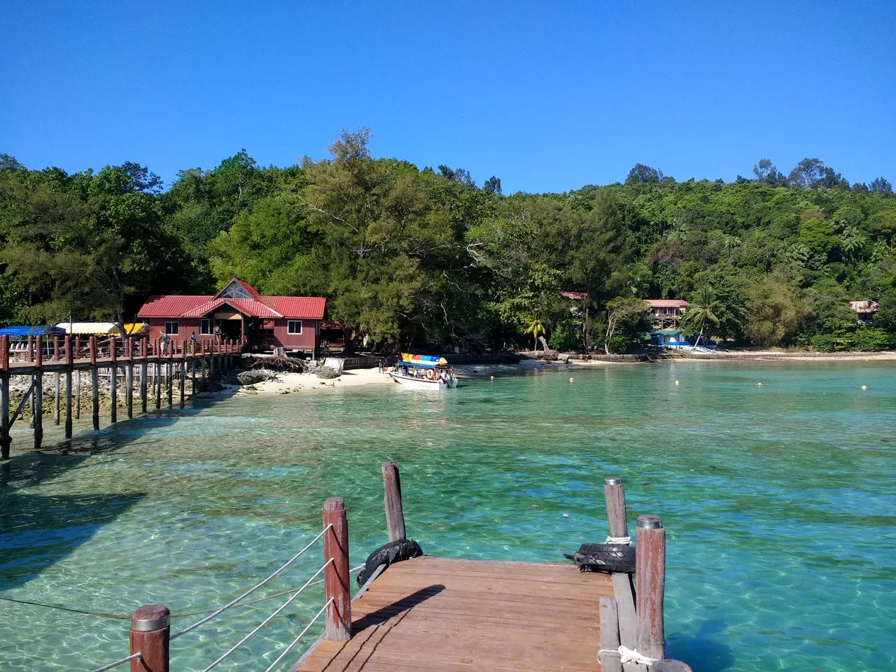
Gaya: The Big Island
The Bajau people named it Goyoh, meaning "big," and at 15 square kilometres, Gaya earns the title. It is the largest island in the park and the closest to downtown Kota Kinabalu, covered in dense virgin tropical forest that has been a forest reserve since 1923. Several ridges rise along its backbone, peaking at roughly 300 metres. Twenty kilometres of hiking trails wind through the canopy. The island hosts two five-star resorts -- Gayana Eco Resort, which houses a Marine Ecology Research Centre, and Bunga Raya Island Resort on the northeast shore. Police Bay, on Gaya's far side, offers a 400-metre stretch of white sand that slopes gently into crystal-clear water. The coral reefs ringing the entire coast are in excellent condition, making Gaya a surprisingly good diving destination given its proximity to a state capital. Sabah Parks, the body charged with managing the national park, is headquartered on Gaya's southeastern shore.
Five Islands, Five Characters
Each island has carved out a distinct personality. Manukan, the second largest, is the most popular with Kota Kinabalu residents, offering developed facilities including chalets, restaurants, a diving centre, and even a desalination plant. Sapi Island -- "Cow Island" in Malay -- sits just off Gaya's southwestern tip and draws the most tourists for snorkelling and scuba diving. Between mid-morning and late afternoon the beach fills with visitors, but after the last ferry departs, overnight campers have the island to themselves and its resident macaques. Mamutik, at just 15 acres, is the smallest island, offering good coral at its northeastern tip along with the constant hazard of sea urchins lurking among the rocks. Sulug, the farthest island, remains relatively untouched and undeveloped, popular with visitors who value quiet over convenience. A long sand spit juts out into the ocean, formed during the same geological upheaval that created the islands themselves.
From Api-Api to National Park
The human history of these islands begins with the British North Borneo Company, which established a trading settlement called Api-Api on Gaya Island in 1882. The settlement later moved to the mainland and was renamed Jesselton after Sir Charles Jessel, the company's vice-chairman. In 1968, Jesselton became Kota Kinabalu, and the city grew into Sabah's capital while the islands it had once occupied remained largely wild. Today, ferries depart from downtown Kota Kinabalu throughout the day, delivering visitors to island beaches in minutes. The park exists in that rare space where urban life and marine wilderness share a horizon. Office workers in KK can see the islands from their windows; by lunchtime, they could be snorkelling over the reefs. That proximity is both the park's greatest asset and its greatest challenge, as development pressure and visitor numbers test the boundaries of conservation in waters that were once a mountaintop.
From the Air
Coordinates: 5.97N, 116.00E. The five islands of Tunku Abdul Rahman National Park are located 3 to 8 km offshore from Kota Kinabalu, the capital of Sabah, Malaysian Borneo. The nearest airport is Kota Kinabalu International Airport (ICAO: WBKK), which is practically adjacent to the coastline facing the islands. Gaya Island, the largest, is clearly visible from altitude. The Crocker Range rises behind the city to the east, while Mount Kinabalu dominates the northeast horizon at 4,095 metres.
Nearby Stories
- Mount Trusmadi 19 km away
- Crocker Mountains 21 km away
- The Chimney of Labuan 28 km away
- Battle of Beaufort (1945) 33 km away
- The Battle of Labuan 64 km away
- Tip of Borneo 107 km away
- Balambangan Island 169 km away
- Tango Maru 171 km away