Crocker Mountains
Mount Kinabalu appears first, the way a cathedral appears above a medieval city: sudden, massive, and belonging to a different order of things entirely. At 4,095 meters, it is the highest point between the Himalayas and New Guinea, and it is merely the crown of the Crocker Mountains, a range that runs like a spine down the length of Sabah, dividing the state's West Coast from its Interior. With an average elevation of 1,800 meters, the Crockers are not gentle hills. They are a wall of folded sedimentary rock, uplifted from ancient seabeds, clothed in some of the most biodiverse forest on Earth, and named after a 19th-century British administrator who likely never imagined his name would outlast his empire.
Deep Time in Sandstone and Shale
The Crocker Mountains are built from the compressed remains of ancient oceans. Weathered sandstones and shales, the products of millions of years of sediment accumulation on the sea floor, were folded and thrust upward by the same tectonic forces that produced Borneo itself. The geology is visible in road cuts and riverbanks throughout the range: layered rock tilted at sharp angles, crumbling where water has found its way in, holding firm where the stone is dense enough to resist. Below 300 meters, the lowlands have been converted to cash crops and paddy fields, the terraced landscapes that define Sabah's agricultural economy. Above that line, the forest takes over, climbing through montane zones where the air cools, the mist thickens, and the species assemblages shift toward the endemic and the strange.
The Richest Forest in Borneo
The Crocker Mountains Forest Reserve holds the highest diversity of nocturnal insects of any of the 20 forest reserves surveyed within Sabah's portion of the Heart of Borneo, the vast tropical wilderness that spans three nations. The range's biodiversity is a function of altitude, isolation, and age. Species that evolved in the montane cloud forests have nowhere else to go. They are stranded on their peaks like sailors on islands, adapting to conditions found nowhere else on the planet. Pitcher plants, orchids, and the Rafflesia, the world's largest flower, all occur within the range. The forest canopy is layered and dense, home to hornbills, gibbons, and the Bornean clouded leopard. Part of the range has been protected as Crocker Range National Park since 1984, and in 2014, the entire range was recognized as a UNESCO Biosphere Reserve, only the second such designation in Malaysia.
Homeland of the Dusun
For the various Dusunic subgroups of northern Borneo, the Crocker Mountains are not wilderness but home. These communities have farmed, hunted, and gathered in the range for centuries, developing sophisticated systems of land management that balanced subsistence needs with forest conservation long before the concept had a name in English. The designation of national parks and biosphere reserves has created tensions between conservation goals and indigenous land use, a conflict that the Community Use Zone concept, developed through a partnership between the Sabah government and the Japan International Cooperation Agency, has attempted to address. The CUZ model allows indigenous communities to continue utilizing resources within protected areas under negotiated guidelines, an acknowledgment that the people who know these mountains best are the ones who have lived in them longest.
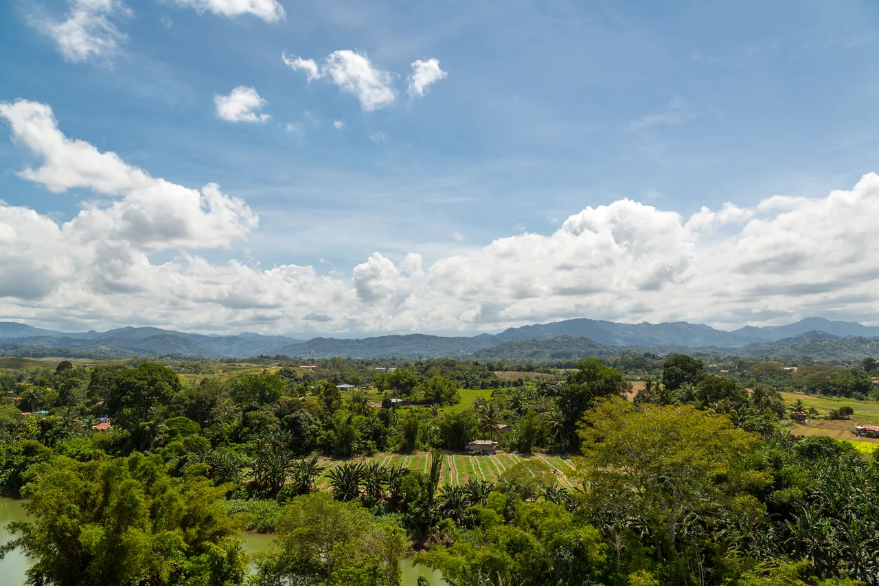
The View from Above
From the air, the Crocker Mountains present a corrugated landscape of ridge and valley stretching from northwest to southeast, the ridgelines sharp where recent landslides have exposed bare rock, the valleys deep and dark with old-growth forest. Clouds form along the upper slopes by midmorning, pouring through the saddles between peaks like slow-motion waterfalls. On clear days, the range is visible from Kota Kinabalu's waterfront, a green wall rising behind the coastal plain. Mount Kinabalu towers above everything, its granite peak bare and pale against the sky, often wreathed in its own weather system. William Maunder Crocker, the British colonial official who lent the range his name, served in North Borneo during the late 19th century. The mountains have outlasted every administration that has tried to govern them.
From the Air
Located at approximately 5.75°N, 116.50°E, the Crocker Mountains run NW-SE through Sabah, with Mount Kinabalu (4,095 m / 13,435 ft) as the highest point. CRITICAL: Maintain safe altitude when transiting this range. Terrain rises rapidly from the coastal plain to over 1,800 meters average, with Kinabalu exceeding 4,000 meters. Mountain wave turbulence and rapid weather changes are common. Nearest major airport is Kota Kinabalu International Airport (WBKK) on the west coast. Ranau airstrip lies to the east. The range is a dramatic visual feature from any altitude, with cloud forests, exposed granite peaks, and deep river valleys.
Nearby Stories
- Kundasang War Memorial 3.9 km away
- Kinarut Mansion 9.7 km away
- Starcevich Monument 32 km away
- Cho Huan Lai Memorial 43 km away
- Jambongan Island 87 km away
- Danum Valley Conservation Area 89 km away
- Operation Agas 95 km away
- Tango Maru 212 km away