.jpg)
Jambongan Island
Before the first Suluk settlers could establish a village on Jambongan Island, they consulted a shaman. According to oral tradition passed down through generations, the intermediary communed with the island's spirits, seeking permission to open a settlement. Only after that permission was granted did the founders build their port. They had already stopped at Libaran and Banggi islands on the way -- these were ocean people, more comfortable on water than land, and they chose their home with spiritual as much as practical deliberation. At 113 square kilometers, Jambongan is the second-largest island in Sabah, yet it remains one of the least known.
Empires at the Doorstep
In 1877, Sultan Abdul Momin of Brunei granted the territories of northeast Borneo -- including all islands within three marine leagues of the coast -- to the North Borneo Chartered Company. Jambongan fell under this sweeping transfer. By 1894, Governor Charles Vandeleur Creagh had established a customs station on the island, staffed by a single native clerk and one policeman. This modest outpost enraged a local leader named Mat Salleh, who had inherited administrative authority over the Sugut River from his father, the former Chief of Sulu. When the Company introduced poll taxes and boat permits, Mat Salleh saw an intolerable encroachment on his people's rights. The murder of two Iban Dayak agents of the Company on the island drew Jambongan into the broader Mat Salleh rebellion, one of the most significant uprisings against colonial rule in North Borneo.
Wartime Choices
When the Japanese occupied Borneo during World War II, they imposed their own taxes on Jambongan's islanders. But the occupation brought something the British administration never had: an atmosphere of open terror. Villagers who disobeyed were taken away and killed. After the death of a local villager at Japanese hands, fear transformed into resolve. Many islanders became resistance members, collaborating closely with the British in the lead-up to the Allied liberation of Borneo. The British, who had been colonial administrators extracting taxes and imposing permits, were now perceived as saviors -- a bitter irony born of the cruelties of a worse occupier. After Japan's defeat, the British returned to administer the island through the late 1950s, and village heads served as intermediaries between colonial authority and local life until Malayan independence reshaped the region.
Where Greater Sabah Once Stood
Between 50,000 and 9,000 years ago, when sea levels were 36 meters lower, Jambongan was not an island at all. It was part of a continuous landmass called Greater Sabah, connected to Balambangan, Banggi, and Malawali. The waters rose, and the land fractured into an archipelago. Today the island sits within the Coral Triangle, its terrain formed of sandstones and shales from the Bongaya formation, generally flat or gently undulating, reaching a high point of 156 meters at Buli Gantungan Hill. Among the northern islands of Sabah, Jambongan holds the widest mangrove area. Dugongs have been sighted in its waters, along with Irrawaddy dolphins and Indo-Pacific humpback dolphins, though encounters are rare.
Scars and Regrowth
In the 1980s, an El Nino-related fire tore through the Jambongan Forest Reserve, destroying much of the natural forest. What replaced it was not jungle but fern and Imperata cylindrica grassland -- a hardy, fire-adapted cover that resists reforestation. The landscape carries this scar visibly. In 2011, a replanting effort began, using fast-growing tree species to re-establish forest cover over the burned areas. The island's Class 1 Protection Forest status prohibits timber harvesting, but threats persist: attempts to expand oil palm milling operations on the island have drawn protests, as the mills damage water sources and ecosystems. Meanwhile, the Bajau-Ubian and Suluk communities who call Jambongan home continue their fishing traditions, receiving annual government fuel subsidies and living allowances through Malaysia's Fisheries Development Authority.
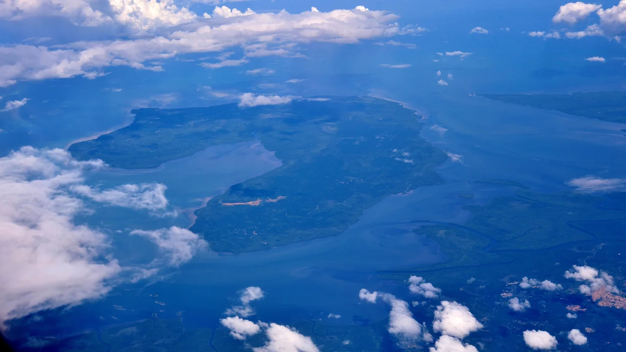
From the Air
Located at 6.68N, 117.42E on the northern coast of Sabah's Beluran District. Jambongan is visible as a large, flat island in the Sulu Sea, distinctive for its extensive mangrove fringes. Nearest airports are Sandakan (WBKS) and Kota Kinabalu (WBKK). Approach from the north reveals the shallow bays on the western coast. Expect equatorial weather with temperatures 26-32C year-round and frequent thunderstorms.
Nearby Stories
- Banggi Island 26 km away
- Kinabalu Park 40 km away
- Turtle Islands National Park 50 km away
- Mount Kinabalu 79 km away
- Quailey's Hill Memorial 81 km away
- Sepilok Orangutan Rehabilitation Centre 102 km away
- HMS Pelorus (1808) 183 km away
- Tabon Caves 251 km away