Vallecito
The Kumeyaay knew this place as Hawi. The Spanish, when they arrived, called it Vallecito — "little valley" — and the name fit: a small bowl of relative green in an otherwise demanding desert landscape, where cienegas (marshy springs) and salt grass provided what the surrounding terrain withheld. When Gold Rush emigrants came through on the Southern Emigrant Trail in 1849 and the years following, they were following a route that Kumeyaay people had traveled for generations, toward an oasis whose importance to desert survival was understood long before California gold made it internationally famous.
Hawi, the Kumeyaay Village
Vallecito's character as a habitable place in otherwise demanding terrain made it a Kumeyaay settlement long before European contact. The cienegas — areas where water reached the surface — supported the salt grass and other vegetation that gave the little valley its relative fertility. The Kumeyaay who lived at Hawi understood the water sources, the seasonal patterns of vegetation, and the resources that made this spot worth inhabiting. When Spanish expeditioner Pedro Fages passed through in 1781, becoming the first European to visit the area by documented record, he was visiting a community that had already been there for an unknown number of generations.
Pedro Fages and the Spanish Crossing
Pedro Fages arrived at Vallecito in 1781 as part of his overland travels through Alta California. The Spanish were mapping routes, establishing contacts, and asserting presence across a territory whose indigenous populations had no say in the matter. Fages's visit to what the Kumeyaay called Hawi marked the entry of this particular place into European geographical knowledge — a process that would continue as Spanish and then Mexican authorities used the Southern Emigrant Trail corridor for military and administrative movements. The oasis that had sustained Kumeyaay communities for generations became a waypoint in a colonial infrastructure.
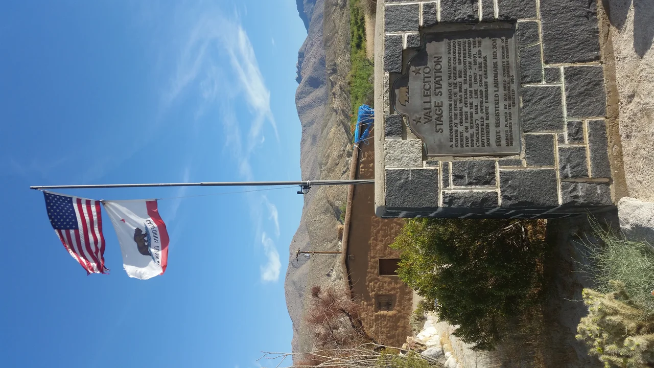
The Army Depot and American Claims
After the Mexican-American War transferred California to the United States, the Army established a depot at Vallecito in 1850, recognizing the same qualities that had made it a Kumeyaay village and a Spanish waypoint: reliable water in a desert corridor. The depot supported the military operations and emigrant assistance functions that the newly acquired territory required. James Lassator established a ranch at the site in 1854, providing services to the travelers who continued to use the Southern Emigrant Trail. Lassator was murdered in Arizona in 1863 — the violence of the frontier era touching even this relatively established desert stop.
The Stagecoach Years
The San Antonio-San Diego Mail Line and subsequently the Butterfield Overland Mail incorporated Vallecito into their stage routes, making it an official station on the trail that connected Texas to California. The little valley's water supply made it non-negotiable: horses and mules needed water at regular intervals, and the desert between the Colorado River and the Coast Ranges offered few reliable sources. Vallecito's station served the mail coaches and the passengers who endured what was, by all accounts, an extremely uncomfortable journey. The Southern Pacific Railroad's arrival in Fort Yuma in 1877 ended the stagecoach era by providing an alternative that made the overland desert crossing unnecessary.
What Remains
The Vallecito Stage Station County Park preserves the reconstructed adobe structure that marks the site, sitting in the little valley that gave the place its Spanish name. The Anza-Borrego Desert State Park surrounds it, the same desert terrain that Gold Rush emigrants crossed on foot and mule, that Kumeyaay families traveled seasonally, that Pedro Fages mapped for the Spanish crown. The cienegas may be drier than they once were — the water table in desert regions has shifted with the interventions of the past century — but the valley's character as a relative oasis persists, a small green thing held in the palm of the surrounding desert.
From the Air
Vallecito sits at approximately 32.98°N, 116.35°W in a small valley within Anza-Borrego Desert State Park, San Diego County. The Vallecito Stage Station County Park marks the historic site. The valley's slight increase in vegetation relative to the surrounding desert is visible from the air. Borrego Valley Airport (L08) is approximately 25 miles to the north. The Southern Emigrant Trail corridor follows the valley eastward toward the Carrizo Badlands.
Nearby Stories
- Mount Signal Solar 3.3 km away
- Capitan Grande Reservation 3.8 km away
- Jacumba Valley and Jacumba Wilderness Area 4.5 km away
- Westmorland, California 9.6 km away
- Niland Geyser 11 km away
- Thomas L. "Pegleg" Smith 13 km away
- Richard J. Donovan Correctional Facility 24 km away
- Antique Gas and Steam Engine Museum 50 km away