Várzea Grande
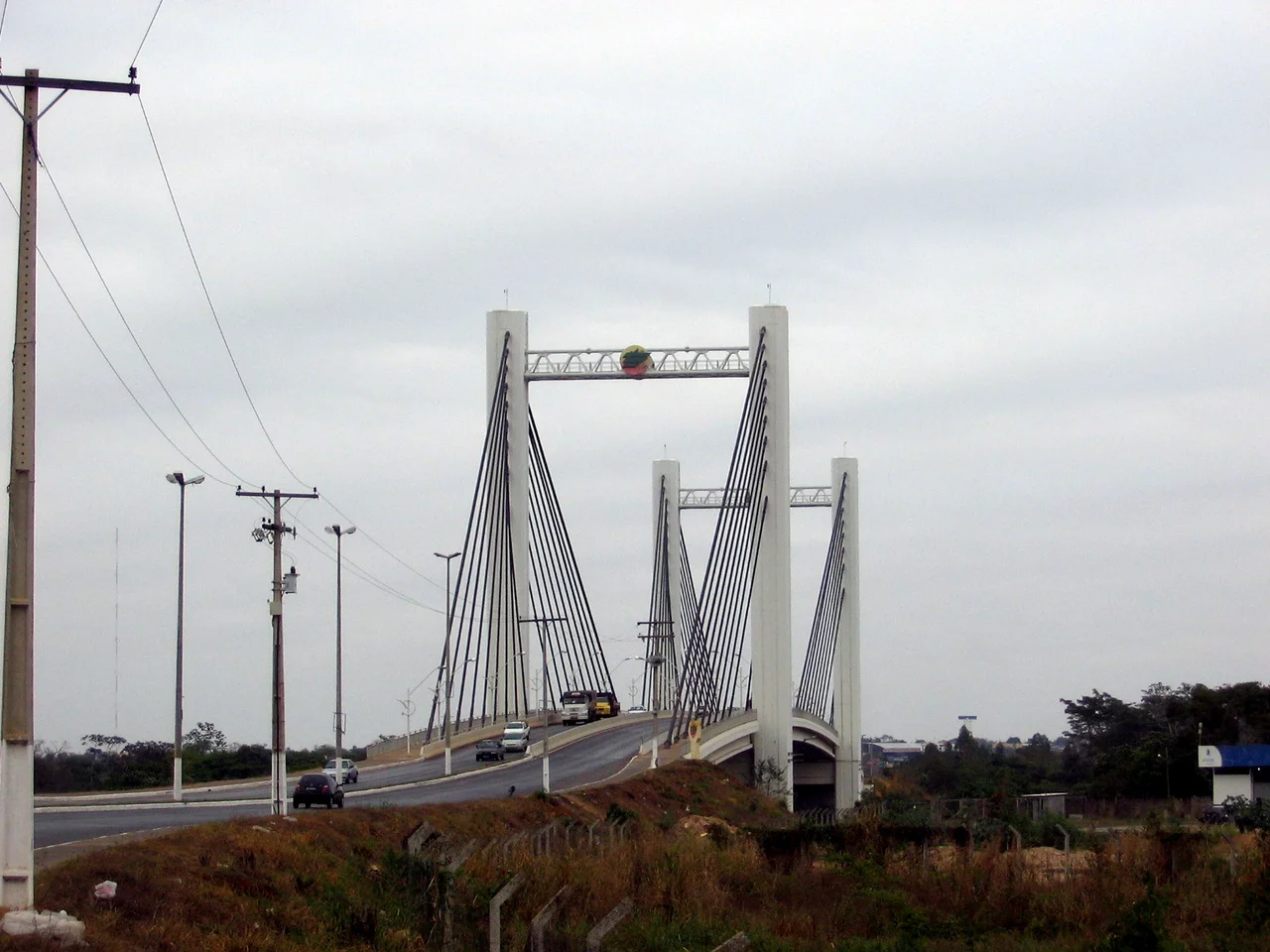
The Cuiabá River runs between two cities that were never meant to be separate. On the east bank, Cuiabá - the old gold-mining capital of Mato Grosso, founded in 1719 when prospectors struck the metal in the Coxipó stream. On the west bank, Várzea Grande - which means Big Floodplain in Portuguese, a name that tells you everything about how the land lies when the rains come. Together, the two cities hold about 834,000 people. Apart, they have separate mayors, separate budgets, and separate civic pride. The Sérgio Motta bridge carries traffic across the river. Everyone who flies into Mato Grosso lands in Várzea Grande, because the international airport is on this side. Everyone who gets off the plane promptly drives into Cuiabá, because that is where most visitors think they are going.
The Airport on the Floodplain
Marechal Rondon International Airport takes its name from Cândido Rondon, the Brazilian explorer and Positivist general who strung telegraph wire across Mato Grosso in the early twentieth century and whose advocacy for indigenous peoples shaped the nation's Indian policy for decades. LATAM, Gol, and other Brazilian carriers fly into the airport from São Paulo, Brasília, and smaller cities of the interior. For travelers bound for the Pantanal wetlands or the red-rock plateau of Chapada dos Guimarães, the airport is the gateway. The bus terminal downtown carries the name André Maggi, after one of the founding soy barons of Mato Grosso - the family whose grain trade turned the state into one of the world's great agricultural powers. Names on buildings are a quick lesson in who built the place.
Two Churches, Two Centuries
The Igreja de Nossa Senhora da Guia stands on the small rise where the oldest part of the city began. Elesbão Pinto built it in 1892 in honor of Our Lady of the Guide, the patron saint of the city. A few kilometers away, in the Passagem da Conceição district, the Igreja de Nossa Senhora da Conceição was built in 1910 for Our Lady of Conception, the patron of her own neighborhood. Both churches are now designated cultural heritage of Várzea Grande. In a city whose name simply describes its geography, the churches are among the few old things that stand on their own terms. The rest of the city runs on highways: the Highway Mario Andreazza from Cuiabá, the BR-364 from Campo Grande, the BR-174 from Porto Velho, the BR-163 from the north of Mato Grosso. Várzea Grande is a place where roads converge.
The Feast of Saint Peter
On June 29 each year, the district of Bonsucesso hosts the Festa de São Pedro - the Feast of Saint Peter. Saint Peter is the patron of fishermen, and in a city where the Cuiabá River has always yielded fish, the feast is a nationally known event. The Rota do Peixe - the Fish Route - runs through Bonsucesso, lined with fishmongers, restaurants, and the kind of small bakeries that sell sweet bread alongside grilled pacu and pintado fish pulled from the Paraguay basin. The feast comes at the beginning of the dry season, when the air finally cools after months of swelter and the floodplains begin to drain. Also every May, the UNIVAG complex hosts Expovag, the agroindustrial exhibition, where ranchers and grain traders from the state show their bulls and their equipment.
The Brown Sugar Mill
In Bonsucesso there is a working engenho - the Engenho Dona Buguela - a traditional brown sugar mill still open to visitors. Engenhos defined colonial Brazil; the country's entire economy once ran on sugar crushed by oxen-driven rollers and boiled in copper pans. Most engenhos have long since been replaced by industrial plants. Dona Buguela's is a rare survivor, turning cane into brown sugar and rapadura - the hard cakes of unrefined sugar that Brazilians still eat as candy - the way their grandmothers did it. A few blocks from the mill, the Casa de Artes Várzea-grandense on Avenida Couto Magalhães shows work by local artisans. The Casa de Memória on Main Street preserves the oldest memories of the Passagem da Conceição district. For a city whose tourism brochures emphasize its airport, Várzea Grande keeps a surprising amount of itself intact.
Second City, Not Second Place
With 260,000 residents in its urban core, Várzea Grande is the second-largest municipality in Mato Grosso by population, behind Cuiabá. It is a city that serves without demanding center stage. Most tourists arrive at its airport and leave for the Pantanal or Chapada dos Guimarães or Cuiabá itself, never pausing to see the churches or the engenho. The Festa de São Pedro draws visitors for a week each June. The Expovag brings the cattle industry for its exhibition each May. Most of the year, the city simply does its work: moving passengers through the airport, trucking soybeans on the BR-163, running the shops, filling the buses. It is the working partner of a more famous twin, and it knows exactly what it is.
From the Air
Located at 15.65 degrees south, 56.13 degrees west on the west bank of the Cuiabá River, directly across from Cuiabá. Marechal Rondon International Airport (SBCY) is within the municipality, the primary air gateway for central Mato Grosso, the Pantanal, and Chapada dos Guimarães. From cruising altitude, the two cities appear as a single urban mass split by the river, with the airport's long runway clearly visible on the west bank. The Pantanal wetlands lie about 100 km to the south.
Nearby Stories
- Chapada dos Guimarães 35 km away
- Guiratinga 195 km away
- Pantanal Matogrossense National Park 208 km away
- Central-West Region, Brazil 231 km away
- Guaporé River 270 km away
- Araguainha Crater 298 km away
- Vila Bela da Santíssima Trindade 368 km away
- Mineiros 414 km away